Estimated Value: $281,000 - $326,000
3
Beds
2
Baths
1,689
Sq Ft
$175/Sq Ft
Est. Value
About This Home
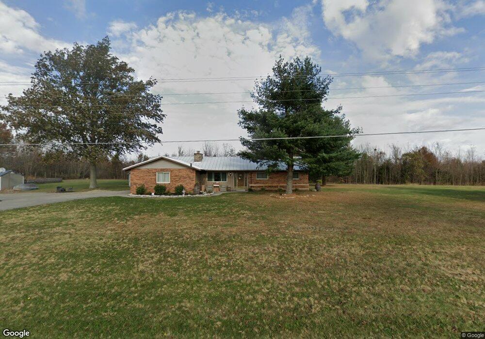
This home is located at 6490 Fort Amanda Rd, Lima, OH 45806 and is currently estimated at $295,671, approximately $175 per square foot. 6490 Fort Amanda Rd is a home located in Allen County with nearby schools including Maplewood Elementary School, Elmwood Elementary School, and Shawnee Middle School.
Ownership History
Date
Name
Owned For
Owner Type
Purchase Details
Closed on
Jun 9, 2023
Sold by
Lange Tod E and Lange Jan C
Bought by
Cox Larry and Cox Amy
Current Estimated Value
Home Financials for this Owner
Home Financials are based on the most recent Mortgage that was taken out on this home.
Original Mortgage
$256,410
Interest Rate
7.13%
Mortgage Type
Credit Line Revolving
Purchase Details
Closed on
Jul 6, 2022
Sold by
Elois Chambers Revocable Trust
Bought by
Lange Tod E and Lange Jan C
Home Financials for this Owner
Home Financials are based on the most recent Mortgage that was taken out on this home.
Original Mortgage
$188,465
Interest Rate
32%
Purchase Details
Closed on
Jul 28, 1997
Sold by
Gutman Christopher
Bought by
Lange Tod and Lange Sharon
Home Financials for this Owner
Home Financials are based on the most recent Mortgage that was taken out on this home.
Original Mortgage
$118,750
Interest Rate
7.81%
Mortgage Type
New Conventional
Purchase Details
Closed on
Nov 14, 1984
Bought by
Gutman Christopher G
Create a Home Valuation Report for This Property
The Home Valuation Report is an in-depth analysis detailing your home's value as well as a comparison with similar homes in the area
Purchase History
We collect this data history from publicly available records. To have your information removed, we recommend requesting removal directly through your county’s website.
| Date | Buyer | Sale Price | Title Company |
|---|---|---|---|
| Cox Larry | $280,000 | None Listed On Document | |
| Lange Tod E | $186,000 | None Listed On Document | |
| Lange Tod | $125,000 | -- | |
| Gutman Christopher G | $60,500 | -- |
Source: Public Records
Mortgage History
We collect this data history from publicly available records. To have your information removed, we recommend requesting removal directly through your county’s website.
| Date | Status | Borrower | Loan Amount |
|---|---|---|---|
| Previous Owner | Cox Larry | $256,410 | |
| Previous Owner | Lange Tod E | $188,465 | |
| Previous Owner | Lange Tod E | $200,000 | |
| Previous Owner | Lange Tod | $118,750 |
Source: Public Records
Tax History
| Year | Tax Paid | Tax Assessment Tax Assessment Total Assessment is a certain percentage of the fair market value that is determined by local assessors to be the total taxable value of land and additions on the property. | Land | Improvement |
|---|---|---|---|---|
| 2025 | $3,133 | $78,050 | $14,840 | $63,210 |
| 2024 | $3,090 | $78,050 | $14,840 | $63,210 |
| 2023 | $2,624 | $60,030 | $11,410 | $48,620 |
| 2022 | $2,705 | $60,030 | $11,410 | $48,620 |
| 2021 | $2,721 | $60,030 | $11,410 | $48,620 |
| 2020 | $2,246 | $52,640 | $11,060 | $41,580 |
| 2019 | $2,246 | $52,640 | $11,060 | $41,580 |
| 2018 | $2,236 | $52,640 | $11,060 | $41,580 |
| 2017 | $2,120 | $48,860 | $11,060 | $37,800 |
| 2016 | $2,096 | $48,860 | $11,060 | $37,800 |
| 2015 | $2,281 | $48,860 | $11,060 | $37,800 |
| 2014 | $2,281 | $52,430 | $11,970 | $40,460 |
| 2013 | $1,874 | $44,030 | $11,970 | $32,060 |
Source: Public Records
Map
Nearby Homes
- 3041 Coon Rd
- 1360 Forest Dr
- 7570 Fort Amanda Rd
- 1300 Nancy Sue Dr
- 2350 S Wapakoneta Rd
- 3000 S Sunderland Rd
- 4499 Indian Hill Dr
- 2905 Oak Hill Ct
- 4422 Indian Hill Dr
- 3065 Lakeshore Dr
- 4259 Blue Spruce Ln
- 3500 Woodhaven Ln
- 3441 Winston Ln
- 4062 Cypress Ave
- 4054 Cypress Ave
- 3547 Woodhaven Ln
- 4046 Cypress Ave
- 4039 Magnolia
- 3136 Juliette Dr
- 128 Tolowa Trail
- 6400 Fort Amanda Rd
- 3110 S Kemp Rd
- 3190 S Kemp Rd
- 6666 Fort Amanda Rd
- 3195 Coon Rd
- 3223 S Kemp Rd
- 3018 S Kemp Rd
- 6688 Fort Amanda Rd
- 3080 S Kemp Rd
- 2992 S Kemp Rd
- 6730 Fort Amanda Rd
- 6200 Fort Amanda Rd
- 3237 Coon Rd
- 3011 Coon Rd
- 3073 Coon Rd
- 3275 Coon Rd
- 6145 Fort Amanda Rd
- 6820 Fort Amanda Rd
- 2977 Coon Rd
- 6123 Fort Amanda Rd
Your Personal Tour Guide
Ask me questions while you tour the home.