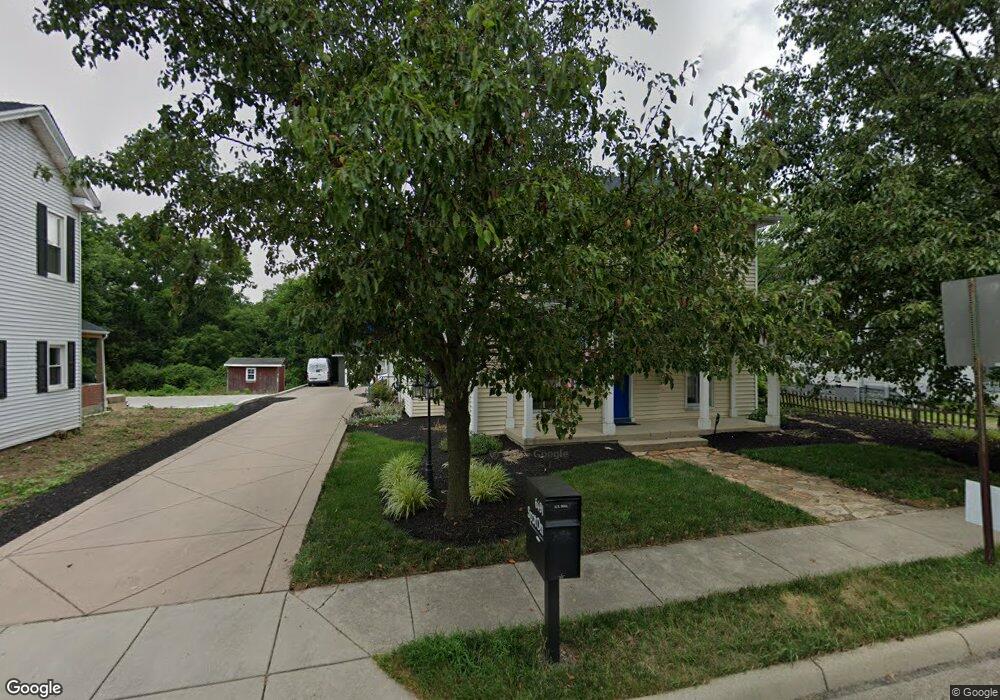
6491 Cincinnati Dayton Rd Liberty Township, OH 45044
Estimated Value: $527,380
3
Beds
3
Baths
2,822
Sq Ft
$187/Sq Ft
Est. Value
About This Home
This home is located at 6491 Cincinnati Dayton Rd, Liberty Township, OH 45044 and is currently estimated at $527,380, approximately $186 per square foot. 6491 Cincinnati Dayton Rd is a home located in Butler County with nearby schools including Woodland Elementary School, Liberty Junior School, and Lakota East High School.
Ownership History
Date
Name
Owned For
Owner Type
Purchase Details
Closed on
Jan 31, 2019
Sold by
Sparks Mark A and Sparks Kimberly S
Bought by
Lamppost Properties Llc
Current Estimated Value
Home Financials for this Owner
Home Financials are based on the most recent Mortgage that was taken out on this home.
Original Mortgage
$176,750
Outstanding Balance
$135,301
Interest Rate
4.6%
Mortgage Type
Future Advance Clause Open End Mortgage
Estimated Equity
$392,079
Purchase Details
Closed on
May 9, 2007
Sold by
Bolin James Roy and Bolin Dessie M
Bought by
Sparks Mark A and Sparks Kimberly S
Home Financials for this Owner
Home Financials are based on the most recent Mortgage that was taken out on this home.
Original Mortgage
$148,000
Interest Rate
6.21%
Mortgage Type
Purchase Money Mortgage
Create a Home Valuation Report for This Property
The Home Valuation Report is an in-depth analysis detailing your home's value as well as a comparison with similar homes in the area
Home Values in the Area
Average Home Value in this Area
Purchase History
| Date | Buyer | Sale Price | Title Company |
|---|---|---|---|
| Lamppost Properties Llc | $288,500 | None Available | |
| Sparks Mark A | $185,000 | Springdale Title Agency Llc |
Source: Public Records
Mortgage History
| Date | Status | Borrower | Loan Amount |
|---|---|---|---|
| Open | Lamppost Properties Llc | $176,750 | |
| Previous Owner | Sparks Mark A | $148,000 |
Source: Public Records
Tax History Compared to Growth
Tax History
| Year | Tax Paid | Tax Assessment Tax Assessment Total Assessment is a certain percentage of the fair market value that is determined by local assessors to be the total taxable value of land and additions on the property. | Land | Improvement |
|---|---|---|---|---|
| 2024 | $6,752 | $79,440 | $34,300 | $45,140 |
| 2023 | $4,330 | $79,440 | $34,300 | $45,140 |
| 2022 | $7,502 | $79,440 | $34,300 | $45,140 |
| 2021 | $4,717 | $79,440 | $34,300 | $45,140 |
| 2020 | $4,816 | $79,440 | $34,300 | $45,140 |
| 2019 | $5,004 | $51,950 | $17,840 | $34,110 |
| 2018 | $2,986 | $51,950 | $17,840 | $34,110 |
| 2017 | $3,030 | $51,950 | $17,840 | $34,110 |
| 2016 | $2,915 | $50,670 | $17,840 | $32,830 |
| 2015 | $2,913 | $50,670 | $17,840 | $32,830 |
| 2014 | $3,306 | $50,670 | $17,840 | $32,830 |
| 2013 | $3,306 | $55,540 | $17,840 | $37,700 |
Source: Public Records
Map
Nearby Homes
- 6405 Cincinnati Dayton Rd
- 6681 Cincinnati Dayton Rd
- 6335 Gem Stone Dr
- 6703 Cincinnati Dayton Rd
- 7232 Eaglestone Ct
- 7241 Stonebrook Ct
- 7162 Wyandot Ln
- 6821 Cincinnati Dayton Rd
- 7147 Wilhelmina Dr
- 7109 Maple Creek Dr
- 6951 Ash Creek Ct
- 7644 Millikin Rd
- 8091 Green Lake Dr
- 5933 Old Pebble Path
- 6300 Lindsey Ct
- 5913 Stones Throw Way
- 7120 Shady Brook Bend
- 7798 Derbyshire Ct
- 7113 Shady Brook Bend
- 7108 Shady Brook Bend
- 6501 Cincinnati Dayton Rd
- 6483 Cincinnati Dayton Rd
- 6503 Cincinnati Dayton Rd
- 6471 Cincinnati Dayton Rd
- 6471 Cincinnati Dayton Rd
- 6473 Cincinnati Dayton Rd
- 6494 Cincinnati Dayton Rd
- 6512 Cincinnati Dayton Rd
- 6461 Cincinnati Dayton Rd
- 6527 Cincinnati Dayton Rd
- 6520 Cincinnati Dayton Rd
- 6464 Cincinnati Dayton Rd
- 6533 Cincinnati Dayton Rd
- 6528 Cincinnati Dayton Rd
- 6439 Cincinnati Dayton Rd
- 6541 Cincinnati Dayton Rd
- 6536 Cincinnati Dayton Rd
- 6433 Cincinnati Dayton Rd
- 6551 Cincinnati Dayton Rd
- 6511 Gem Stone Dr