Estimated Value: $251,000 - $295,000
3
Beds
2
Baths
1,156
Sq Ft
$234/Sq Ft
Est. Value
About This Home
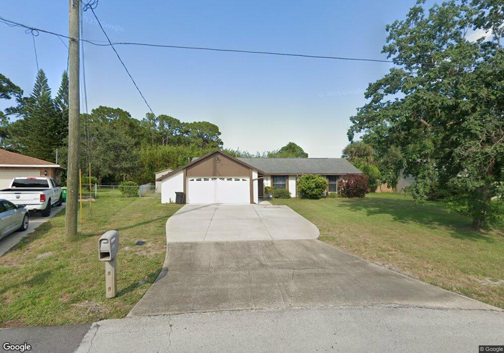
This home is located at 6493 Hudson Rd, Cocoa, FL 32927 and is currently estimated at $270,249, approximately $233 per square foot. 6493 Hudson Rd is a home located in Brevard County with nearby schools including Enterprise Elementary School, Space Coast Junior/Senior High School, and East Atlantic Prep of Brevard County.
Ownership History
Date
Name
Owned For
Owner Type
Purchase Details
Closed on
May 15, 1996
Sold by
White William D and White Patricia A
Bought by
Humphreys Kenneth W and Humphreys Linda J
Current Estimated Value
Home Financials for this Owner
Home Financials are based on the most recent Mortgage that was taken out on this home.
Original Mortgage
$73,000
Outstanding Balance
$4,061
Interest Rate
7.74%
Estimated Equity
$266,188
Create a Home Valuation Report for This Property
The Home Valuation Report is an in-depth analysis detailing your home's value as well as a comparison with similar homes in the area
Home Values in the Area
Average Home Value in this Area
Purchase History
| Date | Buyer | Sale Price | Title Company |
|---|---|---|---|
| Humphreys Kenneth W | $73,000 | -- |
Source: Public Records
Mortgage History
| Date | Status | Borrower | Loan Amount |
|---|---|---|---|
| Open | Humphreys Kenneth W | $73,000 |
Source: Public Records
Tax History
| Year | Tax Paid | Tax Assessment Tax Assessment Total Assessment is a certain percentage of the fair market value that is determined by local assessors to be the total taxable value of land and additions on the property. | Land | Improvement |
|---|---|---|---|---|
| 2025 | $3,241 | $209,260 | -- | -- |
| 2024 | $3,270 | $213,450 | -- | -- |
| 2023 | $3,270 | $211,600 | $52,000 | $159,600 |
| 2022 | $956 | $69,720 | $0 | $0 |
| 2021 | $958 | $67,690 | $0 | $0 |
| 2020 | $912 | $66,760 | $0 | $0 |
| 2019 | $860 | $65,260 | $0 | $0 |
| 2018 | $861 | $64,050 | $0 | $0 |
| 2017 | $862 | $62,740 | $0 | $0 |
| 2016 | $869 | $61,450 | $18,000 | $43,450 |
| 2015 | $876 | $61,030 | $15,000 | $46,030 |
| 2014 | $880 | $60,550 | $11,000 | $49,550 |
Source: Public Records
Map
Nearby Homes
- 6438 Hudson Rd
- 6481 La Brea Ave
- 6450 Ember Ave
- 6615 Dock Ave
- 6581 Bancroft Ave
- 5715 Fairbridge St
- 00 Unknown
- 6760 Cairo Rd
- 5220 Holden Rd
- 5215 Holden Rd
- 6815 Bryant Rd
- 5221 Carrick Rd
- 5720 Flint Rd
- 5095 Hogan Place
- 6375 Cable Ave
- 5555 Brandon St
- 0000 Grissom Pkwy
- 6020 Cannon Ave
- 7065 Hundred Acre Dr
- 6620 Grissom Pkwy
- 6487 Hudson Rd
- 6499 Hudson Rd
- 5505 Fairbridge St
- 6460 Gillette Ave
- 6481 Hudson Rd
- 5500 Fairbridge St
- 6486 Hudson Rd
- 6450 Gillette Ave
- 5510 Fairbridge St
- 6480 Hudson Rd
- 6469 Hudson Rd
- 5485 Curtis Blvd
- 5495 Curtis Blvd
- 5525 Fairbridge St
- 5475 Curtis Blvd
- 5520 Fairbridge St
- 6449 Irving Rd
- 5505 Curtis Blvd
- 5385 Fruitport St
- 6474 Hudson Rd
Your Personal Tour Guide
Ask me questions while you tour the home.