Estimated Value: $291,000 - $309,000
3
Beds
2
Baths
1,402
Sq Ft
$213/Sq Ft
Est. Value
About This Home
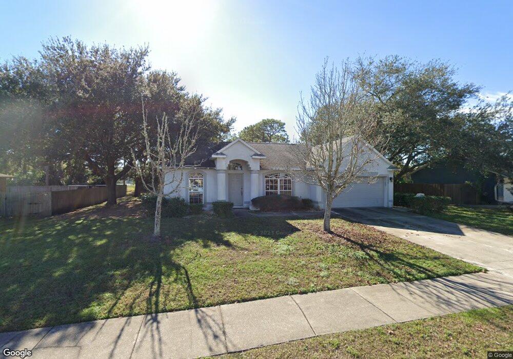
This home is located at 6494 Hunt Rd, Cocoa, FL 32927 and is currently estimated at $298,353, approximately $212 per square foot. 6494 Hunt Rd is a home located in Brevard County with nearby schools including Challenger 7 Elementary School, Space Coast Junior/Senior High School, and Sculptor Charter School.
Ownership History
Date
Name
Owned For
Owner Type
Purchase Details
Closed on
Nov 21, 2000
Sold by
Mercedes Homes Inc
Bought by
Shaw William C and Shaw Marcia R
Current Estimated Value
Home Financials for this Owner
Home Financials are based on the most recent Mortgage that was taken out on this home.
Original Mortgage
$95,268
Outstanding Balance
$35,079
Interest Rate
7.87%
Estimated Equity
$263,274
Purchase Details
Closed on
Jul 20, 2000
Sold by
Vosilla John and Cirelli Emilio
Bought by
Mercedes Homes Inc
Purchase Details
Closed on
Mar 17, 1998
Sold by
Clerk Circuit Court
Bought by
Cirelli Emilio and Vosilla John
Create a Home Valuation Report for This Property
The Home Valuation Report is an in-depth analysis detailing your home's value as well as a comparison with similar homes in the area
Home Values in the Area
Average Home Value in this Area
Purchase History
| Date | Buyer | Sale Price | Title Company |
|---|---|---|---|
| Shaw William C | $93,500 | -- | |
| Mercedes Homes Inc | $9,800 | -- | |
| Cirelli Emilio | $4,200 | -- |
Source: Public Records
Mortgage History
| Date | Status | Borrower | Loan Amount |
|---|---|---|---|
| Open | Shaw William C | $95,268 |
Source: Public Records
Tax History
| Year | Tax Paid | Tax Assessment Tax Assessment Total Assessment is a certain percentage of the fair market value that is determined by local assessors to be the total taxable value of land and additions on the property. | Land | Improvement |
|---|---|---|---|---|
| 2025 | $1,195 | $90,060 | -- | -- |
| 2024 | $1,157 | $87,530 | -- | -- |
| 2023 | $1,157 | $84,990 | $0 | $0 |
| 2022 | $1,130 | $82,520 | $0 | $0 |
| 2021 | $1,118 | $80,120 | $0 | $0 |
| 2020 | $1,053 | $79,020 | $0 | $0 |
| 2019 | $987 | $77,250 | $0 | $0 |
| 2018 | $976 | $75,810 | $0 | $0 |
| 2017 | $969 | $74,260 | $0 | $0 |
| 2016 | $978 | $72,740 | $18,000 | $54,740 |
| 2015 | $988 | $72,240 | $15,000 | $57,240 |
| 2014 | $993 | $71,670 | $11,000 | $60,670 |
Source: Public Records
Map
Nearby Homes
- 6310 Depot Ave
- 4721 Fairsun St
- 4590 Ponds Dr
- 4715 Greenhill St
- 0000 Grissom Pkwy
- 4975 Fay Blvd
- 0000 Unknown St
- 6375 Cable Ave
- 6162 Rena Ave
- 4790 Greenhill St
- 6398 Cable Ave
- 6240 Grissom Pkwy
- 4470 Ponds Dr
- 6620 Grissom Pkwy
- 4485 Fay Blvd
- 4390 Ponds Dr
- 4440 Fay Blvd
- 6094 Cardiff Ave
- 4240 Ponds Dr
- 00 Unknown
- 6498 Hunt Rd
- 6482 Hunt Rd
- 6493 Hunt Rd
- 6481 Hunt Rd
- 6499 Hunt Rd
- 6470 Hunt Rd
- 6366 Depot Ave
- 6469 Hunt Rd
- 6374 Depot Ave Unit 3
- 6374 Depot Ave
- 4771 Byron St
- 6458 Hunt Rd
- 4759-4765 2 Adjacent Lots On Byron St
- 4765 Byron St
- 6382 Depot Ave
- 6393 Depot Ave
- 6342 Depot Ave
- 6457 Hunt Rd
- 6390 Depot Ave
- 6446 Hunt Rd
Your Personal Tour Guide
Ask me questions while you tour the home.