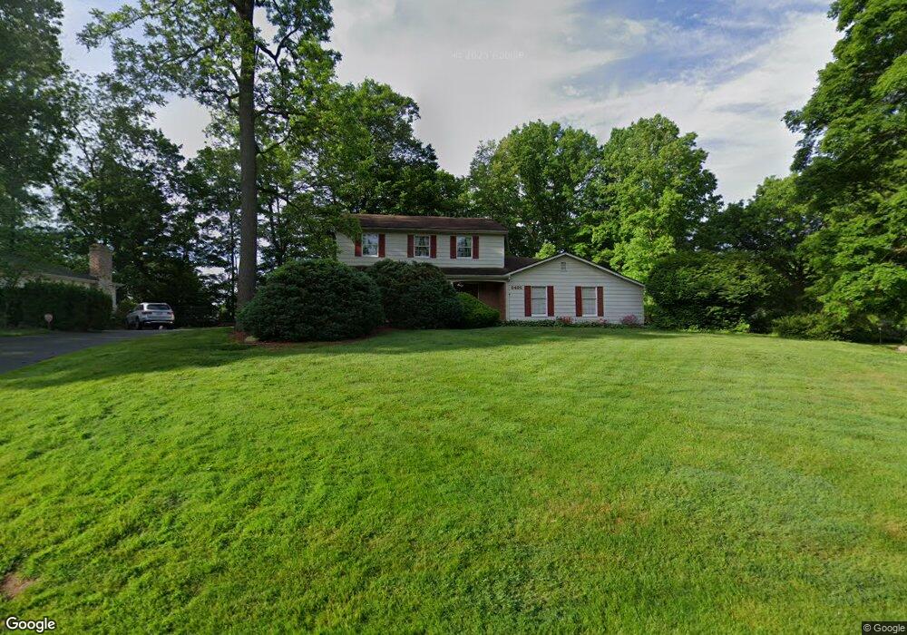
6495 Farmington Cir Canfield, OH 44406
Estimated Value: $317,813 - $375,000
3
Beds
3
Baths
2,036
Sq Ft
$165/Sq Ft
Est. Value
About This Home
This home is located at 6495 Farmington Cir, Canfield, OH 44406 and is currently estimated at $334,953, approximately $164 per square foot. 6495 Farmington Cir is a home located in Mahoning County with nearby schools including Canfield Village Middle School, Canfield High School, and St Charles Elementary School.
Ownership History
Date
Name
Owned For
Owner Type
Purchase Details
Closed on
Oct 26, 2004
Sold by
Anderson Cynthia E and Anderson Norman
Bought by
Mancini Howard J and Mancini Linda A
Current Estimated Value
Home Financials for this Owner
Home Financials are based on the most recent Mortgage that was taken out on this home.
Original Mortgage
$143,650
Outstanding Balance
$67,304
Interest Rate
4.87%
Mortgage Type
Purchase Money Mortgage
Estimated Equity
$267,649
Purchase Details
Closed on
Feb 25, 1994
Bought by
Perantoni Cynthia E
Create a Home Valuation Report for This Property
The Home Valuation Report is an in-depth analysis detailing your home's value as well as a comparison with similar homes in the area
Home Values in the Area
Average Home Value in this Area
Purchase History
| Date | Buyer | Sale Price | Title Company |
|---|---|---|---|
| Mancini Howard J | $169,000 | -- | |
| Perantoni Cynthia E | -- | -- |
Source: Public Records
Mortgage History
| Date | Status | Borrower | Loan Amount |
|---|---|---|---|
| Open | Mancini Howard J | $143,650 |
Source: Public Records
Tax History Compared to Growth
Tax History
| Year | Tax Paid | Tax Assessment Tax Assessment Total Assessment is a certain percentage of the fair market value that is determined by local assessors to be the total taxable value of land and additions on the property. | Land | Improvement |
|---|---|---|---|---|
| 2024 | $3,417 | $83,480 | $12,690 | $70,790 |
| 2023 | $3,360 | $83,480 | $12,690 | $70,790 |
| 2022 | $3,280 | $65,090 | $11,420 | $53,670 |
| 2021 | $3,178 | $65,090 | $11,420 | $53,670 |
| 2020 | $3,191 | $65,090 | $11,420 | $53,670 |
| 2019 | $2,902 | $53,020 | $11,420 | $41,600 |
| 2018 | $2,790 | $53,020 | $11,420 | $41,600 |
| 2017 | $2,787 | $53,020 | $11,420 | $41,600 |
| 2016 | $2,836 | $51,390 | $11,420 | $39,970 |
| 2015 | $2,774 | $51,390 | $11,420 | $39,970 |
| 2014 | $2,785 | $51,390 | $11,420 | $39,970 |
| 2013 | $2,684 | $51,390 | $11,420 | $39,970 |
Source: Public Records
Map
Nearby Homes
- 3770 Fairway Dr
- 3649 Indian Run Dr Unit 2
- 4032 Saint Andrews Ct Unit 1
- 6931 Lockwood Blvd
- 6768 Colleen Dr
- 6729 Tippecanoe Rd Unit 6
- 6747 Lockwood Blvd
- 6723 Lockwood Blvd Unit 4
- 1422 Turnberry Dr
- 6873 Tippecanoe Rd
- 6911 Tippecanoe Rd
- 1133 Red Tail Hawk Ct Unit 6
- 5391 Muirfield Dr
- 1193 Red Tail Hawk Ct Unit 1
- 6670 Summit Dr
- 6957 Tippecanoe Rd
- 6850 Abbey Rd N
- 6879 Kyle Ridge Pointe
- 3682 Sperone Dr
- 3885 Shields Rd
- 6471 Farmington Cir
- 6147 Westington Dr
- 6492 Farmington Cir
- 6120 Westington Dr
- 6451 Farmington Cir
- 6136 Westington Dr
- 6163 Westington Dr
- 6470 Farmington Cir
- 6116 Westington Dr
- 6150 Westington Dr
- 6090 Westington Dr
- 6450 Farmington Cir
- 6429 Farmington Cir
- 6177 Westington Dr
- 6168 Westington Dr
- 6121 Jamison Place
- 3795 Barber Dr
- 6147 Jamison Place
- 6135 Jamison Place
- 6426 Farmington Cir