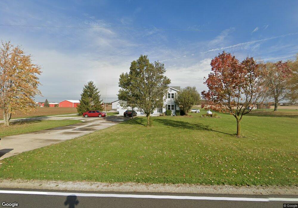
6495 Fort Loramie Swanders Rd Minster, OH 45865
Estimated Value: $340,000 - $403,000
3
Beds
2
Baths
2,244
Sq Ft
$165/Sq Ft
Est. Value
About This Home
This home is located at 6495 Fort Loramie Swanders Rd, Minster, OH 45865 and is currently estimated at $370,624, approximately $165 per square foot. 6495 Fort Loramie Swanders Rd is a home located in Shelby County with nearby schools including Fort Loramie Elementary School and Fort Loramie Junior/Senior High School.
Ownership History
Date
Name
Owned For
Owner Type
Purchase Details
Closed on
Dec 10, 2008
Sold by
Hoying Holli N
Bought by
Hoying Thomas D
Current Estimated Value
Purchase Details
Closed on
Apr 27, 2006
Sold by
Snarr Robert Paul and Snarr Jeannie Lynn
Bought by
Hoying Thomas D and Hoying Holli N
Home Financials for this Owner
Home Financials are based on the most recent Mortgage that was taken out on this home.
Original Mortgage
$121,099
Interest Rate
6.42%
Mortgage Type
FHA
Create a Home Valuation Report for This Property
The Home Valuation Report is an in-depth analysis detailing your home's value as well as a comparison with similar homes in the area
Home Values in the Area
Average Home Value in this Area
Purchase History
| Date | Buyer | Sale Price | Title Company |
|---|---|---|---|
| Hoying Thomas D | -- | Attorney | |
| Hoying Thomas D | $123,000 | None Available |
Source: Public Records
Mortgage History
| Date | Status | Borrower | Loan Amount |
|---|---|---|---|
| Closed | Hoying Thomas D | $121,099 |
Source: Public Records
Tax History Compared to Growth
Tax History
| Year | Tax Paid | Tax Assessment Tax Assessment Total Assessment is a certain percentage of the fair market value that is determined by local assessors to be the total taxable value of land and additions on the property. | Land | Improvement |
|---|---|---|---|---|
| 2024 | $3,157 | $91,390 | $13,840 | $77,550 |
| 2023 | $3,157 | $91,390 | $13,840 | $77,550 |
| 2022 | $2,749 | $73,440 | $11,210 | $62,230 |
| 2021 | $2,375 | $63,000 | $11,210 | $51,790 |
| 2020 | $2,375 | $63,000 | $11,210 | $51,790 |
| 2019 | $2,003 | $53,570 | $9,180 | $44,390 |
| 2018 | $1,954 | $53,570 | $9,180 | $44,390 |
| 2017 | $1,967 | $53,570 | $9,180 | $44,390 |
| 2016 | $1,910 | $50,940 | $7,520 | $43,420 |
| 2015 | $1,893 | $50,940 | $7,520 | $43,420 |
| 2014 | $1,893 | $50,940 | $7,520 | $43,420 |
| 2013 | $1,962 | $48,870 | $7,520 | $41,350 |
Source: Public Records
Map
Nearby Homes
- 11968 Arling Rd
- 11519 Eilerman Rd
- 12244 Short Dr Unit Condo Unit 10
- 13400 Whitefeather Trail
- 8381 Ohio 66
- 193 N Paris St
- 7 E 2nd St
- 10810 Wenger Rd
- 36 Shania Place Unit 23
- 27 Shania Place Unit 26
- 19 Shania Place Unit 33
- 28 Shania Place Unit 33
- 11 Shania Place Unit 28
- 0 Stonegate Dr Unit 21 10544857
- 0 Stonegate Dr Unit 14 10544847
- 17 Stonegate Dr
- 47 N Frankfort St
- 9908 N Kuther Rd
- 3538 N Kuther Rd
- 10944 W Russell Rd
- 6509 Fort Loramie Swanders Rd
- 6444 Fort Loramie Swanders Rd
- 6333 Fort Loramie Swanders Rd
- 6277 Fort Loramie Swanders Rd
- 7100 Fort Loramie Swanders Rd
- 6101 Fort Loramie Swanders Rd
- 6061 Fort Loramie Swanders Rd
- 7307 Fort Loramie Swanders Rd
- 11230 Schmitmeyer Baker Rd
- 11220 Schmitmeyer Baker Rd
- 11246 Schmitmeyer Baker Rd
- 6019 Fort Loramie Swanders Rd
- 11260 Schmitmeyer Baker Rd
- 11270 Schmitmeyer Baker Rd
- 7381 Fort Loramie Swanders Rd
- 6251 Barhorst Plieman Rd
- 0 Luthman Rd Unit 8 285055
- 0 Luthman Rd
- 11111 Schmitmeyer Baker Rd
- 11201 Schmitmeyer Baker Rd