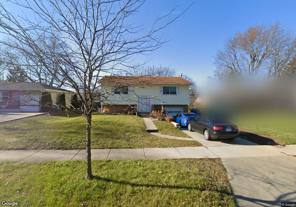
6495 Karl Rd Columbus, OH 43229
Devonshire NeighborhoodEstimated Value: $195,000 - $256,000
3
Beds
2
Baths
992
Sq Ft
$229/Sq Ft
Est. Value
About This Home
This home is located at 6495 Karl Rd, Columbus, OH 43229 and is currently estimated at $227,546, approximately $229 per square foot. 6495 Karl Rd is a home located in Franklin County with nearby schools including Devonshire Alternative Elementary School, Woodward Park Middle School, and Beechcroft High School.
Ownership History
Date
Name
Owned For
Owner Type
Purchase Details
Closed on
Aug 23, 2018
Sold by
Depouw Matthew
Bought by
Nmd Investments Llc
Current Estimated Value
Home Financials for this Owner
Home Financials are based on the most recent Mortgage that was taken out on this home.
Original Mortgage
$89,300
Interest Rate
4.5%
Mortgage Type
New Conventional
Purchase Details
Closed on
Aug 22, 2018
Sold by
Lewis Barbara A and Lewis Barbara
Bought by
Depouw Matthew
Home Financials for this Owner
Home Financials are based on the most recent Mortgage that was taken out on this home.
Original Mortgage
$89,300
Interest Rate
4.5%
Mortgage Type
New Conventional
Purchase Details
Closed on
May 2, 1998
Sold by
Lewis Dale
Bought by
Lewis Barbara
Purchase Details
Closed on
Jul 8, 1997
Sold by
Ope Inc
Bought by
Lewis Dale and Lewis Barbara
Home Financials for this Owner
Home Financials are based on the most recent Mortgage that was taken out on this home.
Original Mortgage
$80,000
Interest Rate
8%
Mortgage Type
Balloon
Purchase Details
Closed on
Apr 29, 1997
Sold by
Ope Inc
Bought by
Lewis Dale M and Lewis Barbara A
Home Financials for this Owner
Home Financials are based on the most recent Mortgage that was taken out on this home.
Original Mortgage
$73,405
Interest Rate
11%
Mortgage Type
Seller Take Back
Purchase Details
Closed on
Sep 5, 1995
Sold by
Rives Stephen R
Bought by
Ope Inc
Create a Home Valuation Report for This Property
The Home Valuation Report is an in-depth analysis detailing your home's value as well as a comparison with similar homes in the area
Home Values in the Area
Average Home Value in this Area
Purchase History
| Date | Buyer | Sale Price | Title Company |
|---|---|---|---|
| Nmd Investments Llc | -- | None Available | |
| Depouw Matthew | $94,000 | None Available | |
| Lewis Barbara | -- | -- | |
| Lewis Dale | $77,000 | Golden Title Agency Inc | |
| Lewis Dale M | $77,000 | -- | |
| Ope Inc | $60,750 | -- |
Source: Public Records
Mortgage History
| Date | Status | Borrower | Loan Amount |
|---|---|---|---|
| Previous Owner | Depouw Matthew | $89,300 | |
| Previous Owner | Lewis Dale | $80,000 | |
| Previous Owner | Lewis Dale M | $73,405 |
Source: Public Records
Tax History
| Year | Tax Paid | Tax Assessment Tax Assessment Total Assessment is a certain percentage of the fair market value that is determined by local assessors to be the total taxable value of land and additions on the property. | Land | Improvement |
|---|---|---|---|---|
| 2025 | $3,451 | $72,030 | $17,640 | $54,390 |
| 2024 | $3,451 | $72,030 | $17,640 | $54,390 |
| 2023 | $3,410 | $72,030 | $17,640 | $54,390 |
| 2022 | $2,680 | $46,590 | $13,020 | $33,570 |
| 2021 | $2,630 | $46,590 | $13,020 | $33,570 |
| 2020 | $2,484 | $46,590 | $13,020 | $33,570 |
| 2019 | $2,285 | $37,660 | $10,430 | $27,230 |
| 2018 | $1,815 | $37,660 | $10,430 | $27,230 |
| 2017 | $1,882 | $37,660 | $10,430 | $27,230 |
| 2016 | $1,424 | $30,240 | $7,910 | $22,330 |
| 2015 | $1,292 | $30,240 | $7,910 | $22,330 |
| 2014 | $1,295 | $30,240 | $7,910 | $22,330 |
| 2013 | $739 | $33,600 | $8,785 | $24,815 |
Source: Public Records
Map
Nearby Homes
- 1635 Tendril Ct
- 6336 Archmere Square E
- 1322 Bolenhill Ct
- 1268 Kildale Ct
- 6496 Hearthstone Ave
- 6242 Skywae Dr
- 1288 Oakfield Dr N
- 6245 Sharon Woods Blvd
- 6162 Oakfield Dr E
- 1947 Rockdale Dr Unit 33
- 6035 Karl Rd
- 1457 Burnley Square S
- 6189 Northgap Dr
- 6448 Sharon Woods Blvd Unit B
- 6211 Parkdale Dr
- 1451 Chesterton Square S
- 5990 Ambleside Dr
- 6326 Birkewood St
- 1390 E Dublin Granville Rd
- 5885 Beechcroft Rd Unit 116
- 6507 Karl Rd
- 6487 Karl Rd
- 6504 Dobson Square E
- 6515 Karl Rd
- 6496 Dobson Square E
- 6512 Dobson Square E
- 6488 Dobson Square E
- 6520 Dobson Square E
- 6523 Karl Rd
- 6496 Karl Rd
- 6488 Karl Rd
- 6504 Karl Rd
- 1516 Cranwood Dr
- 6528 Dobson Square E
- 6471 Karl Rd
- 6480 Karl Rd
- 6512 Karl Rd
- 6531 Karl Rd
- 6480 Dobson Square E
- 6472 Karl Rd