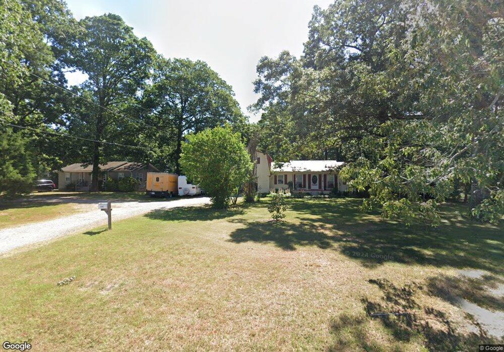
6496 Moores Mill Rd Huntsville, AL 35811
Moores Mill NeighborhoodEstimated Value: $241,333 - $349,000
--
Bed
--
Bath
2,544
Sq Ft
$115/Sq Ft
Est. Value
About This Home
This home is located at 6496 Moores Mill Rd, Huntsville, AL 35811 and is currently estimated at $292,583, approximately $115 per square foot. 6496 Moores Mill Rd is a home with nearby schools including Mt Carmel Elementary School, Riverton Intermediate School, and Buckhorn Middle School.
Ownership History
Date
Name
Owned For
Owner Type
Purchase Details
Closed on
Apr 17, 2009
Sold by
Thomas Kenneth Ray and Moore Debra Lynn
Bought by
Kearns Lee Christopher
Current Estimated Value
Home Financials for this Owner
Home Financials are based on the most recent Mortgage that was taken out on this home.
Original Mortgage
$157,102
Outstanding Balance
$99,686
Interest Rate
5.01%
Mortgage Type
FHA
Estimated Equity
$192,897
Purchase Details
Closed on
Feb 15, 2008
Sold by
Thomas Billy Wayne
Bought by
Thomas Kenneth Ray and Moore Debra Lynn
Home Financials for this Owner
Home Financials are based on the most recent Mortgage that was taken out on this home.
Original Mortgage
$79,300
Interest Rate
5.85%
Mortgage Type
Purchase Money Mortgage
Create a Home Valuation Report for This Property
The Home Valuation Report is an in-depth analysis detailing your home's value as well as a comparison with similar homes in the area
Home Values in the Area
Average Home Value in this Area
Purchase History
| Date | Buyer | Sale Price | Title Company |
|---|---|---|---|
| Kearns Lee Christopher | -- | -- | |
| Thomas Kenneth Ray | -- | -- | |
| Thomas Kenneth Ray | -- | -- |
Source: Public Records
Mortgage History
| Date | Status | Borrower | Loan Amount |
|---|---|---|---|
| Open | Kearns Lee Christopher | $157,102 | |
| Previous Owner | Thomas Kenneth Ray | $79,300 |
Source: Public Records
Tax History Compared to Growth
Tax History
| Year | Tax Paid | Tax Assessment Tax Assessment Total Assessment is a certain percentage of the fair market value that is determined by local assessors to be the total taxable value of land and additions on the property. | Land | Improvement |
|---|---|---|---|---|
| 2024 | $712 | $21,020 | $2,500 | $18,520 |
| 2023 | $712 | $20,520 | $2,500 | $18,020 |
| 2022 | $586 | $17,480 | $1,460 | $16,020 |
| 2021 | $523 | $15,760 | $1,460 | $14,300 |
| 2020 | $487 | $14,760 | $1,450 | $13,310 |
| 2019 | $469 | $14,270 | $1,450 | $12,820 |
| 2018 | $432 | $13,260 | $0 | $0 |
| 2017 | $432 | $13,260 | $0 | $0 |
| 2016 | $432 | $13,260 | $0 | $0 |
| 2015 | $432 | $13,260 | $0 | $0 |
| 2014 | $428 | $13,140 | $0 | $0 |
Source: Public Records
Map
Nearby Homes
- Charleston Pennington Ave
- Shelburne Pennington Ave
- Cambridge Pennington Ave
- Raleigh Pennington Ave
- Bennington Pennington Ave
- 0.40 acres Laurel Oak Rd
- Blakley Pennington Ave
- The Cambridge Plan at Pennington
- The Raleigh Plan at Pennington
- The Manhattan Plan at Pennington
- The Lincoln Plan at Pennington
- The Winston Plan at Pennington
- The Bennington Plan at Pennington
- The Shelburne Plan at Pennington
- The Savannah Plan at Pennington
- The Charleston Plan at Pennington
- Winston Pennington Ave
- 154 Stone Hill Dr
- 206 Exeter St
- Independence II Plan at St. Clair Place - Ranchers
- 6506 Moores Mill Rd
- 6488 Moores Mill Rd
- 6514 Moores Mill Rd
- 6480 Moores Mill Rd
- 6522 Moores Mill Rd
- 102 Oakcrest Rd
- 79 Robinson Rd
- 126 Robinson Rd
- 104 Oakcrest Rd
- 106 Oakcrest Rd
- 101 Oakcrest Rd
- 103 Oakcrest Rd
- 6546 Moores Mill Rd
- 108 Oakcrest Rd
- 107 Oakcrest Rd
- 159 Robinson Rd
- 6523 Moores Mill Rd
- 158 Robinson Rd
- 167 Robinson Rd
- 110 Oakcrest Rd