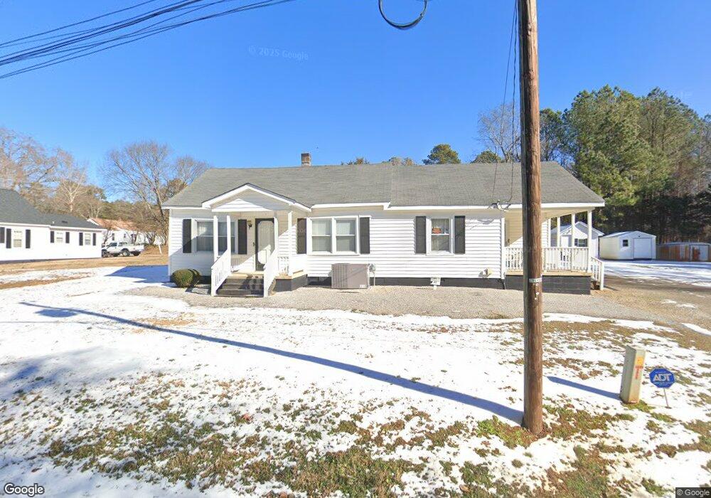
65 Cheatham Ln Henderson, NC 27537
Estimated Value: $198,000 - $246,000
2
Beds
1
Bath
1,845
Sq Ft
$118/Sq Ft
Est. Value
About This Home
This home is located at 65 Cheatham Ln, Henderson, NC 27537 and is currently estimated at $216,973, approximately $117 per square foot. 65 Cheatham Ln is a home located in Vance County with nearby schools including E.M. Rollins Elementary School, Vance County Middle School, and Vance County High School.
Ownership History
Date
Name
Owned For
Owner Type
Purchase Details
Closed on
Jan 3, 2024
Sold by
Marable Bennett Sadie
Bought by
Hill Brenda B
Current Estimated Value
Purchase Details
Closed on
Aug 6, 2009
Sold by
Bennett Sadie Marable and Bennett Clarence C
Bought by
Bennett Sadie Marable and Hill Brenda B
Home Financials for this Owner
Home Financials are based on the most recent Mortgage that was taken out on this home.
Original Mortgage
$69,698
Interest Rate
5.19%
Mortgage Type
Purchase Money Mortgage
Create a Home Valuation Report for This Property
The Home Valuation Report is an in-depth analysis detailing your home's value as well as a comparison with similar homes in the area
Home Values in the Area
Average Home Value in this Area
Purchase History
| Date | Buyer | Sale Price | Title Company |
|---|---|---|---|
| Hill Brenda B | -- | None Listed On Document | |
| Hill Brenda B | -- | None Listed On Document | |
| Bennett Sadie Marable | -- | -- |
Source: Public Records
Mortgage History
| Date | Status | Borrower | Loan Amount |
|---|---|---|---|
| Previous Owner | Bennett Sadie Marable | $69,698 |
Source: Public Records
Tax History Compared to Growth
Tax History
| Year | Tax Paid | Tax Assessment Tax Assessment Total Assessment is a certain percentage of the fair market value that is determined by local assessors to be the total taxable value of land and additions on the property. | Land | Improvement |
|---|---|---|---|---|
| 2025 | $1,608 | $200,222 | $21,830 | $178,392 |
| 2024 | $1,960 | $200,222 | $21,830 | $178,392 |
| 2023 | $445 | $66,344 | $5,625 | $60,719 |
| 2022 | $445 | $66,344 | $5,625 | $60,719 |
| 2021 | $650 | $66,344 | $5,625 | $60,719 |
| 2020 | $442 | $66,344 | $5,625 | $60,719 |
| 2019 | $437 | $66,344 | $5,625 | $60,719 |
| 2018 | $620 | $66,344 | $5,625 | $60,719 |
| 2017 | $415 | $66,344 | $5,625 | $60,719 |
| 2016 | $415 | $66,344 | $5,625 | $60,719 |
| 2015 | $500 | $60,740 | $6,075 | $54,665 |
| 2014 | $358 | $60,735 | $6,075 | $54,660 |
Source: Public Records
Map
Nearby Homes
- 415 Beechwood Trail
- 105 Sunset Cir
- 3203 Cameron Dr
- 3070 Cameron Dr
- 115 Red Bud Dr
- 00 Oxford Rd Southern Ave Rd
- 106 Orchard Rd
- 2315 Oxford Rd
- 105 Fernwood Creek Ct
- 2535 Fairway Dr Unit 3
- 159 Dorsey Place
- 2118 N Woodland Rd
- 65 Pine View Rd
- 1922 Oxford Rd
- 1744 Parker Ln
- 307 Yowland Rd
- 1822 Ruin Creek Rd
- 409 Eagle Ct
- 407 Eagle Ct
- 404 Eagle Ct
- 50 Fort Cheatham Land
- 81 Cheatham Ln
- 47 Cheatham Ln
- 29 Cheatham Ln
- 90 Cheatham Ln
- 48 Cheatham Ln
- 101 Cheatham Ln
- 19 Cheatham Ln
- 3161 Us 158 Bypass
- 3095 Highway 158 Business
- 207 Truman Ave
- 205 Truman Ave
- 209 Truman Ave
- 213 Truman Ave
- 119 Westlake Dr
- 217 Truman Ave
- 117 Westlake Dr
- 221 Truman Ave
- 224 Truman Ave
- 225 Truman Ave