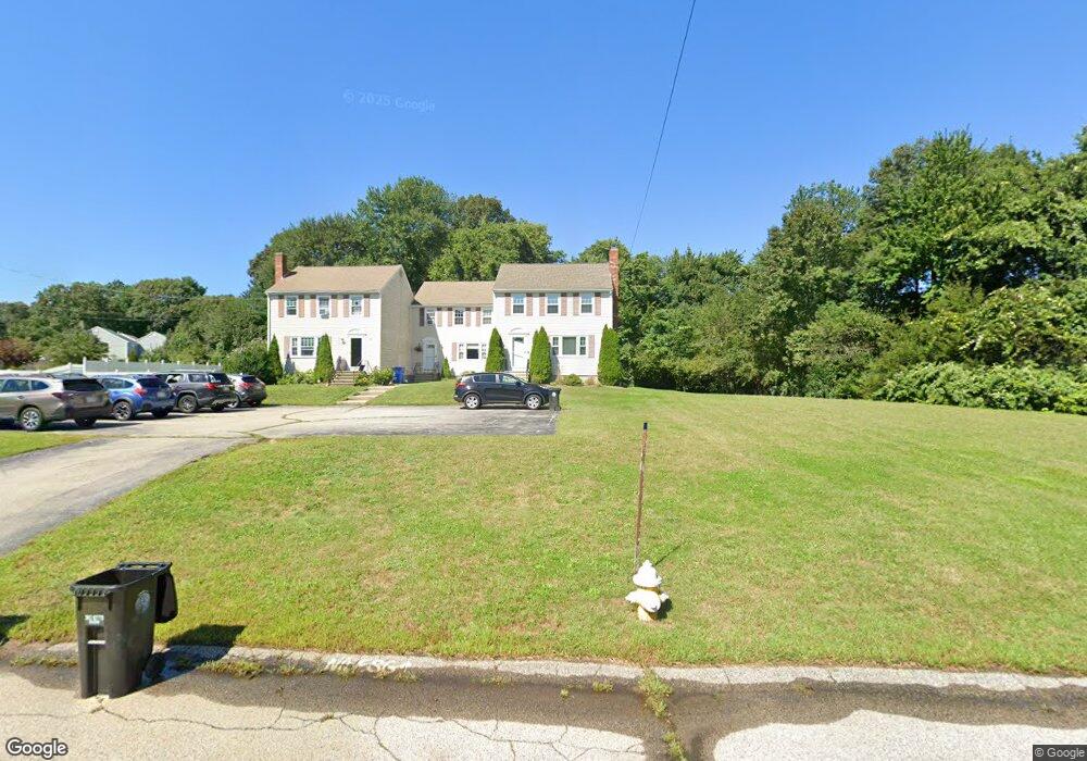
65 Cobb Rd Wrentham, MA 02093
Estimated Value: $407,000 - $439,000
2
Beds
2
Baths
1,590
Sq Ft
$263/Sq Ft
Est. Value
About This Home
This home is located at 65 Cobb Rd, Wrentham, MA 02093 and is currently estimated at $418,480, approximately $263 per square foot. 65 Cobb Rd is a home located in Norfolk County with nearby schools including Delaney Elementary School, Charles E Roderick, and Discovery Daycare Center.
Ownership History
Date
Name
Owned For
Owner Type
Purchase Details
Closed on
Jun 4, 2021
Sold by
Montillo Stefania
Bought by
Sarnie Susan R
Current Estimated Value
Home Financials for this Owner
Home Financials are based on the most recent Mortgage that was taken out on this home.
Original Mortgage
$272,000
Outstanding Balance
$246,262
Interest Rate
2.9%
Mortgage Type
Purchase Money Mortgage
Estimated Equity
$172,218
Purchase Details
Closed on
Jul 1, 2019
Sold by
Kemper William B and Kemper Wendy
Bought by
Montillo Stefania
Home Financials for this Owner
Home Financials are based on the most recent Mortgage that was taken out on this home.
Original Mortgage
$234,000
Interest Rate
3.9%
Mortgage Type
New Conventional
Purchase Details
Closed on
Feb 27, 2017
Sold by
Mastrogiacomo Jason and Mastrogiacomo Stacy
Bought by
Kemper William B and Kemper Wendy
Purchase Details
Closed on
Jul 16, 2010
Sold by
Dorcil Jean M and Moore Tracy
Bought by
Mastrogiacomo Jason and Mcgloughlin Stacy
Home Financials for this Owner
Home Financials are based on the most recent Mortgage that was taken out on this home.
Original Mortgage
$212,143
Interest Rate
5.5%
Mortgage Type
FHA
Purchase Details
Closed on
Oct 27, 2004
Sold by
Omalley Jennifer M and Pagel Jennifer M
Bought by
Dorcil Jean M and Moore Tracy
Home Financials for this Owner
Home Financials are based on the most recent Mortgage that was taken out on this home.
Original Mortgage
$255,000
Interest Rate
5.74%
Mortgage Type
Purchase Money Mortgage
Purchase Details
Closed on
Feb 22, 2002
Sold by
Scanlon Donna M and Scanlon Robert E
Bought by
Omalley Sean C
Home Financials for this Owner
Home Financials are based on the most recent Mortgage that was taken out on this home.
Original Mortgage
$152,000
Interest Rate
7.08%
Mortgage Type
Purchase Money Mortgage
Purchase Details
Closed on
Jan 7, 2000
Sold by
Volpicelli Joseph A
Bought by
Scanlon Donna M and Scanlon Robert E
Home Financials for this Owner
Home Financials are based on the most recent Mortgage that was taken out on this home.
Original Mortgage
$106,875
Interest Rate
7.73%
Mortgage Type
Purchase Money Mortgage
Create a Home Valuation Report for This Property
The Home Valuation Report is an in-depth analysis detailing your home's value as well as a comparison with similar homes in the area
Purchase History
| Date | Buyer | Sale Price | Title Company |
|---|---|---|---|
| Sarnie Susan R | $350,000 | None Available | |
| Montillo Stefania | $260,000 | -- | |
| Kemper William B | $250,000 | -- | |
| Mastrogiacomo Jason | $215,000 | -- | |
| Dorcil Jean M | $255,000 | -- | |
| Omalley Sean C | $169,000 | -- | |
| Omalley Sean C | $169,000 | -- | |
| Scanlon Donna M | $142,500 | -- |
Source: Public Records
Mortgage History
| Date | Status | Borrower | Loan Amount |
|---|---|---|---|
| Open | Sarnie Susan R | $272,000 | |
| Previous Owner | Montillo Stefania | $234,000 | |
| Previous Owner | Mastrogiacomo Jason | $212,143 | |
| Previous Owner | Dorcil Jean M | $255,000 | |
| Previous Owner | Omalley Sean C | $152,000 | |
| Previous Owner | Scanlon Donna M | $106,875 |
Source: Public Records
Tax History
| Year | Tax Paid | Tax Assessment Tax Assessment Total Assessment is a certain percentage of the fair market value that is determined by local assessors to be the total taxable value of land and additions on the property. | Land | Improvement |
|---|---|---|---|---|
| 2025 | $3,785 | $326,600 | $0 | $326,600 |
| 2024 | $3,815 | $317,900 | $0 | $317,900 |
| 2023 | $4,102 | $325,000 | $0 | $325,000 |
| 2022 | $3,763 | $275,300 | $0 | $275,300 |
| 2021 | $3,591 | $255,200 | $0 | $255,200 |
| 2020 | $3,721 | $261,100 | $0 | $261,100 |
| 2019 | $3,687 | $261,100 | $0 | $261,100 |
| 2018 | $3,410 | $239,500 | $0 | $239,500 |
| 2017 | $3,285 | $230,500 | $0 | $230,500 |
| 2016 | $3,203 | $224,300 | $0 | $224,300 |
| 2015 | $3,406 | $227,400 | $0 | $227,400 |
| 2014 | $3,305 | $215,900 | $0 | $215,900 |
Source: Public Records
Map
Nearby Homes
- 282 Thurston St
- 10 Nature View Dr
- 15 Nature View Dr
- 483 Thurston St
- 576 Dedham St
- 135 Creek St Unit 2
- 3 Earle Stewart Ln
- 2 Earle Stewart Ln
- 12 Earle Stewart Ln
- 10 Earle Stewart Ln Unit Lot 5
- 1 Weber Farm Rd Unit 1
- 25 Foxboro Rd
- 11 Weber Farm Rd Unit 11
- 8 Weber Farm Rd Unit 8
- 131 Washington St Unit 42
- 131 Washington St Unit 50
- 30 Weber Farm Rd Unit 30
- 75 Foxboro Rd
- 500 Franklin St
- 65 Foxboro Rd
Your Personal Tour Guide
Ask me questions while you tour the home.