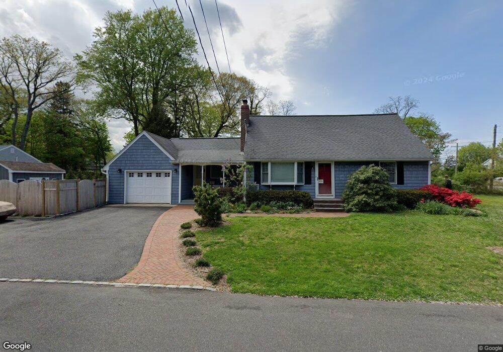
65 Crest Dr East Northport, NY 11731
Estimated Value: $546,000 - $674,906
--
Bed
--
Bath
--
Sq Ft
0.25
Acres
About This Home
This home is located at 65 Crest Dr, East Northport, NY 11731 and is currently estimated at $639,477. 65 Crest Dr is a home located in Suffolk County with nearby schools including Northport Senior High School, The School House, and Trinity Regional School-East Northport Campus.
Ownership History
Date
Name
Owned For
Owner Type
Purchase Details
Closed on
Jun 13, 2003
Sold by
Secor Hazel and Dolle Karen
Bought by
Butler Christopher and Butler Dana
Current Estimated Value
Home Financials for this Owner
Home Financials are based on the most recent Mortgage that was taken out on this home.
Original Mortgage
$200,000
Interest Rate
5.28%
Mortgage Type
Purchase Money Mortgage
Purchase Details
Closed on
Nov 19, 1999
Sold by
Secor Hazel
Bought by
Dooley Virginia L and Dolle Karen
Create a Home Valuation Report for This Property
The Home Valuation Report is an in-depth analysis detailing your home's value as well as a comparison with similar homes in the area
Home Values in the Area
Average Home Value in this Area
Purchase History
| Date | Buyer | Sale Price | Title Company |
|---|---|---|---|
| Butler Christopher | $355,000 | Fidelity National Title Ins | |
| Dooley Virginia L | -- | Fidelity National Title Ins |
Source: Public Records
Mortgage History
| Date | Status | Borrower | Loan Amount |
|---|---|---|---|
| Previous Owner | Butler Christopher | $200,000 |
Source: Public Records
Tax History Compared to Growth
Tax History
| Year | Tax Paid | Tax Assessment Tax Assessment Total Assessment is a certain percentage of the fair market value that is determined by local assessors to be the total taxable value of land and additions on the property. | Land | Improvement |
|---|---|---|---|---|
| 2024 | $9,718 | $3,025 | $125 | $2,900 |
| 2023 | $4,859 | $3,025 | $125 | $2,900 |
| 2022 | $9,135 | $3,025 | $125 | $2,900 |
| 2021 | $8,847 | $3,025 | $125 | $2,900 |
| 2020 | $8,703 | $3,025 | $125 | $2,900 |
| 2019 | $17,405 | $0 | $0 | $0 |
| 2018 | $8,159 | $3,025 | $125 | $2,900 |
| 2017 | $8,159 | $3,025 | $125 | $2,900 |
| 2016 | $8,025 | $3,025 | $125 | $2,900 |
| 2015 | -- | $3,025 | $125 | $2,900 |
| 2014 | -- | $3,025 | $125 | $2,900 |
Source: Public Records
Map
Nearby Homes
- 18 Norton Dr
- 167 Vernon Valley Rd
- 15 Crest Dr
- 96 Bellecrest Ave
- 62 Forest Dr
- 110 Bellecrest Ave
- 17 Terrace Dr
- 96 Soundview Ave
- 44 Grant St
- 72 Upland Dr
- 54A Upland Dr
- 66 Upland Dr
- 83 Bellerose Ave
- 65 Circle Dr
- 267 Laurel Rd
- 40 Irving Johnson St
- 26 Irving Johnson St
- 909 2nd St N
- 27 Brittany Ct
- 292 Laurel Rd
- 32 Bellecrest Ave
- 30 Bellecrest Ave
- 61 Crest Dr
- 38 Bellecrest Ave
- 54 Crest Dr
- 28 Bellecrest Ave
- 29 Bellecrest Ave
- 33 Bellecrest Ave
- 27 Bellecrest Ave
- 35 Bellecrest Ave
- 40 Bellecrest Ave
- 37 Bellecrest Ave
- 23 Bellecrest Ave
- 24 Bellecrest Ave
- 25 Norton Dr
- 21 Suffolk Place
- 17 Suffolk Place
- 42 Bellecrest Ave
- 39 Bellecrest Ave
- 19 Norton Dr