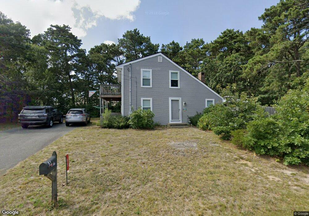
65 Cynthia Ln Dennis Port, MA 02639
Dennis Port NeighborhoodEstimated Value: $576,000 - $665,000
3
Beds
1
Bath
1,001
Sq Ft
$628/Sq Ft
Est. Value
About This Home
This home is located at 65 Cynthia Ln, Dennis Port, MA 02639 and is currently estimated at $628,771, approximately $628 per square foot. 65 Cynthia Ln is a home located in Barnstable County with nearby schools including Dennis-Yarmouth Regional High School and St. Pius X. School.
Ownership History
Date
Name
Owned For
Owner Type
Purchase Details
Closed on
Dec 24, 2002
Sold by
Lonabocker Thomas M
Bought by
Doyle John M and Doyle Maureen E
Current Estimated Value
Home Financials for this Owner
Home Financials are based on the most recent Mortgage that was taken out on this home.
Original Mortgage
$180,800
Outstanding Balance
$77,215
Interest Rate
6.16%
Mortgage Type
Purchase Money Mortgage
Estimated Equity
$551,556
Create a Home Valuation Report for This Property
The Home Valuation Report is an in-depth analysis detailing your home's value as well as a comparison with similar homes in the area
Home Values in the Area
Average Home Value in this Area
Purchase History
| Date | Buyer | Sale Price | Title Company |
|---|---|---|---|
| Doyle John M | $226,000 | -- |
Source: Public Records
Mortgage History
| Date | Status | Borrower | Loan Amount |
|---|---|---|---|
| Open | Doyle John M | $180,800 |
Source: Public Records
Tax History Compared to Growth
Tax History
| Year | Tax Paid | Tax Assessment Tax Assessment Total Assessment is a certain percentage of the fair market value that is determined by local assessors to be the total taxable value of land and additions on the property. | Land | Improvement |
|---|---|---|---|---|
| 2025 | $2,119 | $489,300 | $202,200 | $287,100 |
| 2024 | $2,122 | $483,400 | $194,500 | $288,900 |
| 2023 | $2,052 | $439,500 | $176,800 | $262,700 |
| 2022 | $1,985 | $354,400 | $159,300 | $195,100 |
| 2021 | $2,003 | $332,200 | $178,400 | $153,800 |
| 2020 | $1,793 | $294,000 | $156,100 | $137,900 |
| 2019 | $1,787 | $289,600 | $153,100 | $136,500 |
| 2018 | $1,678 | $264,600 | $145,700 | $118,900 |
| 2017 | $1,613 | $262,200 | $135,300 | $126,900 |
| 2016 | $1,642 | $251,500 | $145,700 | $105,800 |
| 2015 | $1,610 | $251,500 | $145,700 | $105,800 |
| 2014 | $1,513 | $238,300 | $124,900 | $113,400 |
Source: Public Records
Map
Nearby Homes
- 31 Easy St
- 80 Michaels Ave
- 19 Standish Way
- 22 Wixon Rd
- 4 Coffey Ln
- 72 Bassett Ln
- 125 Main St Unit 3
- 71 Main St
- 37 Ocean Dr Unit 2
- 268 Main St
- 12 Spoonbill Rd
- 64 Beaten Rd
- 22 Ferncliff Rd
- 37 Beach Hills Rd
- 37-A Beach Hills Rd
- 262 Old Wharf Rd Unit 67
- 262 Old Wharf Rd Unit 5
- 262 Old Wharf Rd Unit 5
- 262 Old Wharf Rd Unit 20
- 262 Old Wharf Rd Unit 87
- 64 Cynthia Ln
- 59 Cynthia Ln
- 71 Cynthia Ln
- 64 Kibby Ln
- 58 Cynthia Ln
- 72 Cynthia Ln
- 57 Siasconset Ave
- 53 Siasconset Ave
- 59 Siasconset Ave
- 51 Siasconset Ave
- 51 Siasconset Ave Unit 1
- 78 Kibby Ln
- 61 Siasconset Ave
- 49 Siasconset Ave
- 74 Kibby Ln
- 84 Kibby Ln
- 63 Siasconset Ave
- 53 Cynthia Ln
- 79 Cynthia Ln
- 45 Siasconset Ave