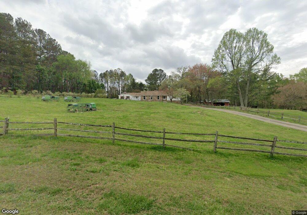
65 Dorris Rd Alpharetta, GA 30004
Estimated Value: $1,043,000 - $1,433,000
4
Beds
4
Baths
2,928
Sq Ft
$435/Sq Ft
Est. Value
About This Home
This home is located at 65 Dorris Rd, Alpharetta, GA 30004 and is currently estimated at $1,274,953, approximately $435 per square foot. 65 Dorris Rd is a home located in Fulton County with nearby schools including Summit Hill Elementary School, Northwestern Middle School, and Milton High School.
Ownership History
Date
Name
Owned For
Owner Type
Purchase Details
Closed on
Jul 29, 2016
Sold by
Malon D
Bought by
Mimms Frek and Mimms Amanda
Current Estimated Value
Home Financials for this Owner
Home Financials are based on the most recent Mortgage that was taken out on this home.
Original Mortgage
$400,000
Outstanding Balance
$182,998
Interest Rate
3.48%
Mortgage Type
New Conventional
Estimated Equity
$1,091,955
Purchase Details
Closed on
Jun 17, 2016
Sold by
Doelling Nancy S
Bought by
Mimms Malon D
Home Financials for this Owner
Home Financials are based on the most recent Mortgage that was taken out on this home.
Original Mortgage
$400,000
Outstanding Balance
$182,998
Interest Rate
3.48%
Mortgage Type
New Conventional
Estimated Equity
$1,091,955
Purchase Details
Closed on
Aug 4, 2008
Sold by
Doelling Louis R
Bought by
Doelling Nancy S
Purchase Details
Closed on
Mar 26, 2003
Sold by
Doelling Nancy S and Doelling Louis R
Bought by
Doelling Nancy S and Doelling Louis
Create a Home Valuation Report for This Property
The Home Valuation Report is an in-depth analysis detailing your home's value as well as a comparison with similar homes in the area
Home Values in the Area
Average Home Value in this Area
Purchase History
| Date | Buyer | Sale Price | Title Company |
|---|---|---|---|
| Mimms Frek | $660,000 | -- | |
| Mimms Malon D | $660,000 | -- | |
| Doelling Nancy S | -- | -- | |
| Doelling Nancy S | -- | -- | |
| Doelling Louis R | -- | -- |
Source: Public Records
Mortgage History
| Date | Status | Borrower | Loan Amount |
|---|---|---|---|
| Open | Mimms Frek | $400,000 |
Source: Public Records
Tax History Compared to Growth
Tax History
| Year | Tax Paid | Tax Assessment Tax Assessment Total Assessment is a certain percentage of the fair market value that is determined by local assessors to be the total taxable value of land and additions on the property. | Land | Improvement |
|---|---|---|---|---|
| 2025 | $1,111 | $503,520 | $361,400 | $142,120 |
| 2023 | $10,726 | $380,000 | $251,720 | $128,280 |
| 2022 | $5,642 | $380,000 | $251,720 | $128,280 |
| 2021 | $6,425 | $258,640 | $159,320 | $99,320 |
| 2020 | $5,377 | $244,280 | $139,200 | $105,080 |
| 2019 | $1,022 | $239,960 | $136,720 | $103,240 |
| 2018 | $5,673 | $223,760 | $108,320 | $115,440 |
| 2017 | $5,083 | $186,160 | $70,040 | $116,120 |
| 2016 | $3,256 | $186,160 | $70,040 | $116,120 |
| 2015 | $4,069 | $186,160 | $70,040 | $116,120 |
| 2014 | $3,259 | $186,160 | $70,040 | $116,120 |
Source: Public Records
Map
Nearby Homes
- 13150 New Providence Rd
- 85 Arabian Ave Unit 2
- 13340 New Providence Rd
- 13535 Blakmaral Ln
- 12950 New Providence Rd
- 257 Ranchette Rd
- 13560 Blakmaral Ln
- 13550 Blakmaral Ln
- 12842 Waterside Dr Unit 2
- 195 Horizon Hill
- 520 Heathmill Ct
- 13540 Providence Lake Dr
- 601 Dorris Rd
- 435 Old Holly Rd
- 775 Lake Mist Cove
- 13015 Morningpark Cir Unit 1
- 12655 New Providence Rd
- 13025 Morningpark Cir
- 137 Quinn Way
- 13250 Birmingham Hwy
- 65 Dorris Rd
- 65 Dorris Rd
- 85 Dorris Rd Unit 3
- 105 Dorris Rd Unit 3
- 60 Dorris Rd
- 13185 New Providence Rd
- 50 Dorris Rd Unit 4
- 20 Dorris Rd
- 710 Oxford Lakes Ct
- 710 Oxford Lakes Ct Unit II
- 725 Oxford Lakes Ct
- 125 Dorris Rd
- 100 Dorris Rd
- 100 Dorris Rd Unit 2
- 13175 New Providence Rd
- 1 Dorris Rd
- 0000 New Providence Rd
- 715 Oxford Lakes Ct
- 535 Oxford Lakes Run
- 700 Oxford Lakes Ct