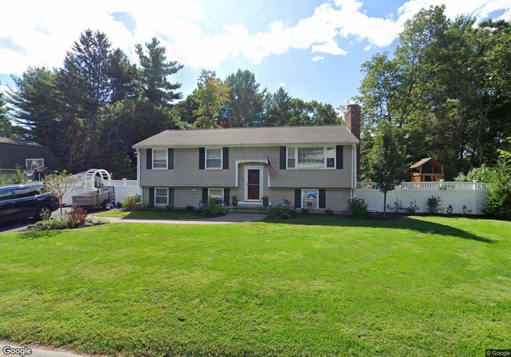
65 Dover St Concord, MA 01742
Estimated Value: $830,000 - $994,000
3
Beds
2
Baths
1,791
Sq Ft
$505/Sq Ft
Est. Value
About This Home
This home is located at 65 Dover St, Concord, MA 01742 and is currently estimated at $904,910, approximately $505 per square foot. 65 Dover St is a home located in Middlesex County with nearby schools including Willard School, Concord Middle School, and Corwin-Russell School at Broccoli Hall.
Ownership History
Date
Name
Owned For
Owner Type
Purchase Details
Closed on
Sep 30, 2011
Sold by
Corp Clive L and Corp Beverly A
Bought by
Whalen James E and Whalen Courtney D
Current Estimated Value
Home Financials for this Owner
Home Financials are based on the most recent Mortgage that was taken out on this home.
Original Mortgage
$344,800
Outstanding Balance
$235,733
Interest Rate
4.15%
Mortgage Type
Purchase Money Mortgage
Estimated Equity
$669,177
Create a Home Valuation Report for This Property
The Home Valuation Report is an in-depth analysis detailing your home's value as well as a comparison with similar homes in the area
Home Values in the Area
Average Home Value in this Area
Purchase History
| Date | Buyer | Sale Price | Title Company |
|---|---|---|---|
| Whalen James E | $431,000 | -- |
Source: Public Records
Mortgage History
| Date | Status | Borrower | Loan Amount |
|---|---|---|---|
| Open | Whalen James E | $344,800 |
Source: Public Records
Tax History Compared to Growth
Tax History
| Year | Tax Paid | Tax Assessment Tax Assessment Total Assessment is a certain percentage of the fair market value that is determined by local assessors to be the total taxable value of land and additions on the property. | Land | Improvement |
|---|---|---|---|---|
| 2025 | $10,166 | $766,700 | $449,600 | $317,100 |
| 2024 | $9,724 | $740,600 | $449,600 | $291,000 |
| 2023 | $9,320 | $719,100 | $428,100 | $291,000 |
| 2022 | $8,621 | $584,100 | $342,500 | $241,600 |
| 2021 | $8,499 | $577,400 | $342,500 | $234,900 |
| 2020 | $7,965 | $559,700 | $342,500 | $217,200 |
| 2019 | $7,802 | $549,800 | $332,600 | $217,200 |
| 2018 | $7,312 | $511,700 | $302,300 | $209,400 |
| 2017 | $7,119 | $506,000 | $308,500 | $197,500 |
| 2016 | $6,979 | $501,400 | $308,500 | $192,900 |
| 2015 | $6,428 | $449,800 | $266,600 | $183,200 |
Source: Public Records
Map
Nearby Homes
- 40 Rookery Ln Unit 5
- 72 Rookery Ln Unit 3
- 24 Rookery Ln Unit 6
- 121 White Pond Way Unit 121
- 56 Rookery Ln Unit 4
- 401 Emery Ln Unit 304
- 42 Dakin Rd
- 37 Wolf Pine Way
- 16 Blacksmith Dr
- 497 Old Road to 9 Acre Corner
- Lot 5 Sailaway Ln
- 45 N Crescent Cir
- Lot 4 Sailaway Ln
- 2 Betts Way
- 8 Mina Way
- 0 Elm Unit 73282184
- Lot 9 Sailaway Ln
- 4 Betts Way
- 122 Sand Gully Rd N Unit B
- 941 Concord Rd