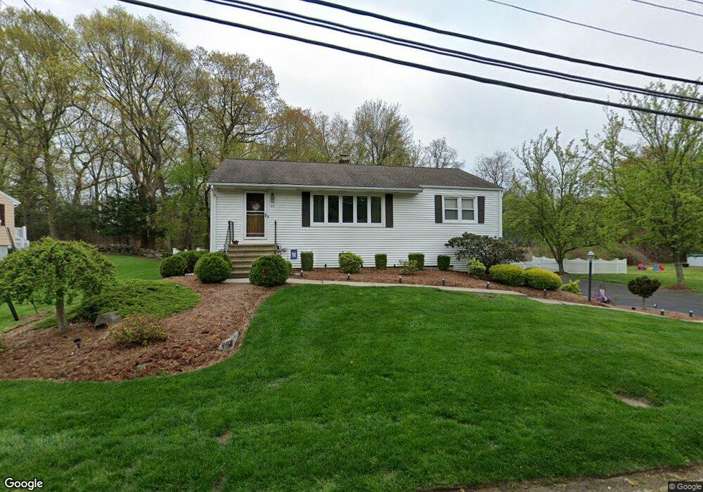
65 Euclid Ave Stratford, CT 06614
Estimated Value: $451,000 - $474,000
3
Beds
1
Bath
1,232
Sq Ft
$375/Sq Ft
Est. Value
About This Home
This home is located at 65 Euclid Ave, Stratford, CT 06614 and is currently estimated at $461,915, approximately $374 per square foot. 65 Euclid Ave is a home located in Fairfield County with nearby schools including Chapel Street Elementary School, Harry B. Flood Middle School, and Bunnell High School.
Ownership History
Date
Name
Owned For
Owner Type
Purchase Details
Closed on
Apr 21, 2008
Sold by
Charak Anna and Keller George
Bought by
Paris Michael and Fletcher Kelly
Current Estimated Value
Home Financials for this Owner
Home Financials are based on the most recent Mortgage that was taken out on this home.
Original Mortgage
$280,596
Outstanding Balance
$178,157
Interest Rate
6.1%
Estimated Equity
$283,758
Create a Home Valuation Report for This Property
The Home Valuation Report is an in-depth analysis detailing your home's value as well as a comparison with similar homes in the area
Home Values in the Area
Average Home Value in this Area
Purchase History
| Date | Buyer | Sale Price | Title Company |
|---|---|---|---|
| Paris Michael | $285,000 | -- |
Source: Public Records
Mortgage History
| Date | Status | Borrower | Loan Amount |
|---|---|---|---|
| Open | Paris Michael | $280,596 |
Source: Public Records
Tax History Compared to Growth
Tax History
| Year | Tax Paid | Tax Assessment Tax Assessment Total Assessment is a certain percentage of the fair market value that is determined by local assessors to be the total taxable value of land and additions on the property. | Land | Improvement |
|---|---|---|---|---|
| 2025 | $7,114 | $176,960 | $100,450 | $76,510 |
| 2024 | $7,114 | $176,960 | $100,450 | $76,510 |
| 2023 | $7,114 | $176,960 | $100,450 | $76,510 |
| 2022 | $6,983 | $176,960 | $100,450 | $76,510 |
| 2021 | $6,985 | $176,960 | $100,450 | $76,510 |
| 2020 | $7,015 | $176,960 | $100,450 | $76,510 |
| 2019 | $6,254 | $156,870 | $85,610 | $71,260 |
| 2018 | $6,259 | $156,870 | $85,610 | $71,260 |
| 2017 | $6,270 | $156,870 | $85,610 | $71,260 |
| 2016 | $6,116 | $156,870 | $85,610 | $71,260 |
| 2015 | $5,801 | $156,870 | $85,610 | $71,260 |
| 2014 | $5,904 | $165,690 | $91,980 | $73,710 |
Source: Public Records
Map
Nearby Homes
- 175 Post Oak Rd
- 80 Wilbrook Rd
- 717 Hawley Glen Unit 18
- 135 Wigwam Ln
- 30 Bulmer Dr
- 15 Tavern Rock Rd
- 80 Sheffield Cir
- 290 Pumpkin Ground Rd
- 160 Cheshire St
- 1053 Cutspring Rd
- 52 Circle Dr
- 735 Chickadee Ln
- 1314 Huntington Rd
- 1250 Huntington Rd
- 360 Nutmeg Ln Unit 360
- 165 Douglas St
- 246 Delaware Dr
- 410 Seabreeze Dr
- 420 Peters Ln
- 500 Peters Ln
- 45 Euclid Ave
- 85 Euclid Ave
- 60 Euclid Ave
- 80 Euclid Ave
- 2016 Huntington Rd
- 40 Euclid Ave
- 100 Euclid Ave
- 25 Euclid Ave
- 105 Euclid Ave
- 2080 Huntington Rd
- 2030 Huntington Rd
- 2012 Huntington Rd Unit 2
- 120 Euclid Ave
- 2050 Huntington Rd
- 125 Euclid Ave
- 2040 Huntington Rd
- 2020 Huntington Rd
- 12 Reut Dr
- 140 Euclid Ave
- 145 Euclid Ave