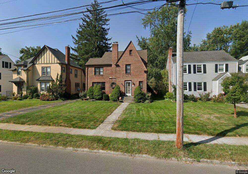
65 Griswold Dr West Hartford, CT 06119
Estimated Value: $622,000 - $684,000
4
Beds
3
Baths
2,456
Sq Ft
$271/Sq Ft
Est. Value
About This Home
This home is located at 65 Griswold Dr, West Hartford, CT 06119 and is currently estimated at $666,717, approximately $271 per square foot. 65 Griswold Dr is a home located in Hartford County with nearby schools including Morley School, King Philip Middle School, and Hall High School.
Ownership History
Date
Name
Owned For
Owner Type
Purchase Details
Closed on
Aug 18, 2008
Sold by
Stevens Tiffany and Iannuzzi Michael C
Bought by
Lim Ying and Liu Min-Hwei
Current Estimated Value
Home Financials for this Owner
Home Financials are based on the most recent Mortgage that was taken out on this home.
Original Mortgage
$300,000
Outstanding Balance
$189,911
Interest Rate
5.62%
Estimated Equity
$476,806
Purchase Details
Closed on
Aug 12, 2004
Sold by
Will Albert F and Will Kelly A
Bought by
Stevens Tiffany and Iannuzzi Michael C
Home Financials for this Owner
Home Financials are based on the most recent Mortgage that was taken out on this home.
Original Mortgage
$290,800
Interest Rate
6.16%
Purchase Details
Closed on
May 15, 2000
Sold by
Sciarra Paul R and Sciarra Elizabeth R
Bought by
Will Albert F and Will Kelly A
Create a Home Valuation Report for This Property
The Home Valuation Report is an in-depth analysis detailing your home's value as well as a comparison with similar homes in the area
Home Values in the Area
Average Home Value in this Area
Purchase History
| Date | Buyer | Sale Price | Title Company |
|---|---|---|---|
| Lim Ying | $445,000 | -- | |
| Stevens Tiffany | $363,500 | -- | |
| Will Albert F | $215,000 | -- |
Source: Public Records
Mortgage History
| Date | Status | Borrower | Loan Amount |
|---|---|---|---|
| Open | Will Albert F | $200,600 | |
| Open | Will Albert F | $300,000 | |
| Previous Owner | Will Albert F | $290,800 |
Source: Public Records
Tax History Compared to Growth
Tax History
| Year | Tax Paid | Tax Assessment Tax Assessment Total Assessment is a certain percentage of the fair market value that is determined by local assessors to be the total taxable value of land and additions on the property. | Land | Improvement |
|---|---|---|---|---|
| 2025 | $12,683 | $283,220 | $101,990 | $181,230 |
| 2024 | $11,994 | $283,220 | $101,990 | $181,230 |
| 2023 | $11,589 | $283,220 | $101,990 | $181,230 |
| 2022 | $11,521 | $283,220 | $101,990 | $181,230 |
| 2021 | $11,355 | $267,680 | $106,260 | $161,420 |
| 2020 | $10,735 | $256,830 | $99,330 | $157,500 |
| 2019 | $10,735 | $256,830 | $99,330 | $157,500 |
| 2018 | $10,530 | $256,830 | $99,330 | $157,500 |
| 2017 | $10,540 | $256,830 | $99,330 | $157,500 |
| 2016 | $10,150 | $256,900 | $87,500 | $169,400 |
| 2015 | $9,842 | $256,900 | $87,500 | $169,400 |
| 2014 | $9,600 | $256,900 | $87,500 | $169,400 |
Source: Public Records
Map
Nearby Homes
- 1196 Trout Brook Dr
- 105 Ardmore Rd
- 1268 Trout Brook Dr
- 1272 Trout Brook Dr
- 1110 Trout Brook Dr
- 129 Middlebrook Rd
- 1294 Trout Brook Dr
- 54 Robin Rd Unit B2
- 132 N Main St
- 183 Loomis Dr Unit 109
- 48 Walkley Rd
- 1006A Trout Brook Dr Unit 1006A
- 16 Lilley Rd
- 869 Farmington Ave Unit 305
- 237 Fern St Unit 314
- 30 Outlook Ave Unit 205
- 3 Trumbull Ln
- 11 Lawler Rd
- 85 Memorial Rd Unit 512
- 2 Arapahoe Rd Unit 313