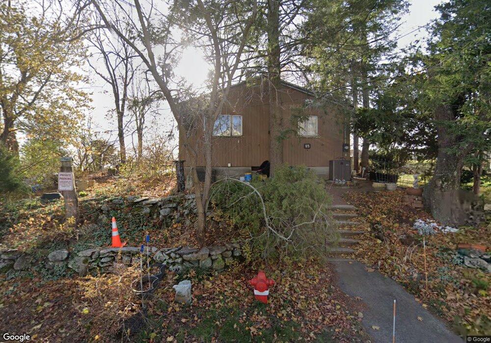
65 Hawthorne Ave Arlington, MA 02476
Arlington Heights NeighborhoodEstimated Value: $746,000 - $944,000
2
Beds
1
Bath
858
Sq Ft
$958/Sq Ft
Est. Value
About This Home
This home is located at 65 Hawthorne Ave, Arlington, MA 02476 and is currently estimated at $821,776, approximately $957 per square foot. 65 Hawthorne Ave is a home located in Middlesex County with nearby schools including Brackett Elementary School, Ottoson Middle School, and Arlington High School.
Ownership History
Date
Name
Owned For
Owner Type
Purchase Details
Closed on
Aug 14, 1997
Sold by
Wheltle R Bruce R and Wheltle Susan Y
Bought by
Beggy Carol A and Otoole Bridget A
Current Estimated Value
Home Financials for this Owner
Home Financials are based on the most recent Mortgage that was taken out on this home.
Original Mortgage
$162,000
Outstanding Balance
$24,325
Interest Rate
7.56%
Mortgage Type
Purchase Money Mortgage
Estimated Equity
$797,451
Purchase Details
Closed on
Jul 25, 1991
Sold by
Kelly Brenda J
Bought by
Wheltle R Bruce R and Wheltle Susan Y
Create a Home Valuation Report for This Property
The Home Valuation Report is an in-depth analysis detailing your home's value as well as a comparison with similar homes in the area
Home Values in the Area
Average Home Value in this Area
Purchase History
| Date | Buyer | Sale Price | Title Company |
|---|---|---|---|
| Beggy Carol A | $180,000 | -- | |
| Wheltle R Bruce R | $173,500 | -- |
Source: Public Records
Mortgage History
| Date | Status | Borrower | Loan Amount |
|---|---|---|---|
| Open | Wheltle R Bruce R | $162,000 |
Source: Public Records
Tax History Compared to Growth
Tax History
| Year | Tax Paid | Tax Assessment Tax Assessment Total Assessment is a certain percentage of the fair market value that is determined by local assessors to be the total taxable value of land and additions on the property. | Land | Improvement |
|---|---|---|---|---|
| 2025 | $7,963 | $739,400 | $546,000 | $193,400 |
| 2024 | $7,431 | $701,700 | $524,200 | $177,500 |
| 2023 | $7,029 | $627,000 | $458,700 | $168,300 |
| 2022 | $6,716 | $588,100 | $436,800 | $151,300 |
| 2021 | $6,616 | $583,400 | $436,800 | $146,600 |
| 2020 | $6,452 | $583,400 | $436,800 | $146,600 |
| 2019 | $6,021 | $534,700 | $409,500 | $125,200 |
| 2018 | $5,625 | $463,700 | $338,500 | $125,200 |
| 2017 | $5,481 | $436,400 | $311,200 | $125,200 |
| 2016 | $5,236 | $409,100 | $283,900 | $125,200 |
| 2015 | $5,462 | $403,100 | $278,500 | $124,600 |
Source: Public Records
Map
Nearby Homes
- 37 Fountain Rd Unit 2
- 37 Fountain Rd
- 789 Concord Turnpike
- 39 Newport St
- 53 Highland Ave
- 10 Plymouth St Unit 10
- 15 Higgins St Unit 17
- 1025 Massachusetts Ave Unit 204
- 204 Plan at Majestic Mill Brook
- 1025 Massachusetts Ave Unit 404
- 1025 Massachusetts Ave Unit 506
- 1025 Massachusetts Ave Unit 401
- 1025 Massachusetts Ave Unit 210
- 1025 Massachusetts Ave Unit 402
- 1025 Massachusetts Ave Unit 308
- 1025 Massachusetts Ave Unit 411
- 1025 Massachusetts Ave Unit 313
- 1025 Massachusetts Ave Unit 304
- 1025 Massachusetts Ave Unit 414
- 1025 Massachusetts Ave Unit 212
- 89 Coolidge Rd
- 100 Coolidge Rd
- 98 Coolidge Rd
- 59 Hawthorne Ave
- 57 Hawthorne Ave
- 94 Coolidge Rd
- 88 Coolidge Rd
- 52 Hawthorne Ave
- 50 Hawthorne Ave
- 85 Coolidge Rd
- 177 Mount Vernon St
- 86 Coolidge Rd
- 86 Coolidge Rd
- 86 Coolidge Rd Unit 1
- 4 Murray St
- 173 Mount Vernon St
- 10 Murray St
- 169 Mount Vernon St
- 14 Murray St
- 165 Mount Vernon St