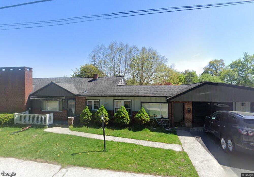
65 High St Monroe, NY 10950
Estimated Value: $554,110 - $667,000
4
Beds
4
Baths
1,772
Sq Ft
$341/Sq Ft
Est. Value
About This Home
This home is located at 65 High St, Monroe, NY 10950 and is currently estimated at $605,028, approximately $341 per square foot. 65 High St is a home located in Orange County with nearby schools including Monroe-Woodbury Middle School, Monroe-Woodbury High School, and United Talmudical Academy Of Kiryas Joel.
Ownership History
Date
Name
Owned For
Owner Type
Purchase Details
Closed on
Aug 17, 2022
Sold by
Valastro Stephen J Est and Mahin
Bought by
Deutsch Jacob
Current Estimated Value
Home Financials for this Owner
Home Financials are based on the most recent Mortgage that was taken out on this home.
Original Mortgage
$356,250
Outstanding Balance
$339,793
Interest Rate
5.22%
Mortgage Type
Purchase Money Mortgage
Estimated Equity
$265,235
Purchase Details
Closed on
Jun 15, 2017
Sold by
Valastro Evelyn
Bought by
Valastro Stephen
Create a Home Valuation Report for This Property
The Home Valuation Report is an in-depth analysis detailing your home's value as well as a comparison with similar homes in the area
Home Values in the Area
Average Home Value in this Area
Purchase History
| Date | Buyer | Sale Price | Title Company |
|---|---|---|---|
| Deutsch Jacob | $475,000 | First American Title | |
| Deutsch Jacob | $475,000 | First American Title | |
| Valastro Stephen | -- | Stephen L. Reineke | |
| Valastro Stephen | -- | Stephen L. Reineke |
Source: Public Records
Mortgage History
| Date | Status | Borrower | Loan Amount |
|---|---|---|---|
| Open | Deutsch Jacob | $356,250 | |
| Closed | Deutsch Jacob | $356,250 |
Source: Public Records
Tax History
| Year | Tax Paid | Tax Assessment Tax Assessment Total Assessment is a certain percentage of the fair market value that is determined by local assessors to be the total taxable value of land and additions on the property. | Land | Improvement |
|---|---|---|---|---|
| 2024 | $14,529 | $60,100 | $12,300 | $47,800 |
| 2023 | $14,529 | $60,100 | $12,300 | $47,800 |
| 2022 | $14,075 | $60,100 | $12,300 | $47,800 |
| 2021 | $14,157 | $60,100 | $12,300 | $47,800 |
| 2020 | $11,881 | $60,100 | $12,300 | $47,800 |
| 2019 | $11,592 | $60,100 | $12,300 | $47,800 |
| 2018 | $11,592 | $60,100 | $12,300 | $47,800 |
| 2017 | $11,354 | $60,100 | $12,300 | $47,800 |
| 2016 | $11,357 | $60,100 | $12,300 | $47,800 |
| 2015 | -- | $60,100 | $12,300 | $47,800 |
| 2014 | -- | $60,100 | $12,300 | $47,800 |
Source: Public Records
Map
Nearby Homes
- 55 High St
- 157 Stage Rd
- 208 Oakland Ave
- 32 Center Hill Rd
- 106 Maple Ave
- 12 Mid Oaks Dr
- 80 N Main St
- 21 Crescent Place
- 35 Mid Oaks St
- 9 Hillside Terrace
- 46 Moulton Cir
- 26 Seeley Bull St
- 261 Spring St
- 304 Round Lake Terrace
- 12 Round Lake Ave
- 31 Newbury St
- 23 Crotty Ct
- 26 Silas Seaman St Unit 85
- 14 Oneil Cir
- 15 Park Ave
- 20 Bridge St
- 23 Bridge St
- 59 High St
- 19 Bridge St
- 18 Bridge St
- 4 Sunset Heights
- 2 Sunset Heights
- 15 Bridge St
- 16 Block Aly
- 6 Sunset Heights
- 57 High St
- 71 High St
- 661 State Route 17m Unit 1
- 14 Block Aly
- 55 High St Unit 1
- 663 State Route 17m
- 665 State Route 17m
- 657 State Route 17m
- 657 Route 17m
- 671 Nys Rte 17m
Your Personal Tour Guide
Ask me questions while you tour the home.