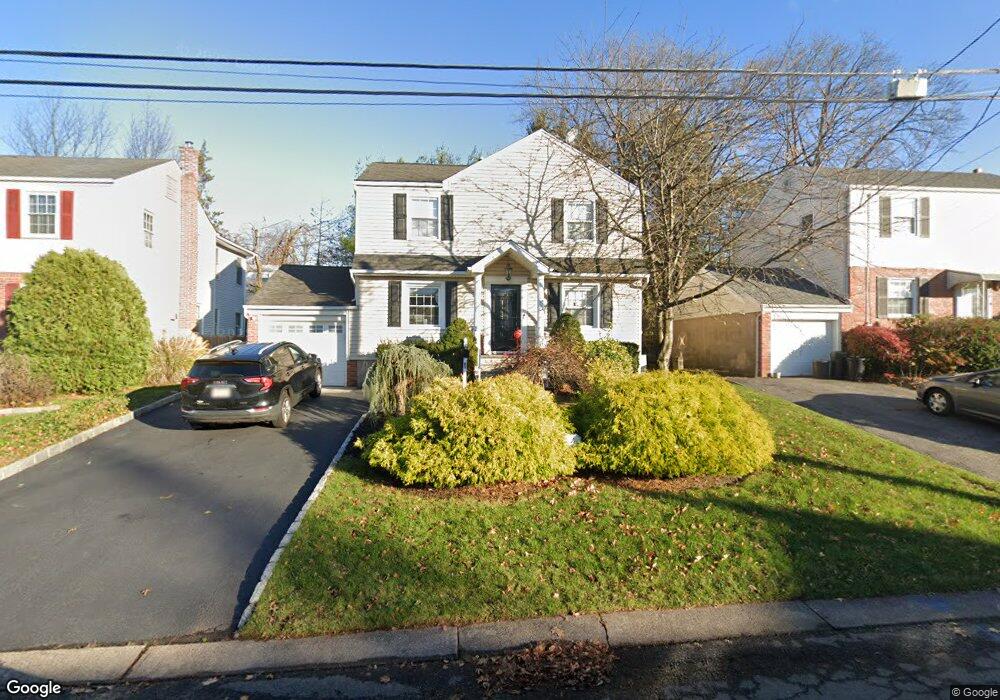
65 Hillcrest Dr Dumont, NJ 07628
Estimated Value: $721,000 - $835,000
4
Beds
3
Baths
2,178
Sq Ft
$358/Sq Ft
Est. Value
About This Home
This home is located at 65 Hillcrest Dr, Dumont, NJ 07628 and is currently estimated at $780,580, approximately $358 per square foot. 65 Hillcrest Dr is a home located in Bergen County with nearby schools including Dumont High School.
Ownership History
Date
Name
Owned For
Owner Type
Purchase Details
Closed on
Sep 14, 2020
Sold by
Iuzzolino Michael C and Iuzzolino Jeanine R
Bought by
Elian Meryl
Current Estimated Value
Home Financials for this Owner
Home Financials are based on the most recent Mortgage that was taken out on this home.
Original Mortgage
$472,500
Interest Rate
2.8%
Mortgage Type
New Conventional
Purchase Details
Closed on
May 22, 2008
Sold by
Foti Michael and Foti Christina
Bought by
Iussolino Michael C and Iuzzolino Jeanine R
Home Financials for this Owner
Home Financials are based on the most recent Mortgage that was taken out on this home.
Original Mortgage
$345,000
Interest Rate
6.11%
Mortgage Type
New Conventional
Purchase Details
Closed on
Jun 30, 1997
Sold by
Grierson Sandra
Bought by
Foti Michael and Foti Christina
Home Financials for this Owner
Home Financials are based on the most recent Mortgage that was taken out on this home.
Original Mortgage
$140,000
Interest Rate
7.86%
Create a Home Valuation Report for This Property
The Home Valuation Report is an in-depth analysis detailing your home's value as well as a comparison with similar homes in the area
Home Values in the Area
Average Home Value in this Area
Purchase History
| Date | Buyer | Sale Price | Title Company |
|---|---|---|---|
| Elian Meryl | $525,000 | Stewart Title Guaranty Co | |
| Iussolino Michael C | $545,000 | -- | |
| Foti Michael | $155,000 | -- |
Source: Public Records
Mortgage History
| Date | Status | Borrower | Loan Amount |
|---|---|---|---|
| Previous Owner | Elian Meryl | $472,500 | |
| Previous Owner | Iussolino Michael C | $345,000 | |
| Previous Owner | Foti Michael | $140,000 |
Source: Public Records
Tax History Compared to Growth
Tax History
| Year | Tax Paid | Tax Assessment Tax Assessment Total Assessment is a certain percentage of the fair market value that is determined by local assessors to be the total taxable value of land and additions on the property. | Land | Improvement |
|---|---|---|---|---|
| 2025 | $14,390 | $611,200 | $286,200 | $325,000 |
| 2024 | $14,036 | $354,000 | $161,000 | $193,000 |
| 2023 | $13,746 | $354,000 | $161,000 | $193,000 |
| 2022 | $13,746 | $354,000 | $161,000 | $193,000 |
| 2021 | $13,606 | $354,000 | $161,000 | $193,000 |
| 2020 | $13,307 | $354,000 | $161,000 | $193,000 |
| 2019 | $12,988 | $354,000 | $161,000 | $193,000 |
| 2018 | $12,723 | $354,000 | $161,000 | $193,000 |
| 2017 | $12,479 | $354,000 | $161,000 | $193,000 |
| 2016 | $12,188 | $354,000 | $161,000 | $193,000 |
| 2015 | $11,909 | $354,000 | $161,000 | $193,000 |
| 2014 | $11,675 | $354,000 | $161,000 | $193,000 |
Source: Public Records
Map
Nearby Homes
- 63 Hillcrest Dr
- 71 Hillcrest Dr
- 64 Overlook Dr
- 53 Hillcrest Dr
- 60 Overlook Dr
- 75 Hillcrest Dr
- 70 Overlook Dr
- 54 Overlook Dr
- 64 Hillcrest Dr
- 49 Hillcrest Dr
- 70 Hillcrest Dr
- 74 Overlook Dr
- 83 Hillcrest Dr
- 50 Overlook Dr
- 60 Hillcrest Dr
- 80 Overlook Dr
- 80 Hillcrest Dr
- 54 Hillcrest Dr
- 45 Hillcrest Dr
- 85 Hillcrest Dr