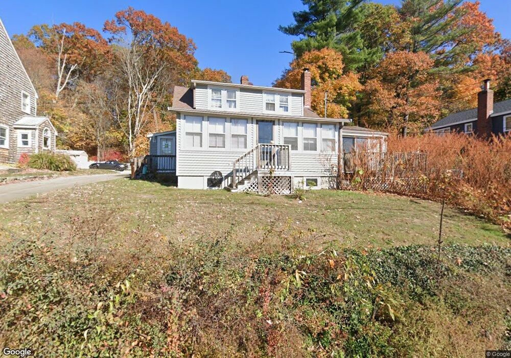
65 Lake Attitash Rd Amesbury, MA 01913
Estimated Value: $550,304 - $603,000
2
Beds
1
Bath
1,496
Sq Ft
$380/Sq Ft
Est. Value
About This Home
This home is located at 65 Lake Attitash Rd, Amesbury, MA 01913 and is currently estimated at $568,826, approximately $380 per square foot. 65 Lake Attitash Rd is a home located in Essex County with nearby schools including Amesbury High School and Amesbury Seventh-Day Adventist School.
Ownership History
Date
Name
Owned For
Owner Type
Purchase Details
Closed on
Nov 22, 2004
Sold by
Mclaughlin Peter J and Mclaughlin Philip J
Bought by
Owens Alicia H
Current Estimated Value
Purchase Details
Closed on
Sep 10, 2004
Sold by
Fhlmc
Bought by
Mclaughlin Philip J and Mclaughlin Peter J
Home Financials for this Owner
Home Financials are based on the most recent Mortgage that was taken out on this home.
Original Mortgage
$152,250
Interest Rate
6.08%
Mortgage Type
Purchase Money Mortgage
Purchase Details
Closed on
Mar 1, 2000
Sold by
Kukene George A
Bought by
Lefebvre Harry J and Lefebvre Laura A
Home Financials for this Owner
Home Financials are based on the most recent Mortgage that was taken out on this home.
Original Mortgage
$131,000
Interest Rate
8.21%
Mortgage Type
Purchase Money Mortgage
Create a Home Valuation Report for This Property
The Home Valuation Report is an in-depth analysis detailing your home's value as well as a comparison with similar homes in the area
Home Values in the Area
Average Home Value in this Area
Purchase History
| Date | Buyer | Sale Price | Title Company |
|---|---|---|---|
| Owens Alicia H | $258,000 | -- | |
| Mclaughlin Philip J | $217,500 | -- | |
| Lefebvre Harry J | $170,000 | -- |
Source: Public Records
Mortgage History
| Date | Status | Borrower | Loan Amount |
|---|---|---|---|
| Previous Owner | Lefebvre Harry J | $152,250 | |
| Previous Owner | Lefebvre Harry J | $131,000 | |
| Previous Owner | Lefebvre Harry J | $80,000 | |
| Previous Owner | Lefebvre Harry J | $33,000 |
Source: Public Records
Tax History Compared to Growth
Tax History
| Year | Tax Paid | Tax Assessment Tax Assessment Total Assessment is a certain percentage of the fair market value that is determined by local assessors to be the total taxable value of land and additions on the property. | Land | Improvement |
|---|---|---|---|---|
| 2025 | $6,900 | $451,000 | $206,900 | $244,100 |
| 2024 | $6,702 | $428,500 | $201,900 | $226,600 |
| 2023 | $6,510 | $398,400 | $183,500 | $214,900 |
| 2022 | $6,089 | $344,200 | $146,800 | $197,400 |
| 2021 | $6,263 | $343,200 | $146,800 | $196,400 |
| 2020 | $5,900 | $343,400 | $146,800 | $196,600 |
| 2019 | $5,256 | $286,100 | $139,800 | $146,300 |
| 2018 | $5,262 | $277,100 | $133,200 | $143,900 |
| 2017 | $5,598 | $280,600 | $155,400 | $125,200 |
| 2016 | $5,303 | $261,500 | $155,400 | $106,100 |
| 2015 | $5,041 | $245,400 | $155,400 | $90,000 |
| 2014 | $5,010 | $238,900 | $155,400 | $83,500 |
Source: Public Records
Map
Nearby Homes
- 4 Acadia Kimball Rd
- 1 Acadia Kimball Rd Unit 1
- 20 Hillside Ct
- 1 Bisson Ln
- 1 Tuxbury Ln
- 3 Greystone Rd
- 160 Haverhill Rd
- 152 Kimball Rd
- 188 Lions Mouth Rd
- 5 Moncrief St Unit 5
- 10 Sharon Cir
- 3 B St
- 6 B St
- 44 Pamela Ln
- 20 Mason Ct
- 10 Mason Ct Unit 10
- 31 Whitter Meadows Dr Unit 31
- 16 Glen Devin St
- 61 E Main St
- 49 W Greenwood St
- 65A Lake Attitash Rd
- 63 Lake Attitash Rd
- 67 Lake Attitash Rd
- 61 Lake Attitash Rd
- 69 Lake Attitash Rd
- 83 Kimball Rd
- 59 Lake Attitash Rd
- 99 Lake Attitash Rd
- 6 Lake Attitash Rd
- 64 Lake Attitash Rd
- 62 Lake Attitash Rd
- 66 Lake Attitash Rd
- 66 Lake Attitash Rd Unit A
- 66B Lake Attitash Rd
- 66A Lake Attitash Rd
- 57 Lake Attitash Rd
- 60 Lake Attitash Rd
- 58 Lake Attitash Rd
- 56 Lake Attitash Rd
- 71 Lake Attitash Rd