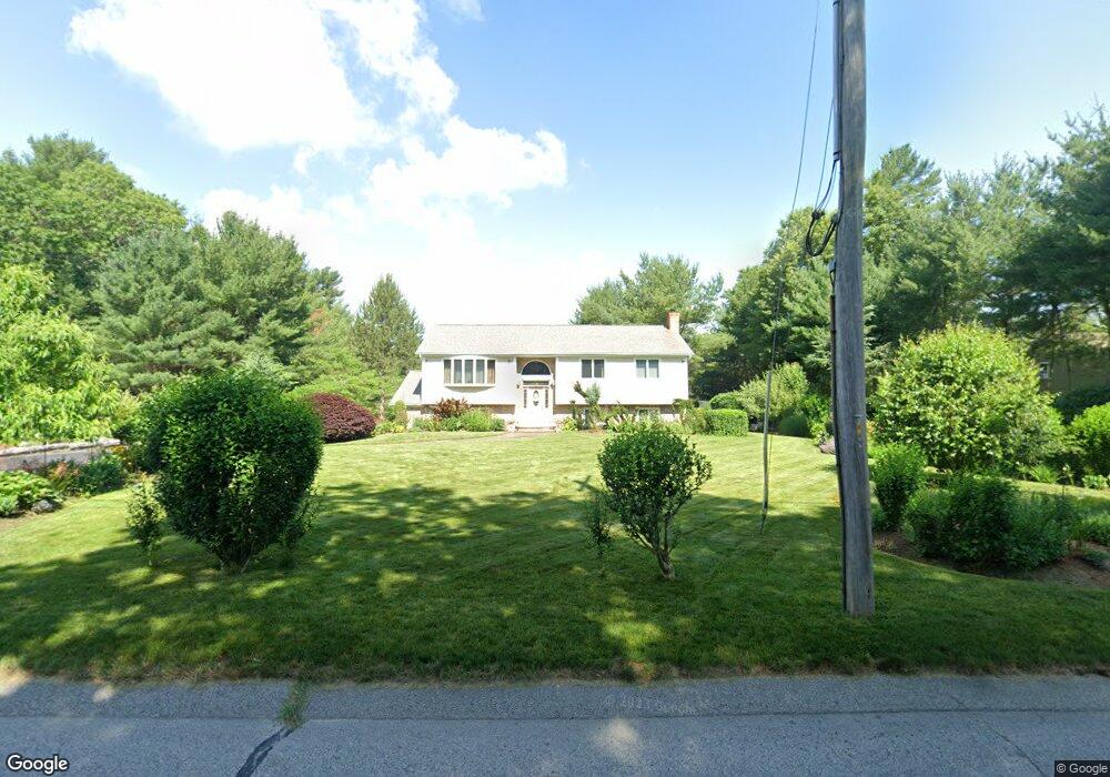
65 Malbone Rd Assonet, MA 02702
Estimated Value: $556,000 - $740,000
3
Beds
2
Baths
2,691
Sq Ft
$251/Sq Ft
Est. Value
About This Home
This home is located at 65 Malbone Rd, Assonet, MA 02702 and is currently estimated at $674,712, approximately $250 per square foot. 65 Malbone Rd is a home located in Bristol County with nearby schools including Freetown Elementary School, George R Austin Intermediate School, and Freetown-Lakeville Middle School.
Ownership History
Date
Name
Owned For
Owner Type
Purchase Details
Closed on
Feb 26, 2019
Sold by
Raposo Manuel and Raposo Helena M
Bought by
Raposo Malnuel and Raposo Helena M
Current Estimated Value
Purchase Details
Closed on
Jan 14, 1994
Sold by
Moniz Robert J and Moniz Sharon M
Bought by
Raposo Manuel and Raposo Helena M
Create a Home Valuation Report for This Property
The Home Valuation Report is an in-depth analysis detailing your home's value as well as a comparison with similar homes in the area
Purchase History
| Date | Buyer | Sale Price | Title Company |
|---|---|---|---|
| Raposo Malnuel | -- | -- | |
| Raposo Manuel | $60,000 | -- |
Source: Public Records
Mortgage History
| Date | Status | Borrower | Loan Amount |
|---|---|---|---|
| Previous Owner | Raposo Manuel | $170,000 | |
| Previous Owner | Raposo Manuel | $108,000 | |
| Previous Owner | Raposo Manuel | $100,000 | |
| Previous Owner | Raposo Manuel | $58,500 |
Source: Public Records
Tax History
| Year | Tax Paid | Tax Assessment Tax Assessment Total Assessment is a certain percentage of the fair market value that is determined by local assessors to be the total taxable value of land and additions on the property. | Land | Improvement |
|---|---|---|---|---|
| 2025 | $6,038 | $609,300 | $188,900 | $420,400 |
| 2024 | $5,998 | $575,100 | $178,200 | $396,900 |
| 2023 | $5,846 | $545,800 | $160,500 | $385,300 |
| 2022 | $5,630 | $466,800 | $136,000 | $330,800 |
| 2021 | $5,410 | $426,000 | $123,600 | $302,400 |
| 2020 | $5,457 | $419,100 | $118,900 | $300,200 |
| 2019 | $5,273 | $401,000 | $118,800 | $282,200 |
| 2018 | $4,998 | $375,500 | $118,800 | $256,700 |
| 2017 | $4,888 | $367,000 | $118,800 | $248,200 |
| 2016 | $4,685 | $357,900 | $115,400 | $242,500 |
| 2015 | $4,594 | $356,100 | $115,400 | $240,700 |
| 2014 | $4,366 | $346,200 | $118,400 | $227,800 |
Source: Public Records
Map
Nearby Homes
- 52 Anthony St
- 0 Sammys Ln
- 23 Elmwood Dr
- 71 County St
- 37 Simpson Ln
- 5 Hadley Heights Way
- 16 Water St Unit C
- 16 Water St Unit A
- 16 Water St Unit B
- 16 Water St Unit D
- 4 Hadley Heights Way
- 73 Seymour St
- 145 County St
- 24 Bells Brook Rd
- 42 High St
- 66 S Main St
- 1969 County St
- 73 Bayview Ave
- 4 Narrows Rd
- 47 Narrows Rd
Your Personal Tour Guide
Ask me questions while you tour the home.