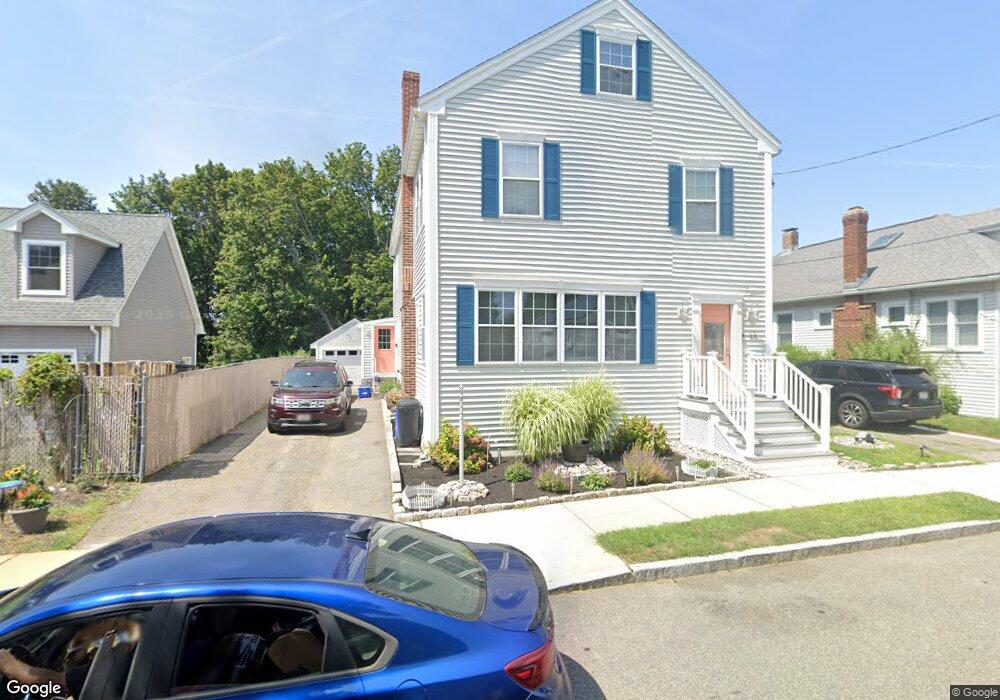
65 Moffat Rd Quincy, MA 02169
Merrymount NeighborhoodEstimated Value: $914,000 - $972,000
2
Beds
4
Baths
2,769
Sq Ft
$339/Sq Ft
Est. Value
About This Home
This home is located at 65 Moffat Rd, Quincy, MA 02169 and is currently estimated at $937,820, approximately $338 per square foot. 65 Moffat Rd is a home located in Norfolk County with nearby schools including Merrymount Elementary School, Broad Meadows Middle School, and Quincy High School.
Create a Home Valuation Report for This Property
The Home Valuation Report is an in-depth analysis detailing your home's value as well as a comparison with similar homes in the area
Home Values in the Area
Average Home Value in this Area
Tax History
| Year | Tax Paid | Tax Assessment Tax Assessment Total Assessment is a certain percentage of the fair market value that is determined by local assessors to be the total taxable value of land and additions on the property. | Land | Improvement |
|---|---|---|---|---|
| 2025 | $10,191 | $883,900 | $286,000 | $597,900 |
| 2024 | $9,616 | $853,200 | $277,600 | $575,600 |
| 2023 | $8,908 | $800,400 | $241,400 | $559,000 |
| 2022 | $9,664 | $806,700 | $219,500 | $587,200 |
| 2021 | $8,752 | $720,900 | $219,500 | $501,400 |
| 2020 | $8,773 | $705,800 | $211,000 | $494,800 |
| 2019 | $6,084 | $484,800 | $197,200 | $287,600 |
| 2018 | $5,764 | $432,100 | $171,500 | $260,600 |
| 2017 | $5,866 | $414,000 | $171,500 | $242,500 |
| 2016 | $5,678 | $395,400 | $171,500 | $223,900 |
| 2015 | $5,368 | $367,700 | $161,800 | $205,900 |
| 2014 | $5,017 | $337,600 | $154,100 | $183,500 |
Source: Public Records
Map
Nearby Homes
- 25 Moffat Rd
- 245 Sea St Unit 45
- 96 Utica St
- 59 Terne Rd
- 479 Sea St Unit 2
- 503 Sea St
- 105 Sea St Unit 105
- 105 Sea St Unit 102
- 40 Virginia Rd
- 36 Palmer St
- 9 Poplar Rd
- 599 Sea St Unit 2
- 599 Sea St Unit 1
- 162 Palmer St
- 386 Washington St Unit 1
- 388 Washington St Unit 302
- 388 Washington St Unit 301
- 388 Washington St Unit 205
- 388 Washington St Unit 401
- 388 Washington St Unit 202
Your Personal Tour Guide
Ask me questions while you tour the home.