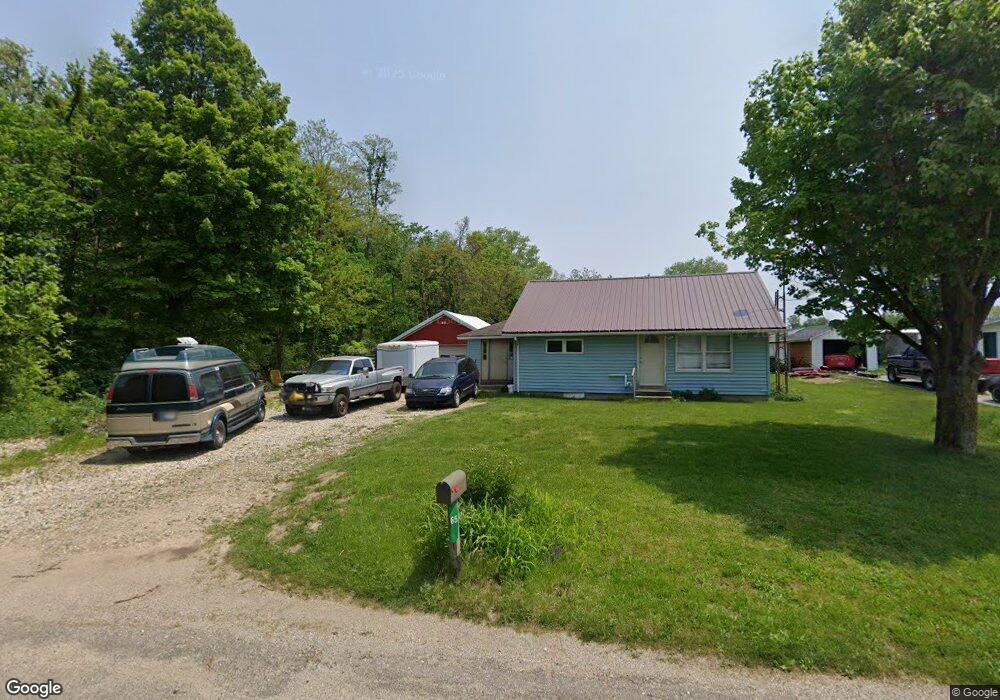
65 N 018 W Lagrange, IN 46761
Estimated Value: $204,000 - $257,000
2
Beds
2
Baths
1,976
Sq Ft
$115/Sq Ft
Est. Value
About This Home
This home is located at 65 N 018 W, Lagrange, IN 46761 and is currently estimated at $227,592, approximately $115 per square foot. 65 N 018 W is a home located in LaGrange County with nearby schools including Lakeland Jr/Sr High School, Southeast Clay School, and Countryside School.
Ownership History
Date
Name
Owned For
Owner Type
Purchase Details
Closed on
Feb 20, 2023
Sold by
Frey Brent H
Bought by
Schoonover Lester A
Current Estimated Value
Purchase Details
Closed on
Aug 3, 2018
Sold by
Timmerman Gary V and Timmerman Dana
Bought by
Frey Brent H
Purchase Details
Closed on
Oct 24, 2016
Sold by
Erma Yoder
Bought by
Brent H Frey
Purchase Details
Closed on
Feb 27, 2012
Bought by
Ollie Preston Pilgrim
Create a Home Valuation Report for This Property
The Home Valuation Report is an in-depth analysis detailing your home's value as well as a comparison with similar homes in the area
Home Values in the Area
Average Home Value in this Area
Purchase History
| Date | Buyer | Sale Price | Title Company |
|---|---|---|---|
| Schoonover Lester A | $35,000 | -- | |
| Frey Brent H | $500,000 | Meridian Title | |
| Brent H Frey | $15,000 | Lakeland Title Company | |
| Ollie Preston Pilgrim | $1,700 | Law Office Of Lisa M Bowen Sla |
Source: Public Records
Tax History
| Year | Tax Paid | Tax Assessment Tax Assessment Total Assessment is a certain percentage of the fair market value that is determined by local assessors to be the total taxable value of land and additions on the property. | Land | Improvement |
|---|---|---|---|---|
| 2024 | $1,097 | $128,500 | $15,100 | $113,400 |
| 2023 | $170 | $90,000 | $14,900 | $75,100 |
| 2022 | $172 | $79,700 | $13,000 | $66,700 |
| 2021 | $132 | $67,500 | $11,800 | $55,700 |
| 2020 | $139 | $66,000 | $11,800 | $54,200 |
| 2019 | $139 | $65,200 | $11,800 | $53,400 |
| 2018 | $139 | $60,600 | $11,800 | $48,800 |
| 2017 | $644 | $60,800 | $10,400 | $50,400 |
| 2016 | $713 | $68,500 | $8,900 | $59,600 |
| 2014 | $569 | $54,800 | $8,900 | $45,900 |
| 2013 | $569 | $55,300 | $8,900 | $46,400 |
Source: Public Records
Map
Nearby Homes
- 45 N 018 W
- 60 N 018 W
- 175 W Us Highway 20
- 215 W Us Highway 20
- 200 W Us Highway 20
- 90 W Us Highway 20
- 90 W Us Highway 20
- 275 W U S Highway 20
- 275 W Us Highway 20
- 295 W U S Highway 20
- 295 W Us Highway 20
- 295 W Us Highway 20
- 275 W Us Highway 20
- 513 W Central Ave
- 513 W Central Ave
- 170 N 010 W
- 170 N 010 W
- 150 W Us Highway 20
- 506 Grant St
- 508 W Central Ave
Your Personal Tour Guide
Ask me questions while you tour the home.