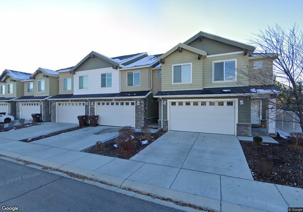
65 N 1800 W Unit 118 Pleasant Grove, UT 84062
Estimated Value: $400,000 - $415,882
3
Beds
3
Baths
1,698
Sq Ft
$241/Sq Ft
Est. Value
About This Home
This home is located at 65 N 1800 W Unit 118, Pleasant Grove, UT 84062 and is currently estimated at $408,971, approximately $240 per square foot. 65 N 1800 W Unit 118 is a home located in Utah County with nearby schools including Barratt Elementary School, American Fork Junior High School, and American Fork High School.
Ownership History
Date
Name
Owned For
Owner Type
Purchase Details
Closed on
Oct 5, 2023
Sold by
Miller Matthew T
Bought by
Fortaterra Llc
Current Estimated Value
Purchase Details
Closed on
Jun 12, 2019
Sold by
Miller Matthew T
Bought by
Miller Matthew T
Home Financials for this Owner
Home Financials are based on the most recent Mortgage that was taken out on this home.
Original Mortgage
$185,200
Interest Rate
4.1%
Mortgage Type
New Conventional
Purchase Details
Closed on
Apr 2, 2014
Sold by
D R Horton Inc
Bought by
Miller Matthew T
Home Financials for this Owner
Home Financials are based on the most recent Mortgage that was taken out on this home.
Original Mortgage
$6,600
Interest Rate
4.3%
Mortgage Type
Stand Alone Second
Create a Home Valuation Report for This Property
The Home Valuation Report is an in-depth analysis detailing your home's value as well as a comparison with similar homes in the area
Home Values in the Area
Average Home Value in this Area
Purchase History
| Date | Buyer | Sale Price | Title Company |
|---|---|---|---|
| Fortaterra Llc | -- | None Listed On Document | |
| Miller Matthew T | -- | Old Republic Title | |
| Miller Matthew T | -- | Provo Land Title Co |
Source: Public Records
Mortgage History
| Date | Status | Borrower | Loan Amount |
|---|---|---|---|
| Previous Owner | Miller Matthew T | $185,200 | |
| Previous Owner | Miller Matthew T | $6,600 |
Source: Public Records
Tax History Compared to Growth
Tax History
| Year | Tax Paid | Tax Assessment Tax Assessment Total Assessment is a certain percentage of the fair market value that is determined by local assessors to be the total taxable value of land and additions on the property. | Land | Improvement |
|---|---|---|---|---|
| 2025 | $1,836 | $211,090 | $56,400 | $327,400 |
| 2024 | $1,836 | $218,790 | $0 | $0 |
| 2023 | $1,673 | $204,435 | $0 | $0 |
| 2022 | $1,826 | $221,980 | $0 | $0 |
| 2021 | $1,573 | $291,100 | $43,700 | $247,400 |
| 2020 | $1,597 | $289,700 | $43,500 | $246,200 |
| 2019 | $1,381 | $259,100 | $38,900 | $220,200 |
| 2018 | $1,269 | $225,100 | $33,800 | $191,300 |
| 2017 | $1,153 | $108,900 | $0 | $0 |
| 2016 | $1,194 | $108,900 | $0 | $0 |
| 2015 | $1,261 | $108,900 | $0 | $0 |
Source: Public Records
Map
Nearby Homes
- 29 S 2000 W
- 1584 W 110 N
- 1559 W 50 N
- 1542 W 110 N
- 1593 W 220 N
- 1775 W 120 S Unit 54
- 1795 W 120 S Unit 52
- 1512 W 50 N
- The Hastings Plan at Tayside Farm - Townhome
- The Henley A Plan at Tayside Farm - Single Family Home
- The Denton Plan at Tayside Farm - Townhome
- The Henley B Plan at Tayside Farm - Single Family Home
- 128 S 1700 W Unit 12
- 1541 W 250 N
- 293 N 1630 W
- 1429 W 110 N
- 1525 W 300 N
- 1406 W 50 N
- 1088 E 390 S
- 1598 W 220 N
- 65 S 1800 W
- 75 N 1800 W
- 55 N 1800 W
- 35 N 1800 W Unit 121
- 35 N 1800 W
- 1796 W 50 N
- 1792 W 50 N Unit 115
- 1792 W 50 N
- 1816 W 20 N Unit 123
- 1806 W 20 N Unit 124
- 1797 W 50 N
- 1826 W 20 N
- 1826 W 20 N Unit 122
- 1782 W 50 N
- 1793 W 50 N Unit 126
- 1772 W 50 N Unit 113
- 1783 W 50 N Unit 127
- 1783 W 50 N
- 1762 W 50 N Unit 112
- 1762 W 50 N