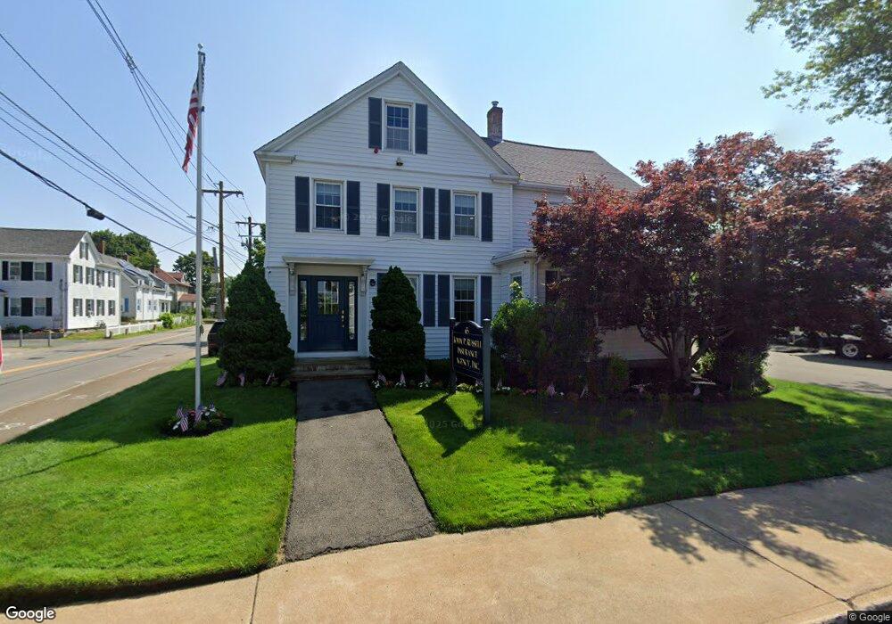
65 Pearl St Stoughton, MA 02072
--
Bed
3
Baths
2,406
Sq Ft
10,454
Sq Ft Lot
About This Home
This home is located at 65 Pearl St, Stoughton, MA 02072. 65 Pearl St is a home located in Norfolk County with nearby schools including Wilkins Elementary School, Dr. Robert G. O'Donnell Middle School, and Stoughton High School.
Ownership History
Date
Name
Owned For
Owner Type
Purchase Details
Closed on
Oct 21, 2005
Sold by
Rogers Insurance Agen
Bought by
Russ Llc
Home Financials for this Owner
Home Financials are based on the most recent Mortgage that was taken out on this home.
Original Mortgage
$425,000
Outstanding Balance
$226,906
Interest Rate
5.72%
Mortgage Type
Commercial
Create a Home Valuation Report for This Property
The Home Valuation Report is an in-depth analysis detailing your home's value as well as a comparison with similar homes in the area
Home Values in the Area
Average Home Value in this Area
Purchase History
| Date | Buyer | Sale Price | Title Company |
|---|---|---|---|
| Russ Llc | $420,000 | -- | |
| Russ Llc | $420,000 | -- |
Source: Public Records
Mortgage History
| Date | Status | Borrower | Loan Amount |
|---|---|---|---|
| Open | Russ Llc | $425,000 | |
| Closed | Russ Llc | $425,000 | |
| Previous Owner | Russ Llc | $225,000 | |
| Previous Owner | Russ Llc | $100,000 |
Source: Public Records
Tax History Compared to Growth
Tax History
| Year | Tax Paid | Tax Assessment Tax Assessment Total Assessment is a certain percentage of the fair market value that is determined by local assessors to be the total taxable value of land and additions on the property. | Land | Improvement |
|---|---|---|---|---|
| 2025 | $12,412 | $604,300 | $263,900 | $340,400 |
| 2024 | $12,029 | $565,000 | $254,400 | $310,600 |
| 2023 | $11,888 | $525,300 | $235,600 | $289,700 |
| 2022 | $12,064 | $498,500 | $217,700 | $280,800 |
| 2021 | $11,988 | $470,300 | $207,300 | $263,000 |
| 2020 | $11,958 | $467,300 | $207,300 | $260,000 |
| 2019 | $11,622 | $434,800 | $188,500 | $246,300 |
| 2018 | $10,817 | $413,800 | $179,100 | $234,700 |
| 2017 | $10,672 | $413,800 | $179,100 | $234,700 |
| 2016 | $10,200 | $392,000 | $169,600 | $222,400 |
| 2015 | $9,830 | $373,200 | $150,800 | $222,400 |
| 2014 | $9,017 | $345,600 | $150,800 | $194,800 |
Source: Public Records
Map
Nearby Homes
- 11 Monk St
- 30 Porter St
- 84 Pearl St
- 12 Rose St Unit C
- 26 Faxon St Unit 2
- 81 Summer St Unit 1
- 5-9 Morton Square
- 15-17 Morton Square
- 6 Grove St
- 52 Adams St
- 15 Jones Terrace Unit 2
- 21 Jones Terrace Unit 2
- 79 Kinsley St
- 62 Kinsley St
- 68 Crescent Ave
- 73 Crescent Ave
- 959 Washington St
- 36 Pleasant Dr Unit 42
- 18 Britton St
- 310 Lincoln St
- 53 Pearl St
- 26 School St
- 73 Pearl St
- 47 Pearl St Unit 3
- 47 Pearl St Unit 2
- 47 Pearl St Unit 1
- 47 Pearl St
- 35 School St
- 35 School St Unit 1
- 64 Pearl St Unit 1
- 43 Pearl St
- 74 Pearl St
- 54 Pearl St
- 25 School St
- 83 Pearl St
- 713 Washington St Unit 5
- 713 Washington St Unit 3
- 713 Washington St
- 713 Washington St Unit 2
- 20 School St