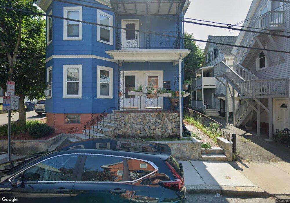
65 Porter Rd Unit 67 Cambridge, MA 02140
North Cambridge NeighborhoodEstimated Value: $701,992 - $932,000
2
Beds
1
Bath
925
Sq Ft
$918/Sq Ft
Est. Value
About This Home
This home is located at 65 Porter Rd Unit 67, Cambridge, MA 02140 and is currently estimated at $849,498, approximately $918 per square foot. 65 Porter Rd Unit 67 is a home located in Middlesex County with nearby schools including Benjamin Banneker Charter Public School, Cambridge Montessori School, and Wild Rose Montessori School.
Ownership History
Date
Name
Owned For
Owner Type
Purchase Details
Closed on
Dec 2, 2025
Sold by
Durand Kevin and Ross Elizabeth
Bought by
Belfry Ret and Durand
Current Estimated Value
Purchase Details
Closed on
Jul 13, 2011
Sold by
Schiefsky Mark J and Sarotte Mary
Bought by
Ross Elizabeth and Durand Kevin
Home Financials for this Owner
Home Financials are based on the most recent Mortgage that was taken out on this home.
Original Mortgage
$256,000
Interest Rate
4.58%
Mortgage Type
Purchase Money Mortgage
Purchase Details
Closed on
Sep 14, 2000
Sold by
Rankin Stephen L and Rankin Jamie S
Bought by
Shiefsky Mark J
Home Financials for this Owner
Home Financials are based on the most recent Mortgage that was taken out on this home.
Original Mortgage
$202,600
Interest Rate
8.07%
Mortgage Type
Purchase Money Mortgage
Create a Home Valuation Report for This Property
The Home Valuation Report is an in-depth analysis detailing your home's value as well as a comparison with similar homes in the area
Home Values in the Area
Average Home Value in this Area
Purchase History
| Date | Buyer | Sale Price | Title Company |
|---|---|---|---|
| Belfry Ret | -- | -- | |
| Ross Elizabeth | $320,000 | -- | |
| Ross Elizabeth | $320,000 | -- | |
| Shiefsky Mark J | $297,000 | -- |
Source: Public Records
Mortgage History
| Date | Status | Borrower | Loan Amount |
|---|---|---|---|
| Previous Owner | Ross Elizabeth | $256,000 | |
| Previous Owner | Shiefsky Mark J | $202,600 |
Source: Public Records
Tax History
| Year | Tax Paid | Tax Assessment Tax Assessment Total Assessment is a certain percentage of the fair market value that is determined by local assessors to be the total taxable value of land and additions on the property. | Land | Improvement |
|---|---|---|---|---|
| 2025 | $4,044 | $636,900 | $0 | $636,900 |
| 2024 | $3,718 | $628,000 | $0 | $628,000 |
| 2023 | $3,633 | $619,900 | $0 | $619,900 |
| 2022 | $3,585 | $605,500 | $0 | $605,500 |
| 2021 | $3,509 | $599,800 | $0 | $599,800 |
| 2020 | $3,371 | $586,200 | $0 | $586,200 |
| 2019 | $3,227 | $543,200 | $0 | $543,200 |
| 2018 | $1,010 | $497,800 | $0 | $497,800 |
| 2017 | $2,987 | $460,300 | $0 | $460,300 |
| 2016 | $2,871 | $410,800 | $0 | $410,800 |
| 2015 | $2,839 | $363,100 | $0 | $363,100 |
| 2014 | $2,791 | $333,100 | $0 | $333,100 |
Source: Public Records
Map
Nearby Homes
- 7 Beech St Unit 319
- 7 Beech St Unit 317
- 18 Upland Rd Unit 1
- 24 Cambridge Terrace Unit 2
- 32-40 White St
- 3 Arlington St Unit 44
- 40 Mount Pleasant St Unit 4
- 7 Russell St Unit 1
- 11 Cogswell Ave Unit 15
- 11 Cogswell Ave Unit 13
- 20 Mossland St
- 353 Summer St Unit 310
- 6 Forest St
- 178 Richdale Ave
- 6 Washington Ave Unit 11
- 49 Cherry St Unit 1
- 355 Highland Ave Unit 3
- 371 Highland Ave
- 43 Linnaean St Unit 1
- 11 Wright St Unit 1
- 65 Porter Rd Unit 67
- 65 Porter Rd Unit 67
- 65 Porter Rd Unit 3
- 65 Porter Rd
- 65 Porter Rd Unit 2
- 49 Porter Rd
- 49 Porter Rd Unit 1
- 55 Porter Rd
- 51 Porter Rd
- 53 Porter Rd Unit A
- 55 Porter Rd Unit 3
- 53 Porter Rd Unit 53 Porter Rd
- 53 Porter Rd Unit T
- 51 Porter Rd Unit T
- 53 Porter Rd Unit 53-1
- 53 Porter Rd Unit 1
- 53 Porter Rd
- 55 Porter Rd Unit 1
- 55 Porter Rd
- 51 Porter Rd Unit 1
Your Personal Tour Guide
Ask me questions while you tour the home.