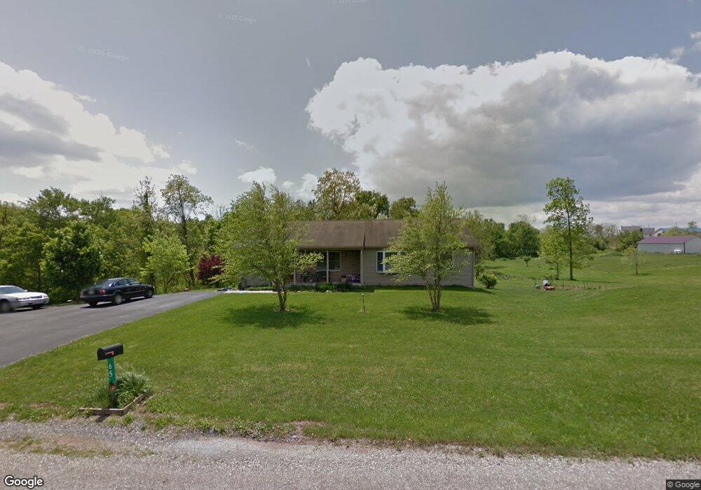
65 Rooster Ln Manchester, PA 17345
Estimated Value: $326,000 - $412,000
3
Beds
2
Baths
1,791
Sq Ft
$197/Sq Ft
Est. Value
About This Home
This home is located at 65 Rooster Ln, Manchester, PA 17345 and is currently estimated at $353,043, approximately $197 per square foot. 65 Rooster Ln is a home located in York County with nearby schools including Northeastern Senior High School and Bible Baptist Christian Academy.
Ownership History
Date
Name
Owned For
Owner Type
Purchase Details
Closed on
Jun 28, 2000
Sold by
Forry Edward L and Forry Dale L
Bought by
Dhanota Amrik S and Dhanota Barbara J
Current Estimated Value
Home Financials for this Owner
Home Financials are based on the most recent Mortgage that was taken out on this home.
Original Mortgage
$142,500
Outstanding Balance
$57,685
Interest Rate
8.59%
Mortgage Type
Construction
Estimated Equity
$295,358
Create a Home Valuation Report for This Property
The Home Valuation Report is an in-depth analysis detailing your home's value as well as a comparison with similar homes in the area
Home Values in the Area
Average Home Value in this Area
Purchase History
| Date | Buyer | Sale Price | Title Company |
|---|---|---|---|
| Dhanota Amrik S | $32,000 | -- |
Source: Public Records
Mortgage History
| Date | Status | Borrower | Loan Amount |
|---|---|---|---|
| Open | Dhanota Amrik S | $142,500 |
Source: Public Records
Tax History Compared to Growth
Tax History
| Year | Tax Paid | Tax Assessment Tax Assessment Total Assessment is a certain percentage of the fair market value that is determined by local assessors to be the total taxable value of land and additions on the property. | Land | Improvement |
|---|---|---|---|---|
| 2025 | $6,000 | $166,950 | $43,320 | $123,630 |
| 2024 | $5,865 | $166,950 | $43,320 | $123,630 |
| 2023 | $5,865 | $166,950 | $43,320 | $123,630 |
| 2022 | $5,828 | $166,950 | $43,320 | $123,630 |
| 2021 | $5,668 | $166,950 | $43,320 | $123,630 |
| 2020 | $5,668 | $166,950 | $43,320 | $123,630 |
| 2019 | $5,593 | $166,950 | $43,320 | $123,630 |
| 2018 | $5,566 | $166,950 | $43,320 | $123,630 |
| 2017 | $5,566 | $166,950 | $43,320 | $123,630 |
| 2016 | $0 | $166,950 | $43,320 | $123,630 |
| 2015 | -- | $166,950 | $43,320 | $123,630 |
| 2014 | -- | $166,950 | $43,320 | $123,630 |
Source: Public Records
Map
Nearby Homes
- 265 Conewago Creek Rd
- 941 Conewago Creek Rd
- 595 Locust Point Rd
- 1370 Conewago Creek Rd
- 701 Cassel Rd Unit 59
- 701 Cassel Rd Unit 105
- 1005 2nd Ave
- 701 LOT 91 Cassel Rd
- 0 Hemlock Rd
- 761 2nd Ave
- 5445 N George Street Extension
- 5230 N George Extension St
- 45 Stony Run Way
- 55 Highland Ave
- 35 Coriander Ln
- 310 Edgeboro Dr
- 85 Auction Dr
- 175 Stone Creek Dr
- 870 Conewago Ave
- 140 Village Rd
- 70 Rooster Ln
- 345 Bowers Bridge Rd
- 0 Bowers Bridge Rd
- 370 Bowers Bridge Rd
- 75 Rooster Ln
- 350 Bowers Bridge Rd
- 307 Bowers Bridge Rd
- Lot 3 Bowers Bridge Rd
- 314 Bowers Bridge Rd
- 305 Bowers Bridge Rd
- 360 Bowers Bridge Rd
- 360 Conewago Creek Rd
- 480 Conewago Creek Rd
- 490 Conewago Creek Rd
- 445 Bowers Bridge Rd
- 498 Conewago Creek Rd
- 350 Conewago Creek Rd
- 355 Conewago Creek Rd
- 465 Bowers Bridge Rd
- 530 Conewago Creek Rd