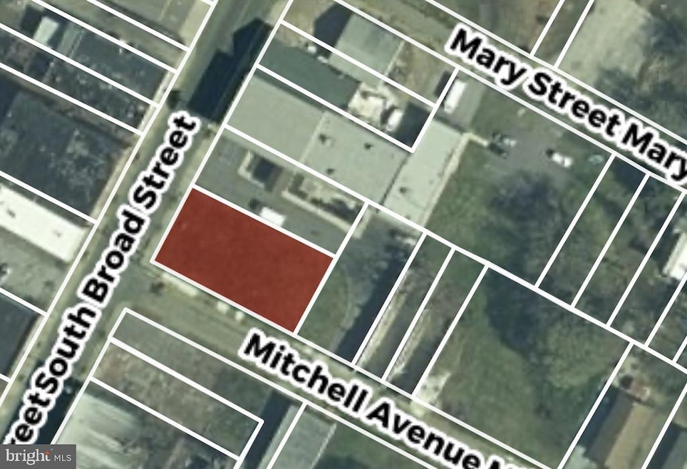
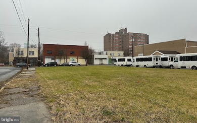
65 S Broad St Penns Grove, NJ 08069
Estimated payment $462/month
About This Lot
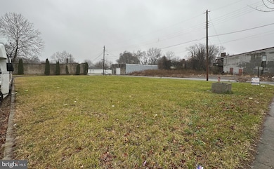
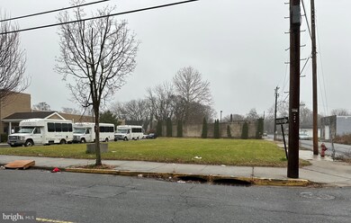
INVESTMENT OPPORTUNITY. This lot is located on the corner of S. Broad and Mitchell. There is access to public water, sewer, and utilities. Zoning is Commercial. This is a buildable lot that meets borough requirements. Block 00067 / Lot 00001. Lot is 65x125. Buyer is responsible for all certifications, zoning and usage within the borough.
Listing Agent
(609) 364-4991 kmurray@adrsj.com American Dream Realty of South Jersey License #2188988 Listed on: 07/17/2025
Property Details
Property Type
- Land
Est. Annual Taxes
- $826
Lot Details
- 8,125 Sq Ft Lot
- Lot Dimensions are 65.00 x 125.00
- Property is zoned COMMERCIAL
Utilities
- Public Hookup Available For Sewer
Community Details
- No Home Owners Association
Listing and Financial Details
- Tax Lot 00001
- Assessor Parcel Number 08-00067-00001
Map
Home Values in the Area
Average Home Value in this Area
Tax History
| Year | Tax Paid | Tax Assessment Tax Assessment Total Assessment is a certain percentage of the fair market value that is determined by local assessors to be the total taxable value of land and additions on the property. | Land | Improvement |
|---|---|---|---|---|
| 2025 | $826 | $14,900 | $14,900 | -- |
| 2024 | $799 | $14,900 | $14,900 | $0 |
| 2023 | -- | $14,900 | $14,900 | $0 |
| 2022 | $0 | $14,900 | $14,900 | $0 |
| 2021 | $0 | $14,900 | $14,900 | $0 |
| 2020 | $749 | $14,900 | $14,900 | $0 |
| 2019 | $749 | $14,900 | $14,900 | $0 |
| 2018 | $0 | $19,900 | $19,900 | $0 |
| 2017 | $0 | $19,900 | $19,900 | $0 |
| 2016 | $0 | $19,900 | $19,900 | $0 |
| 2015 | -- | $19,900 | $19,900 | $0 |
| 2014 | -- | $19,900 | $19,900 | $0 |
Property History
| Date | Event | Price | List to Sale | Price per Sq Ft |
|---|---|---|---|---|
| 07/17/2025 07/17/25 | For Sale | $75,000 | -- | -- |
Purchase History
| Date | Type | Sale Price | Title Company |
|---|---|---|---|
| Quit Claim Deed | $27,000 | Salem Oak Title | |
| Quit Claim Deed | $27,000 | Salem Oak Title | |
| Quit Claim Deed | $6,500 | -- | |
| Deed | -- | None Available | |
| Deed | -- | -- |
Source: Bright MLS
MLS Number: NJSA2015620
APN: 08-00067-0000-00001
Disclaimer: Certain information contained herein is derived from information provided by parties other than Homes.com. All information provided is deemed reliable, but is not guaranteed to be accurate and should be independently verified.
![]() The data relating to real estate for sale on this website appears in part through the BRIGHT Internet Data Exchange program, a voluntary cooperative exchange of property listing data between licensed real estate brokerage firms, and is provided by BRIGHT through a licensing agreement.
The data relating to real estate for sale on this website appears in part through the BRIGHT Internet Data Exchange program, a voluntary cooperative exchange of property listing data between licensed real estate brokerage firms, and is provided by BRIGHT through a licensing agreement.
Listing information is from various brokers who participate in the Bright MLS IDX program and not all listings may be visible on the site.
The property information being provided on or through the website is for the personal, non-commercial use of consumers and such information may not be used for any purpose other than to identify prospective properties consumers may be interested in purchasing.
Some properties which appear for sale on the website may no longer be available because they are for instance, under contract, sold or are no longer being offered for sale.
Property information displayed is deemed reliable but is not guaranteed.
Copyright 2025 Bright MLS, Inc.
- 32 Westminster Ave
- 106 S Broad St
- 204 206 S Broad St
- 85 State St
- 15 Walnut St
- 80 S Broad St
- 106 Sack Ave
- 32 Walnut St
- 55 57 Walnut St
- 59-61 Walnut St
- 34 38 Cumberland Ave
- 0 Park Ave Unit NJSA2013690
- 39 41 Cumberland Ave
- 260 S Broad St
- 114 Deming Ave
- 0 Delaware Dr
- 83 Willis St
- 0 Lincoln Avenue & Cumberland
- 49 Delaware Dr
- 45 S Virginia Ave
- 109 111 State St
- 39 Elvin Ave
- 254 G St
- 74 Delaware Ave
- 72 Delaware Ave
- 266 Apt B2 Shell Rd
- 277 Jefferson St
- 294 Merion Ave
- 310 N Broad St
- 344 N Virginia Ave
- 5213 Le Parc Dr Unit 4
- 14 S Rodney Dr
- 1436 Kynlyn Dr
- 0 Paladin Dr Unit DENC2086852
- 3708 Eastview Ln Unit 3708
- 905 Rodman Rd
- 3308 Eastview Ln Unit 3308
- 101 Clifton Park Cir
- 2 Colony Blvd
- 9 Courtyard Ln
