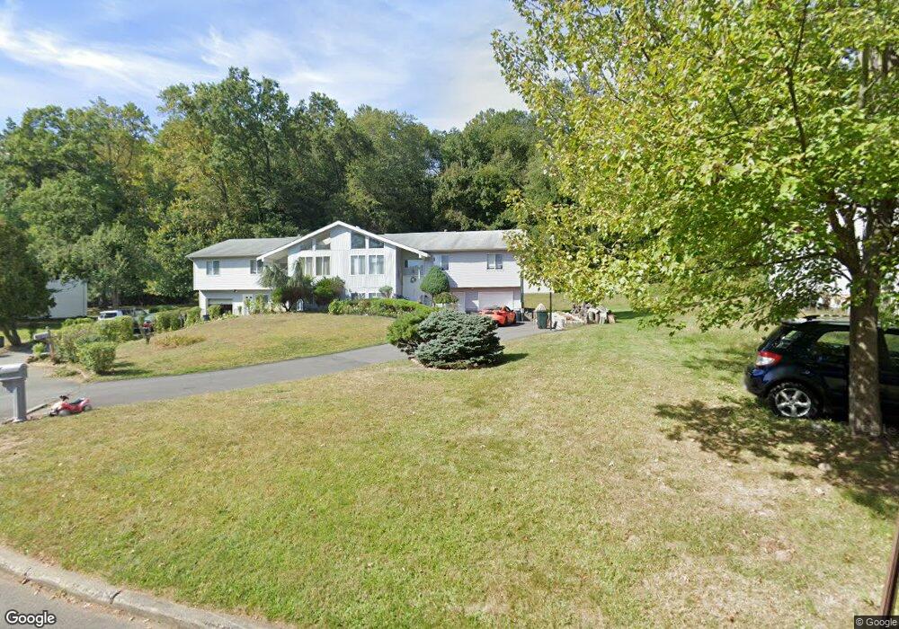
65 S Cole Ct Spring Valley, NY 10977
Estimated Value: $816,000 - $1,153,000
4
Beds
3
Baths
2,464
Sq Ft
$424/Sq Ft
Est. Value
About This Home
This home is located at 65 S Cole Ct, Spring Valley, NY 10977 and is currently estimated at $1,044,861, approximately $424 per square foot. 65 S Cole Ct is a home located in Rockland County with nearby schools including Margetts Elementary School, Chestnut Ridge Middle School, and Spring Valley High School.
Ownership History
Date
Name
Owned For
Owner Type
Purchase Details
Closed on
Mar 28, 2003
Sold by
Thompson Allan A
Bought by
Mizhouiri Luis and Mizhquiri Flor
Current Estimated Value
Home Financials for this Owner
Home Financials are based on the most recent Mortgage that was taken out on this home.
Original Mortgage
$297,000
Outstanding Balance
$126,548
Interest Rate
5.88%
Mortgage Type
Purchase Money Mortgage
Estimated Equity
$918,313
Create a Home Valuation Report for This Property
The Home Valuation Report is an in-depth analysis detailing your home's value as well as a comparison with similar homes in the area
Home Values in the Area
Average Home Value in this Area
Purchase History
| Date | Buyer | Sale Price | Title Company |
|---|---|---|---|
| Mizhouiri Luis | $330,000 | National Granite Title | |
| Mizhouiri Luis | $330,000 | National Granite Title | |
| Mizhouiri Luis | $330,000 | National Granite Title |
Source: Public Records
Mortgage History
| Date | Status | Borrower | Loan Amount |
|---|---|---|---|
| Open | Mizhouiri Luis | $297,000 | |
| Closed | Mizhouiri Luis | $297,000 |
Source: Public Records
Tax History
| Year | Tax Paid | Tax Assessment Tax Assessment Total Assessment is a certain percentage of the fair market value that is determined by local assessors to be the total taxable value of land and additions on the property. | Land | Improvement |
|---|---|---|---|---|
| 2024 | $11,625 | $48,200 | $16,400 | $31,800 |
| 2023 | $11,625 | $48,200 | $16,400 | $31,800 |
| 2022 | $11,202 | $48,200 | $16,400 | $31,800 |
| 2021 | $11,202 | $48,200 | $16,400 | $31,800 |
| 2020 | $10,771 | $48,200 | $16,400 | $31,800 |
| 2019 | $10,857 | $48,200 | $16,400 | $31,800 |
| 2018 | $10,857 | $48,200 | $16,400 | $31,800 |
| 2017 | $10,627 | $48,200 | $16,400 | $31,800 |
| 2016 | $10,532 | $48,200 | $16,400 | $31,800 |
| 2015 | -- | $48,200 | $16,400 | $31,800 |
| 2014 | -- | $48,200 | $16,400 | $31,800 |
Source: Public Records
Map
Nearby Homes
- 14 Singer Ave
- 40 Singer Ave Unit 201
- 40 Singer Ave Unit 214
- 35 S Cole Ave Unit 201
- 35 S Cole Ave Unit 202
- 30 S Cole Ave Unit 1L
- 30 S Cole Ave Unit 3E
- 30 S Cole Ave Unit 6
- 15 Ridge Ave Unit 101
- 15 Ridge Ave Unit 204
- 20 W Funston Ave Unit 212
- 203 Kennedy Dr Unit 203
- 236 Old Nyack Turnpike Unit 202
- 236 Old Nyack Turnpike Unit 201
- 301 Kennedy Dr
- 119 S Main St Unit B
- 8 W Funston Ave
- 402 Kennedy Dr Unit 402
- 518 Kennedy Dr
- 32 Alan Rd Unit 32
Your Personal Tour Guide
Ask me questions while you tour the home.