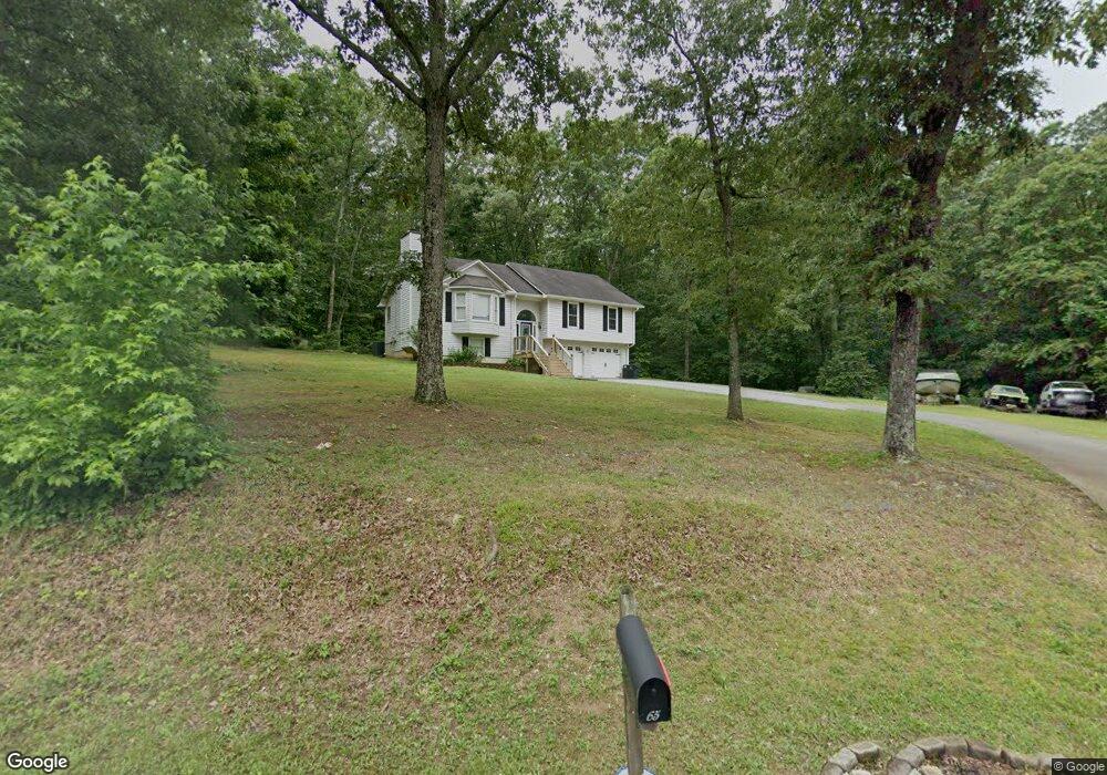
65 Stoker Rd SW Cartersville, GA 30120
Estimated Value: $247,000 - $339,000
4
Beds
3
Baths
1,428
Sq Ft
$200/Sq Ft
Est. Value
About This Home
This home is located at 65 Stoker Rd SW, Cartersville, GA 30120 and is currently estimated at $285,922, approximately $200 per square foot. 65 Stoker Rd SW is a home located in Bartow County with nearby schools including Kingston Elementary School, Cass Middle School, and Cass High School.
Ownership History
Date
Name
Owned For
Owner Type
Purchase Details
Closed on
Mar 18, 2011
Sold by
Secretary Of Housing
Bought by
Brown Jimmy W
Current Estimated Value
Home Financials for this Owner
Home Financials are based on the most recent Mortgage that was taken out on this home.
Original Mortgage
$67,778
Outstanding Balance
$46,920
Interest Rate
4.95%
Mortgage Type
FHA
Estimated Equity
$239,002
Purchase Details
Closed on
Sep 19, 2008
Sold by
Baldwin Michael W
Bought by
Baldwin Michael W and Baldwin Sylvia J
Purchase Details
Closed on
Jul 10, 2007
Sold by
Baldwin Michael W
Bought by
Baldwin Michael W
Home Financials for this Owner
Home Financials are based on the most recent Mortgage that was taken out on this home.
Original Mortgage
$144,000
Interest Rate
6.71%
Mortgage Type
New Conventional
Create a Home Valuation Report for This Property
The Home Valuation Report is an in-depth analysis detailing your home's value as well as a comparison with similar homes in the area
Home Values in the Area
Average Home Value in this Area
Purchase History
| Date | Buyer | Sale Price | Title Company |
|---|---|---|---|
| Brown Jimmy W | $65,007 | -- | |
| Baldwin Michael W | -- | -- | |
| Baldwin Michael W | -- | -- |
Source: Public Records
Mortgage History
| Date | Status | Borrower | Loan Amount |
|---|---|---|---|
| Open | Brown Jimmy W | $67,778 | |
| Previous Owner | Baldwin Michael W | $144,000 |
Source: Public Records
Tax History Compared to Growth
Tax History
| Year | Tax Paid | Tax Assessment Tax Assessment Total Assessment is a certain percentage of the fair market value that is determined by local assessors to be the total taxable value of land and additions on the property. | Land | Improvement |
|---|---|---|---|---|
| 2024 | $2,118 | $93,591 | $12,409 | $81,182 |
| 2023 | $2,118 | $72,259 | $8,899 | $63,360 |
| 2022 | $1,663 | $72,085 | $8,725 | $63,360 |
| 2021 | $1,341 | $56,865 | $8,725 | $48,140 |
| 2020 | $1,425 | $56,865 | $8,725 | $48,140 |
| 2019 | $1,187 | $47,760 | $5,520 | $42,240 |
| 2018 | $1,191 | $47,760 | $5,520 | $42,240 |
| 2017 | $1,197 | $47,760 | $5,520 | $42,240 |
| 2016 | $1,206 | $47,760 | $5,520 | $42,240 |
| 2015 | $1,079 | $43,160 | $5,520 | $37,640 |
| 2014 | $1,037 | $40,520 | $4,840 | $35,680 |
| 2013 | -- | $37,560 | $4,840 | $32,720 |
Source: Public Records
Map
Nearby Homes
- 39 Twin Oaks Ln SW
- 78 Marr Rd SW
- 60 Woodland Rd SW
- 305 Burnt Hickory Rd SE
- 718 Sugar Valley Rd SW
- 273 Burnt Hickory Rd SE
- 30 Road 1 South SW
- 21 Dohrman Way
- 3 Townes at the Stiles
- 3 Townes at the Stiles Unit 3
- 4 Pisgah Crossing
- 4 Pisgah Crossing Unit 4
- 44 Willis Rd SW
- 102 Burnt Hickory Rd SW Unit Tract 2
- 19 Frances Way SW
- 251 Martin Rd SW
- 101 Foley Dr
- 137 Chastain Dr
- 69 Stoker Rd SW
- 12 Darnell Rd SW
- 85 Stoker Rd SW
- 0 Stoker Rd SW Unit 7397067
- 0 Stoker Rd SW Unit 3221306
- 0 Stoker Rd SW Unit 8112006
- 0 Stoker Rd SW Unit 8282780
- 0 Stoker Rd SW Unit 3260334
- 80 Stoker Rd SW
- 20 Pearl Ln
- 20 Pearl Ln
- 20 Pearl Ln
- 20 Pearl Ln
- 0 Darnell Rd SW
- 340 Bingham Rd SW
- 340 Bingham Rd SW Unit N/
- 88 Stoker Rd SW
- 0 Pearl Ln Unit 5375789
- 0 Pearl Ln Unit 5398481
- 0 Pearl Ln