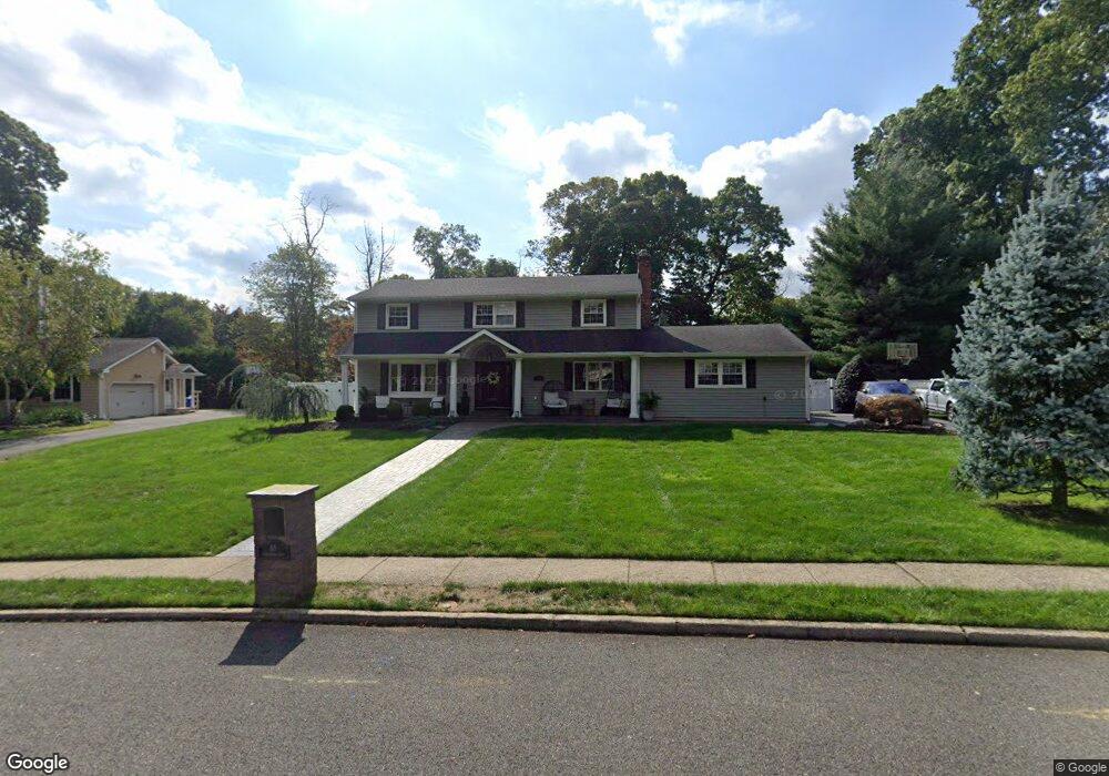
65 Stonehenge Dr Lincroft, NJ 07738
Estimated Value: $1,169,674 - $1,456,000
4
Beds
2
Baths
2,963
Sq Ft
$423/Sq Ft
Est. Value
About This Home
This home is located at 65 Stonehenge Dr, Lincroft, NJ 07738 and is currently estimated at $1,253,669, approximately $423 per square foot. 65 Stonehenge Dr is a home located in Monmouth County with nearby schools including Lincroft Elementary School, Thompson Middle School, and Middletown - South High School.
Ownership History
Date
Name
Owned For
Owner Type
Purchase Details
Closed on
Dec 30, 2019
Sold by
Furnart Salvatoro C
Bought by
152 Long Branch Avenue Llc
Current Estimated Value
Purchase Details
Closed on
Aug 6, 2009
Sold by
Hall Charles R and Hall Patricia G
Bought by
Furnari Salvatore and Furnari Jennifer
Home Financials for this Owner
Home Financials are based on the most recent Mortgage that was taken out on this home.
Original Mortgage
$100,000
Interest Rate
5.36%
Mortgage Type
New Conventional
Purchase Details
Closed on
Nov 13, 2002
Sold by
Bortz Donald
Bought by
Hall Charles and Hall Patricia
Home Financials for this Owner
Home Financials are based on the most recent Mortgage that was taken out on this home.
Original Mortgage
$270,000
Interest Rate
6.07%
Mortgage Type
Purchase Money Mortgage
Create a Home Valuation Report for This Property
The Home Valuation Report is an in-depth analysis detailing your home's value as well as a comparison with similar homes in the area
Home Values in the Area
Average Home Value in this Area
Purchase History
| Date | Buyer | Sale Price | Title Company |
|---|---|---|---|
| 152 Long Branch Avenue Llc | -- | None Available | |
| Furnari Salvatore | $675,000 | New Jersey Land Title | |
| Hall Charles | $490,000 | -- |
Source: Public Records
Mortgage History
| Date | Status | Borrower | Loan Amount |
|---|---|---|---|
| Previous Owner | Furnari Salvatore | $100,000 | |
| Previous Owner | Hall Charles | $270,000 |
Source: Public Records
Tax History Compared to Growth
Tax History
| Year | Tax Paid | Tax Assessment Tax Assessment Total Assessment is a certain percentage of the fair market value that is determined by local assessors to be the total taxable value of land and additions on the property. | Land | Improvement |
|---|---|---|---|---|
| 2025 | $15,725 | $1,074,000 | $516,200 | $557,800 |
| 2024 | $14,985 | $955,900 | $414,100 | $541,800 |
| 2023 | $14,985 | $862,200 | $395,900 | $466,300 |
| 2022 | $14,864 | $752,800 | $308,900 | $443,900 |
| 2021 | $14,864 | $714,600 | $319,700 | $394,900 |
| 2020 | $14,290 | $668,400 | $282,500 | $385,900 |
| 2019 | $14,070 | $666,200 | $282,500 | $383,700 |
| 2018 | $14,991 | $691,800 | $282,500 | $409,300 |
| 2017 | $14,088 | $643,600 | $241,900 | $401,700 |
| 2016 | $13,500 | $633,500 | $241,900 | $391,600 |
| 2015 | $13,867 | $628,300 | $241,900 | $386,400 |
| 2014 | $12,820 | $566,500 | $213,400 | $353,100 |
Source: Public Records
Map
Nearby Homes
- 25 Hamilton Hill Rd
- 45 Turnberry Dr
- 509 Newman Springs Rd
- 119 Lindy Ln
- 107 Lawley Dr
- 36 James St
- 25 Parkview Terrace
- 31 Rosalie Ave
- 60 Privet Place
- 1476 W Front St
- 24 Arrowwood Ct
- 1497 W Front St
- 39 Boxwood Terrace
- 34 Boxwood Terrace Unit 186
- 210 Parkview Terrace
- 110 Viburnum Terrace Unit 304
- 45 Windermere Rd
- 148 Viburnum Terrace Unit 334
- 60 Falmouth Ct
- 12 Ellsworth Ct
- 71 Stonehenge Dr
- 59 Stonehenge Dr
- 124 Antonia Ct
- 125 Antonia Ct
- 54 Stonehenge Dr
- 120 Antonia Ct
- 121 Antonia Ct
- 53 Stonehenge Dr
- 60 Stonehenge Dr
- 10 Hamilton Hill Rd
- 48 Stonehenge Dr
- 18 Hamilton Hill Rd
- 117 Antonia Ct
- 49 Stonehenge Dr
- 12 Hamilton Hill Rd
- 2 Hamilton Hill Rd
- 36 English Ln
- 33 English Ln
- 16 Hill Rd
- 42 Stonehenge Dr