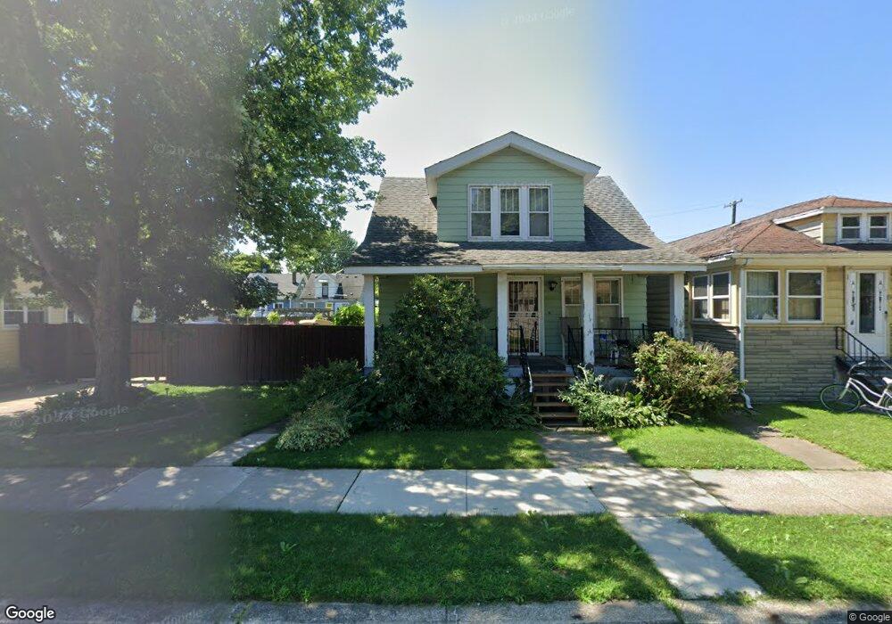
65 Stoner St River Rouge, MI 48218
Estimated Value: $69,000 - $111,000
--
Bed
1
Bath
--
Sq Ft
3,485
Sq Ft Lot
About This Home
This home is located at 65 Stoner St, River Rouge, MI 48218 and is currently estimated at $85,333. 65 Stoner St is a home located in Wayne County with nearby schools including Ann Visger K-5 Preparatory Academy.
Ownership History
Date
Name
Owned For
Owner Type
Purchase Details
Closed on
Jul 18, 2024
Sold by
Feltner Jessica Lynn
Bought by
Fernandez-Colon Jeramy M
Current Estimated Value
Home Financials for this Owner
Home Financials are based on the most recent Mortgage that was taken out on this home.
Original Mortgage
$113,900
Outstanding Balance
$112,481
Interest Rate
6.77%
Mortgage Type
New Conventional
Estimated Equity
-$27,148
Purchase Details
Closed on
Dec 16, 2015
Sold by
Bodrie Robert and Bodrie Lori
Bought by
Federal Home Loan Mortgage Corporation
Purchase Details
Closed on
Dec 23, 2003
Sold by
The City Of River Rouge
Bought by
Bodrie Lori
Purchase Details
Closed on
Jun 23, 2003
Sold by
Thomas Gloria
Bought by
The City Of River Rouge
Purchase Details
Closed on
Jun 14, 1994
Sold by
Hall Josephine
Bought by
Thomas Gloria W
Create a Home Valuation Report for This Property
The Home Valuation Report is an in-depth analysis detailing your home's value as well as a comparison with similar homes in the area
Home Values in the Area
Average Home Value in this Area
Purchase History
| Date | Buyer | Sale Price | Title Company |
|---|---|---|---|
| Fernandez-Colon Jeramy M | $118,000 | Michigan Title Insurance Agenc | |
| Federal Home Loan Mortgage Corporation | -- | Attorney | |
| Bodrie Lori | $4,000 | -- | |
| The City Of River Rouge | $9,000 | -- | |
| Thomas Gloria W | -- | -- |
Source: Public Records
Mortgage History
| Date | Status | Borrower | Loan Amount |
|---|---|---|---|
| Open | Fernandez-Colon Jeramy M | $113,900 |
Source: Public Records
Tax History Compared to Growth
Tax History
| Year | Tax Paid | Tax Assessment Tax Assessment Total Assessment is a certain percentage of the fair market value that is determined by local assessors to be the total taxable value of land and additions on the property. | Land | Improvement |
|---|---|---|---|---|
| 2025 | $49 | $1,700 | $0 | $0 |
| 2024 | $49 | $1,500 | $0 | $0 |
| 2023 | $47 | $1,100 | $0 | $0 |
| 2022 | $71 | $900 | $0 | $0 |
| 2021 | $69 | $900 | $0 | $0 |
| 2020 | $68 | $800 | $0 | $0 |
| 2019 | $43 | $800 | $0 | $0 |
| 2018 | $64 | $900 | $0 | $0 |
| 2017 | $57 | $900 | $0 | $0 |
| 2016 | $177 | $1,800 | $0 | $0 |
| 2015 | $200 | $2,000 | $0 | $0 |
| 2013 | $224 | $4,600 | $0 | $0 |
| 2012 | $171 | $4,500 | $3,100 | $1,400 |
Source: Public Records
Map
Nearby Homes
- 50 Abbott St
- 16 Alexander St
- 20 Hill St
- 15 Forest St
- 426 Genessee St
- 12 Perrin St
- 49 Orchard St
- 27 Orchard St
- 19 Orchard St
- 99 E Great Lakes St
- 71 E Great Lakes St
- 10 E Auburn Ave
- 47 E Rockwood St
- 69 E Great Lakes St
- 50 E Rockwood St
- 70 E Rockwood St
- 20 W Auburn St
- 37 Le Blanc St
- 293 Richter St
- 71 E Glenwood St