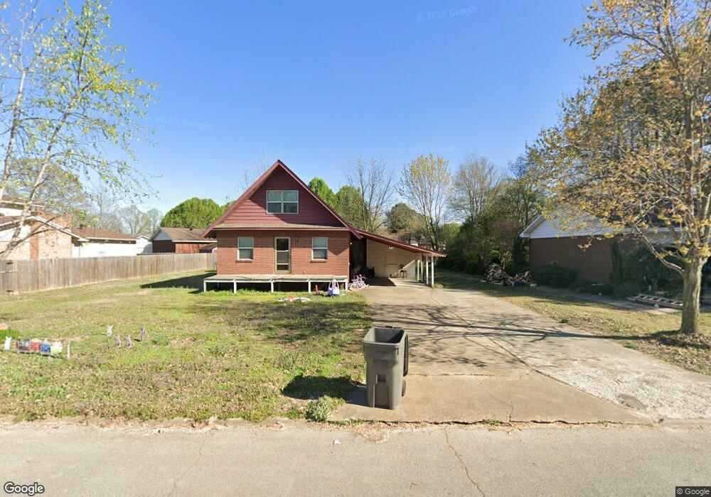
65 Sundale Cir Paragould, AR 72450
Estimated Value: $140,947 - $167,000
--
Bed
2
Baths
1,717
Sq Ft
$89/Sq Ft
Est. Value
About This Home
This home is located at 65 Sundale Cir, Paragould, AR 72450 and is currently estimated at $152,237, approximately $88 per square foot. 65 Sundale Cir is a home located in Greene County with nearby schools including Paragould High School and St. Mary's Catholic School & Preschool.
Ownership History
Date
Name
Owned For
Owner Type
Purchase Details
Closed on
Feb 27, 2006
Sold by
Bratton Bob and Braton Debbie
Bought by
Rowland Jared
Current Estimated Value
Home Financials for this Owner
Home Financials are based on the most recent Mortgage that was taken out on this home.
Original Mortgage
$64,000
Outstanding Balance
$35,610
Interest Rate
6.1%
Mortgage Type
New Conventional
Estimated Equity
$116,627
Purchase Details
Closed on
Sep 5, 2003
Bought by
Bratton B and Bratton D
Create a Home Valuation Report for This Property
The Home Valuation Report is an in-depth analysis detailing your home's value as well as a comparison with similar homes in the area
Home Values in the Area
Average Home Value in this Area
Purchase History
| Date | Buyer | Sale Price | Title Company |
|---|---|---|---|
| Rowland Jared | $64,000 | None Available | |
| Bratton B | -- | -- |
Source: Public Records
Mortgage History
| Date | Status | Borrower | Loan Amount |
|---|---|---|---|
| Open | Rowland Jared | $64,000 |
Source: Public Records
Tax History Compared to Growth
Tax History
| Year | Tax Paid | Tax Assessment Tax Assessment Total Assessment is a certain percentage of the fair market value that is determined by local assessors to be the total taxable value of land and additions on the property. | Land | Improvement |
|---|---|---|---|---|
| 2025 | $1,122 | $26,720 | $3,300 | $23,420 |
| 2024 | $1,029 | $26,720 | $3,300 | $23,420 |
| 2023 | $871 | $20,330 | $3,400 | $16,930 |
| 2022 | $871 | $20,330 | $3,400 | $16,930 |
| 2021 | $798 | $20,330 | $3,400 | $16,930 |
| 2020 | $725 | $15,760 | $3,400 | $12,360 |
| 2019 | $350 | $15,760 | $3,400 | $12,360 |
| 2018 | $375 | $15,760 | $3,400 | $12,360 |
| 2017 | $696 | $15,760 | $3,400 | $12,360 |
| 2016 | $314 | $15,760 | $3,400 | $12,360 |
| 2015 | $637 | $14,180 | $3,000 | $11,180 |
| 2014 | $637 | $14,180 | $3,000 | $11,180 |
Source: Public Records
Map
Nearby Homes
- 2001 W Kingshighway
- 1811 Magnolia Ln
- 1701 Barnhill Rd
- 1905 Glendale St
- 1700 Barnhill Rd
- 2075 S 141 Hwy
- 1801 Sara Ann Cir
- 4063 GRE 934 Rd
- 2311 S 20th St
- 3.65 ACRES U S 49
- 1103 Summit Ridge Trail
- 1101 Summit Ridge Trail
- 1103 Summit Ridge Dr
- 1104 Summit Ridge Dr
- 412 Magnolia Dr
- 106 Magnolia Dr
- 102 Magnolia Dr
- 125 S 12th St
- 731 Greene St
- 3200 Red Oak Dr
- 63 Sundale Cir
- 67 Sundale Cir
- 152 Toma Jean Dr
- 0 Toma Jean
- 154 Toma Jean Dr
- 76 Sundale Cir
- 1 Donna Lynn Dr
- 78 Sundale Cir
- 74 Sundale Cir
- 3 Donna Lynn Dr
- 0 Donna Lynn
- 80 Sundale Cir
- 72 Sundale Cir
- 147 Toma Jean Dr
- 151 Toma Jean Dr
- 149 Toma Jean Dr
- 156 Toma Jean Dr
- 82 Sundale Cir
- 155 Toma Jean Dr
- 2 Donna Lynn Dr