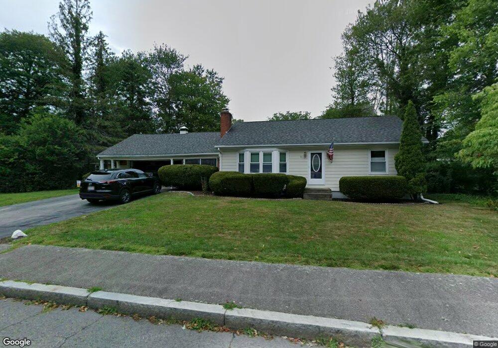
65 Sutherland Rd North Attleboro, MA 02760
North Attleboro NeighborhoodEstimated Value: $482,000 - $570,000
2
Beds
1
Bath
1,131
Sq Ft
$467/Sq Ft
Est. Value
About This Home
This home is located at 65 Sutherland Rd, North Attleboro, MA 02760 and is currently estimated at $528,330, approximately $467 per square foot. 65 Sutherland Rd is a home located in Bristol County with nearby schools including North Attleboro High School, Cadence Academy Preschool - North Attleborough, and Bishop Feehan High School.
Ownership History
Date
Name
Owned For
Owner Type
Purchase Details
Closed on
Sep 29, 1995
Sold by
Rizzardini Paul E and Rizzardini Christina
Bought by
Cahill Kenenth A and Cahill Carla A
Current Estimated Value
Home Financials for this Owner
Home Financials are based on the most recent Mortgage that was taken out on this home.
Original Mortgage
$141,750
Outstanding Balance
$1,023
Interest Rate
7.89%
Mortgage Type
Purchase Money Mortgage
Estimated Equity
$527,307
Create a Home Valuation Report for This Property
The Home Valuation Report is an in-depth analysis detailing your home's value as well as a comparison with similar homes in the area
Home Values in the Area
Average Home Value in this Area
Purchase History
| Date | Buyer | Sale Price | Title Company |
|---|---|---|---|
| Cahill Kenenth A | $139,000 | -- |
Source: Public Records
Mortgage History
| Date | Status | Borrower | Loan Amount |
|---|---|---|---|
| Open | Cahill Kenenth A | $20,000 | |
| Open | Cahill Kenenth A | $141,750 |
Source: Public Records
Tax History Compared to Growth
Tax History
| Year | Tax Paid | Tax Assessment Tax Assessment Total Assessment is a certain percentage of the fair market value that is determined by local assessors to be the total taxable value of land and additions on the property. | Land | Improvement |
|---|---|---|---|---|
| 2025 | $5,519 | $468,100 | $145,300 | $322,800 |
| 2024 | $5,223 | $452,600 | $145,300 | $307,300 |
| 2023 | $5,214 | $407,700 | $151,600 | $256,100 |
| 2022 | $4,728 | $339,400 | $145,300 | $194,100 |
| 2021 | $3,737 | $346,700 | $145,300 | $201,400 |
| 2020 | $4,657 | $324,500 | $145,300 | $179,200 |
| 2019 | $3,701 | $311,300 | $132,100 | $179,200 |
| 2018 | $5,205 | $292,300 | $132,100 | $160,200 |
| 2017 | $5,005 | $284,400 | $132,100 | $152,300 |
| 2016 | $3,724 | $281,700 | $153,100 | $128,600 |
| 2015 | $3,640 | $277,000 | $159,500 | $117,500 |
| 2014 | $3,387 | $255,800 | $139,900 | $115,900 |
Source: Public Records
Map
Nearby Homes
- 50 Metcalf Rd
- 0 Anawan Rd
- 334 S Washington St
- 40 Sperry Ln
- 30 Sperry Ln Unit Lot 15
- 19 Metcalf Cir
- 80 Broadway Unit 9
- 160 Crescent Ave
- 49 Hoppin Hill Ave
- 130 E Washington St Unit 84
- 130 E Washington St Unit 71
- 33 Ash St
- 25 Gregory Way
- 151 Roosevelt Ave Unit A
- 121 E Washington St Unit 13
- 121 E Washington St Unit 11
- 121 E Washington St Unit 12
- 121 E Washington St Unit 8
- 121 E Washington St Unit 6
- 60 Crescent Ave
- 61 Sutherland Rd
- 88 Metcalf Rd
- 96 Metcalf Rd
- 78 Metcalf Rd
- 72 Sutherland Rd
- 64 Sutherland Rd
- 83 Sutherland Rd
- 104 Metcalf Rd
- 57 Sutherland Rd
- 80 Sutherland Rd
- 70 Metcalf Rd
- 54 Sutherland Rd
- 77 Metcalf Rd
- 91 Metcalf Rd
- 61 Calvin Rd
- 91 Sutherland Rd
- 69 Calvin Rd
- 88 Sutherland Rd
- 112 Metcalf Rd
- 51 Sutherland Rd