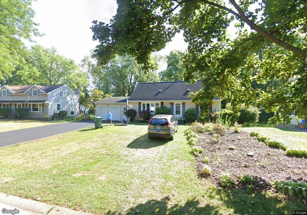
65 Thorncliff Rd Spencerport, NY 14559
Estimated Value: $211,000 - $286,000
3
Beds
2
Baths
1,320
Sq Ft
$190/Sq Ft
Est. Value
About This Home
This home is located at 65 Thorncliff Rd, Spencerport, NY 14559 and is currently estimated at $251,269, approximately $190 per square foot. 65 Thorncliff Rd is a home located in Monroe County with nearby schools including A M Cosgrove Middle School and Spencerport High School.
Ownership History
Date
Name
Owned For
Owner Type
Purchase Details
Closed on
Dec 1, 2020
Sold by
Diaz Pedro S and Diaz Candida R
Bought by
Koke Mark A and Koke Nancy E
Current Estimated Value
Home Financials for this Owner
Home Financials are based on the most recent Mortgage that was taken out on this home.
Original Mortgage
$80,000
Outstanding Balance
$71,351
Interest Rate
2.8%
Mortgage Type
New Conventional
Estimated Equity
$179,918
Create a Home Valuation Report for This Property
The Home Valuation Report is an in-depth analysis detailing your home's value as well as a comparison with similar homes in the area
Home Values in the Area
Average Home Value in this Area
Purchase History
| Date | Buyer | Sale Price | Title Company |
|---|---|---|---|
| Koke Mark A | $100,000 | None Available |
Source: Public Records
Mortgage History
| Date | Status | Borrower | Loan Amount |
|---|---|---|---|
| Open | Koke Mark A | $80,000 |
Source: Public Records
Tax History Compared to Growth
Tax History
| Year | Tax Paid | Tax Assessment Tax Assessment Total Assessment is a certain percentage of the fair market value that is determined by local assessors to be the total taxable value of land and additions on the property. | Land | Improvement |
|---|---|---|---|---|
| 2024 | $6,557 | $208,400 | $51,300 | $157,100 |
| 2023 | $6,848 | $138,000 | $36,300 | $101,700 |
| 2022 | $6,459 | $138,000 | $36,300 | $101,700 |
| 2021 | $6,370 | $138,000 | $36,300 | $101,700 |
| 2020 | $4,750 | $138,000 | $36,300 | $101,700 |
| 2019 | $5,221 | $138,000 | $36,300 | $101,700 |
| 2018 | $5,636 | $138,000 | $36,300 | $101,700 |
| 2017 | $2,323 | $125,500 | $36,300 | $89,200 |
| 2016 | $5,221 | $125,500 | $37,000 | $88,500 |
| 2015 | -- | $125,500 | $37,000 | $88,500 |
| 2014 | -- | $125,500 | $37,000 | $88,500 |
Source: Public Records
Map
Nearby Homes
- 76 Hawthorne Dr
- 2283 S Union St
- 326 Village Walk Cir
- 87 Highview Dr
- 49 Hillcrest Dr
- 24 Birdsong Terrace
- 78 Clark St
- 154 Amity St
- 64 Coleman Ave
- 92 Coolidge Ave
- 28 Coolidge Ave
- 0000 Bay Leaf Cir Lot#119
- 000
- 00 Bay Leaf Circle Lot#117
- 0 Unit R1620030
- 62 Clearview Dr
- 15 Chambers St
- 4028 Canal Rd
- 607 Trimmer Rd
- 3375 Brockport Spencerport Rd
- 71 Thorncliff Rd
- 59 Thorncliff Rd
- 77 Thorncliff Rd
- 53 Thorncliff Rd
- 64 Thorncliff Rd
- 58 Thorncliff Rd
- 70 Thorncliff Rd
- 83 Thorncliff Rd
- 47 Thorncliff Rd
- 76 Thorncliff Rd
- 48 Thorncliff Rd
- 30 Timber Ridge Dr
- 82 Thorncliff Rd
- 89 Thorncliff Rd
- 41 Thorncliff Rd
- 40 Thorncliff Rd
- 32 Timber Ridge Dr
- 17 Hawthorne Dr
- 28 Timber Ridge Dr
- 88 Thorncliff Rd