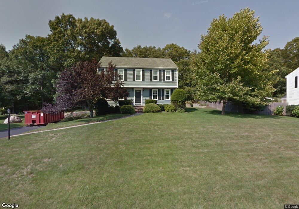
65 Tommy Marks Way South Weymouth, MA 02190
South Weymouth NeighborhoodEstimated Value: $882,000 - $1,009,000
4
Beds
3
Baths
2,244
Sq Ft
$426/Sq Ft
Est. Value
About This Home
This home is located at 65 Tommy Marks Way, South Weymouth, MA 02190 and is currently estimated at $956,250, approximately $426 per square foot. 65 Tommy Marks Way is a home located in Norfolk County with nearby schools including Thomas V Nash, Abigail Adams Middle School, and Weymouth Middle School Chapman.
Ownership History
Date
Name
Owned For
Owner Type
Purchase Details
Closed on
Feb 6, 2014
Sold by
Bridge Daren R and Bridge Dawn M
Bought by
Tommy Marks Rt
Current Estimated Value
Purchase Details
Closed on
Sep 30, 2009
Sold by
Harris Hneil and Harris Jeanne A
Bought by
Bridge Daren R and Bridge Dawn
Home Financials for this Owner
Home Financials are based on the most recent Mortgage that was taken out on this home.
Original Mortgage
$198,000
Interest Rate
5.12%
Mortgage Type
Purchase Money Mortgage
Purchase Details
Closed on
Oct 19, 2007
Sold by
Edgar Jeanne A and Harris Jeanne A
Bought by
Harris Jeanne A and Harris Hneil
Home Financials for this Owner
Home Financials are based on the most recent Mortgage that was taken out on this home.
Original Mortgage
$168,600
Interest Rate
6.51%
Mortgage Type
Purchase Money Mortgage
Purchase Details
Closed on
Jan 16, 1987
Sold by
Amer Heritage Homes
Bought by
Edgar Charles D
Create a Home Valuation Report for This Property
The Home Valuation Report is an in-depth analysis detailing your home's value as well as a comparison with similar homes in the area
Home Values in the Area
Average Home Value in this Area
Purchase History
| Date | Buyer | Sale Price | Title Company |
|---|---|---|---|
| Tommy Marks Rt | -- | -- | |
| Bridge Daren R | $463,000 | -- | |
| Harris Jeanne A | -- | -- | |
| Edgar Charles D | $240,000 | -- |
Source: Public Records
Mortgage History
| Date | Status | Borrower | Loan Amount |
|---|---|---|---|
| Previous Owner | Edgar Charles D | $191,000 | |
| Previous Owner | Bridge Daren R | $198,000 | |
| Previous Owner | Harris Jeanne A | $168,600 | |
| Previous Owner | Harris Jeanne A | $15,000 | |
| Previous Owner | Edgar Charles D | $185,000 | |
| Previous Owner | Edgar Charles D | $25,000 |
Source: Public Records
Tax History Compared to Growth
Tax History
| Year | Tax Paid | Tax Assessment Tax Assessment Total Assessment is a certain percentage of the fair market value that is determined by local assessors to be the total taxable value of land and additions on the property. | Land | Improvement |
|---|---|---|---|---|
| 2025 | $8,494 | $841,000 | $236,200 | $604,800 |
| 2024 | $8,229 | $801,300 | $225,000 | $576,300 |
| 2023 | $7,555 | $723,000 | $227,300 | $495,700 |
| 2022 | $7,377 | $643,700 | $210,500 | $433,200 |
| 2021 | $6,823 | $581,200 | $210,500 | $370,700 |
| 2020 | $6,520 | $547,000 | $210,500 | $336,500 |
| 2019 | $6,405 | $528,500 | $202,400 | $326,100 |
| 2018 | $6,189 | $495,100 | $192,700 | $302,400 |
| 2017 | $6,044 | $471,800 | $183,600 | $288,200 |
| 2016 | $5,606 | $438,000 | $176,500 | $261,500 |
| 2015 | $5,350 | $414,700 | $176,500 | $238,200 |
| 2014 | $4,978 | $374,300 | $164,300 | $210,000 |
Source: Public Records
Map
Nearby Homes
- 308 Forest St
- 16 Jay Rd
- 68 Massapoag St Unit 7
- 24 Fisher Rd
- 354 Tilden Commons Ln
- 92 Mercury St
- 134 Tyson Commons Ln
- 175 Tyson Commons Ln
- 262 West St
- 30 Bradford Commons Ln
- 255 West St
- 211 Randolph St
- 193 Randolph St
- 655 Summer St
- 441 Grove St
- 432 Grove St
- 120 Randolph St
- 972 Liberty St
- 2 Mitchell Ln Unit B
- 50 Hollis St
- 49 Tommy Marks Way
- 69 Tommy Marks Way
- 60 Tommy Marks Way
- 70 Tommy Marks Way
- 50 Tommy Marks Way
- 39 Tommy Marks Way
- 77 Tommy Marks Way
- 40 Tommy Marks Way
- 76 Tommy Marks Way
- 80 Tommy Marks Way
- 27 Tommy Marks Way
- 32 Tommy Marks Way
- 24 Tommy Marks Way
- 17 Tommy Marks Way
- 276 Forest St
- 8 Tommy Marks Way
- 24 Harvest Ln
- 296 Forest St
- 260 Forest St
- 302 Forest St