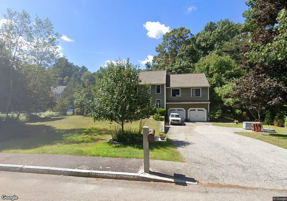
65 Town Line Dr Hanover, MA 02339
Estimated Value: $1,083,593 - $1,412,000
4
Beds
4
Baths
3,136
Sq Ft
$400/Sq Ft
Est. Value
About This Home
This home is located at 65 Town Line Dr, Hanover, MA 02339 and is currently estimated at $1,254,898, approximately $400 per square foot. 65 Town Line Dr is a home located in Plymouth County with nearby schools including Hanover High School, South Shore Charter Public School, and Holy Family Elementary School.
Ownership History
Date
Name
Owned For
Owner Type
Purchase Details
Closed on
Apr 8, 1994
Sold by
Constructo Corp
Bought by
Hasenfuss David M and Hasenfuss Maryvbeth
Current Estimated Value
Home Financials for this Owner
Home Financials are based on the most recent Mortgage that was taken out on this home.
Original Mortgage
$245,300
Interest Rate
7.27%
Mortgage Type
Purchase Money Mortgage
Create a Home Valuation Report for This Property
The Home Valuation Report is an in-depth analysis detailing your home's value as well as a comparison with similar homes in the area
Home Values in the Area
Average Home Value in this Area
Purchase History
| Date | Buyer | Sale Price | Title Company |
|---|---|---|---|
| Hasenfuss David M | $272,600 | -- | |
| Hasenfuss David M | $272,600 | -- |
Source: Public Records
Mortgage History
| Date | Status | Borrower | Loan Amount |
|---|---|---|---|
| Open | Hasenfuss David M | $100,000 | |
| Open | Hasenfuss David M | $283,500 | |
| Closed | Hasenfuss David M | $25,000 | |
| Closed | Hasenfuss David M | $245,300 |
Source: Public Records
Tax History Compared to Growth
Tax History
| Year | Tax Paid | Tax Assessment Tax Assessment Total Assessment is a certain percentage of the fair market value that is determined by local assessors to be the total taxable value of land and additions on the property. | Land | Improvement |
|---|---|---|---|---|
| 2025 | $11,991 | $970,900 | $323,800 | $647,100 |
| 2024 | $11,677 | $909,400 | $323,800 | $585,600 |
| 2023 | $11,315 | $838,800 | $294,300 | $544,500 |
| 2022 | $11,535 | $756,400 | $257,500 | $498,900 |
| 2021 | $13,394 | $694,700 | $234,100 | $460,600 |
| 2020 | $11,008 | $674,900 | $234,100 | $440,800 |
| 2019 | $4,521 | $658,200 | $245,200 | $413,000 |
| 2018 | $4,434 | $630,200 | $256,400 | $373,800 |
| 2017 | $12,751 | $637,600 | $252,600 | $385,000 |
| 2016 | $10,222 | $606,300 | $229,700 | $376,600 |
| 2015 | $9,792 | $606,300 | $229,700 | $376,600 |
Source: Public Records
Map
Nearby Homes
- 120 Deerfield Ln
- 141 Deerfield Ln
- 55 Turner Rd
- 18 Colby St
- 1239 Main St
- 80 Coolidge Rd
- 206-208 Hinghm St
- 18 Midfield Dr
- 216 Whiting St
- 62 High St
- 70 Dillingham Way
- 118 Bates Way
- 214 Washington St Unit 24
- 214 Washington St Unit 28
- 375 Webster St
- 354 Webster St
- 436 E Water St
- 7 Boxberry Ln Unit 7
- 65 Boxberry Ln
- 507 Liberty St
- 47 Town Line Dr
- 73 Town Line Dr
- 33 Town Line Dr
- 83 Town Line Dr
- 56 Town Line Dr
- 48 Town Line Dr
- 38 Town Line Dr
- 68 Town Line Dr
- 23 Town Line Dr Unit 23
- 26 Town Line Dr
- 21 Town Line Dr Unit 21
- 717 Whiting St
- 15 Town Line Dr Unit 15
- 14 Town Line Dr
- 14 Town Line Dr
- 17 Town Line Dr
- 82 Town Line Dr
- 76 Town Line Dr
- 10 Town Line Dr Unit 10
- 42 Bard Rock Ln