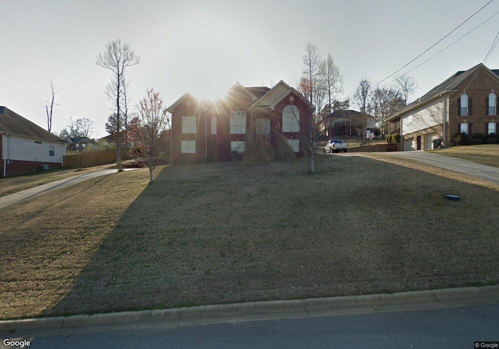
65 Twisted Oak Cir Odenville, AL 35120
Estimated Value: $267,000 - $328,000
--
Bed
1
Bath
1,630
Sq Ft
$184/Sq Ft
Est. Value
About This Home
This home is located at 65 Twisted Oak Cir, Odenville, AL 35120 and is currently estimated at $300,718, approximately $184 per square foot. 65 Twisted Oak Cir is a home located in St. Clair County with nearby schools including Margaret Elementary School, Moody Middle School, and Moody High School.
Ownership History
Date
Name
Owned For
Owner Type
Purchase Details
Closed on
Aug 30, 2006
Sold by
Laverty John Michael and Laverty Teri D
Bought by
Threatt Cedric Lanier and Threat Sharon R
Current Estimated Value
Home Financials for this Owner
Home Financials are based on the most recent Mortgage that was taken out on this home.
Original Mortgage
$201,395
Outstanding Balance
$130,194
Interest Rate
8.12%
Mortgage Type
Adjustable Rate Mortgage/ARM
Estimated Equity
$170,524
Create a Home Valuation Report for This Property
The Home Valuation Report is an in-depth analysis detailing your home's value as well as a comparison with similar homes in the area
Home Values in the Area
Average Home Value in this Area
Purchase History
| Date | Buyer | Sale Price | Title Company |
|---|---|---|---|
| Threatt Cedric Lanier | $201,395 | None Available |
Source: Public Records
Mortgage History
| Date | Status | Borrower | Loan Amount |
|---|---|---|---|
| Open | Threatt Cedric Lanier | $201,395 |
Source: Public Records
Tax History Compared to Growth
Tax History
| Year | Tax Paid | Tax Assessment Tax Assessment Total Assessment is a certain percentage of the fair market value that is determined by local assessors to be the total taxable value of land and additions on the property. | Land | Improvement |
|---|---|---|---|---|
| 2024 | $1,186 | $46,508 | $7,200 | $39,308 |
| 2023 | $1,186 | $46,508 | $7,200 | $39,308 |
| 2022 | $707 | $19,637 | $3,600 | $16,037 |
| 2021 | $707 | $19,637 | $3,600 | $16,037 |
| 2020 | $707 | $19,637 | $3,600 | $16,037 |
| 2019 | $707 | $19,637 | $3,600 | $16,037 |
| 2018 | $698 | $19,400 | $0 | $0 |
| 2017 | $712 | $19,400 | $0 | $0 |
| 2016 | $698 | $19,400 | $0 | $0 |
| 2015 | $712 | $19,400 | $0 | $0 |
| 2014 | $712 | $19,780 | $0 | $0 |
Source: Public Records
Map
Nearby Homes
- 74 Autumn Trace
- 260 Hawks Bend Ln
- 50 Mason Dr
- 922 Brookstone Place
- 125 Deer Creek Dr
- 60 Deer Creek Dr
- 135 Deer Creek Dr
- 1 Summit Ridge Way Unit 76
- 1 Summit Ridge Way Unit 60
- 17 Greenleaf Ln
- 0 Venable Rd
- 180 Levine Rd
- 80 Shadow Cove Ln
- 0 Roulain Rd Unit 7.91 acres 21414127
- 15 County Road 12
- 20 Shadow Cove Ln
- 0 County Road 12 Unit 21395135
- 152 Woodland Ridge Rd
- 55 Rae St
- 306 Hickory Valley Rd
- 75 Twisted Oak Cir
- 55 Twisted Oak Cir
- 32 Autumn Trace
- 32 Autumn Trc
- 58 Autumn Trace
- 14 Autumn Trace
- 85 Twisted Oak Cir
- 70 Twisted Oak Cir
- 60 Twisted Oak Cir
- 50 Twisted Oak Cir
- 100 Hawks Bend Ln
- 90 Twisted Oak Cir
- 95 Hawks Bend Ln
- 19 Fawns Way
- 95 Twisted Oak Cir
- 31 Autumn Trace
- 49 Autumn Trace
- 82 Autumn Trace
- 75 Autumn Trace
- 105 Hawks Bend Ln