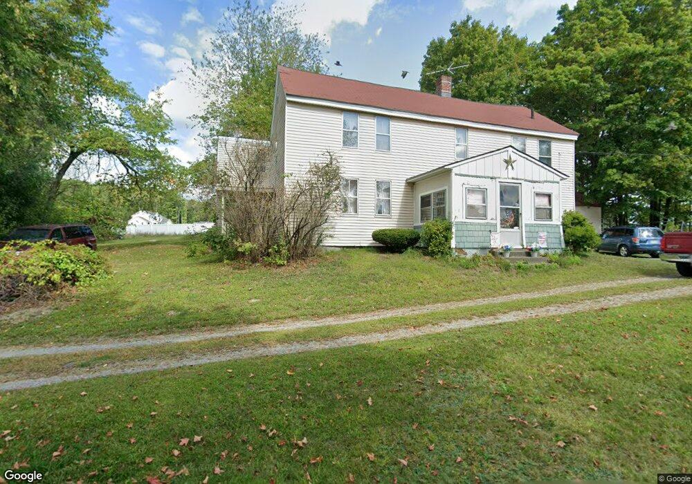
65 Watt St Lunenburg, MA 01462
Estimated Value: $556,983 - $680,000
5
Beds
1
Bath
2,382
Sq Ft
$255/Sq Ft
Est. Value
About This Home
This home is located at 65 Watt St, Lunenburg, MA 01462 and is currently estimated at $607,246, approximately $254 per square foot. 65 Watt St is a home located in Worcester County with nearby schools including Lunenburg Primary School and Lunenburg High School.
Create a Home Valuation Report for This Property
The Home Valuation Report is an in-depth analysis detailing your home's value as well as a comparison with similar homes in the area
Home Values in the Area
Average Home Value in this Area
Tax History
| Year | Tax Paid | Tax Assessment Tax Assessment Total Assessment is a certain percentage of the fair market value that is determined by local assessors to be the total taxable value of land and additions on the property. | Land | Improvement |
|---|---|---|---|---|
| 2025 | $6,361 | $443,000 | $148,500 | $294,500 |
| 2024 | $5,813 | $412,300 | $140,100 | $272,200 |
| 2023 | $5,579 | $381,600 | $127,400 | $254,200 |
| 2022 | $5,300 | $308,300 | $106,400 | $201,900 |
| 2020 | $5,398 | $297,900 | $106,000 | $191,900 |
| 2019 | $5,152 | $275,800 | $99,800 | $176,000 |
| 2018 | $5,087 | $258,200 | $99,800 | $158,400 |
| 2017 | $4,931 | $246,800 | $94,400 | $152,400 |
| 2016 | $4,638 | $236,500 | $89,800 | $146,700 |
| 2015 | $4,164 | $227,300 | $85,200 | $142,100 |
Source: Public Records
Map
Nearby Homes
- 12 Cortland Cir Unit 12
- 11 Longwood Dr
- 146 Elmwood Rd
- 110 Burrage St
- 309 Reservoir Rd
- 2 Gabes Place
- 45 Spring St
- 367 Mulpus Rd
- 120 Robbs Hill Rd
- 22 Townsend Rd
- Lot 5 Townsend Rd
- 24 Townsend Rd
- 17 Longley Rd
- 11 Longley Rd Unit K8
- 11 Longley Rd Unit G3
- 146-148 Kilburn St
- 44 Fire Road 12
- 35 Leominster Rd
- 43 Longley Rd
- 105 Townsend Rd Unit 1
Your Personal Tour Guide
Ask me questions while you tour the home.