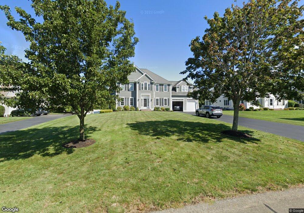
65 Weetamoo Way Wrentham, MA 02093
Estimated Value: $1,144,000 - $1,264,000
4
Beds
3
Baths
3,316
Sq Ft
$358/Sq Ft
Est. Value
About This Home
This home is located at 65 Weetamoo Way, Wrentham, MA 02093 and is currently estimated at $1,187,664, approximately $358 per square foot. 65 Weetamoo Way is a home located in Norfolk County with nearby schools including Delaney Elementary School and Charles E Roderick.
Ownership History
Date
Name
Owned For
Owner Type
Purchase Details
Closed on
Jul 30, 2004
Sold by
Diplacido Dev Corp
Bought by
Mellman Alexandra T and Mellman Brook M
Current Estimated Value
Home Financials for this Owner
Home Financials are based on the most recent Mortgage that was taken out on this home.
Original Mortgage
$395,000
Outstanding Balance
$200,151
Interest Rate
6.33%
Mortgage Type
Purchase Money Mortgage
Estimated Equity
$987,513
Create a Home Valuation Report for This Property
The Home Valuation Report is an in-depth analysis detailing your home's value as well as a comparison with similar homes in the area
Home Values in the Area
Average Home Value in this Area
Purchase History
| Date | Buyer | Sale Price | Title Company |
|---|---|---|---|
| Mellman Alexandra T | $631,000 | -- |
Source: Public Records
Mortgage History
| Date | Status | Borrower | Loan Amount |
|---|---|---|---|
| Open | Mellman Alexandra T | $395,000 |
Source: Public Records
Tax History Compared to Growth
Tax History
| Year | Tax Paid | Tax Assessment Tax Assessment Total Assessment is a certain percentage of the fair market value that is determined by local assessors to be the total taxable value of land and additions on the property. | Land | Improvement |
|---|---|---|---|---|
| 2025 | $11,379 | $981,800 | $318,500 | $663,300 |
| 2024 | $10,852 | $904,300 | $318,500 | $585,800 |
| 2023 | $10,688 | $846,900 | $289,600 | $557,300 |
| 2022 | $10,232 | $748,500 | $263,200 | $485,300 |
| 2021 | $10,019 | $712,100 | $263,200 | $448,900 |
| 2020 | $10,006 | $702,200 | $216,400 | $485,800 |
| 2019 | $9,623 | $681,500 | $216,400 | $465,100 |
| 2018 | $9,535 | $669,600 | $216,700 | $452,900 |
| 2017 | $9,243 | $648,600 | $212,600 | $436,000 |
| 2016 | $9,113 | $638,200 | $206,400 | $431,800 |
| 2015 | $8,470 | $565,400 | $198,400 | $367,000 |
| 2014 | $8,390 | $548,000 | $190,800 | $357,200 |
Source: Public Records
Map
Nearby Homes
- 20 Pokanoket Path
- 100 Pokanoket Path
- 570 Eastside Rd
- Lot 3 - 14 Earle Stewart Ln
- 12 Earle Stewart Ln
- 131 Creek St Unit 9
- 311 South St
- 60 Oxbow Dr
- 20 Rowell Rd
- 791 South St Unit 5
- 319 Taunton St
- 406 West St
- 570 Franklin St
- 15 Nature View Dr
- 10 Nature View Dr
- 10 Tilting Rock Rd
- 440 Chestnut St
- 50 Green St
- 1204 South St
- 1222 South St
- 75 Weetamoo Way
- 55 Weetamoo Way
- 45 Weetamoo Way
- 85 Weetamoo Way
- 115 Annawon Ave
- 105 Annawon Ave
- 40 Weetamoo Way
- 125 Annawon Ave
- 50 Weetamoo Way
- 35 Weetamoo Way
- 95 Weetamoo Way
- 60 Weetamoo Way
- 30 Weetamoo Way
- 70 Pokanoket Path
- 135 Annawon Ave
- 60 Pokanoket Path
- 25 Weetamoo Way
- 70 Weetamoo Way
- 145 Annawon Ave
- 50 Pokanoket Path