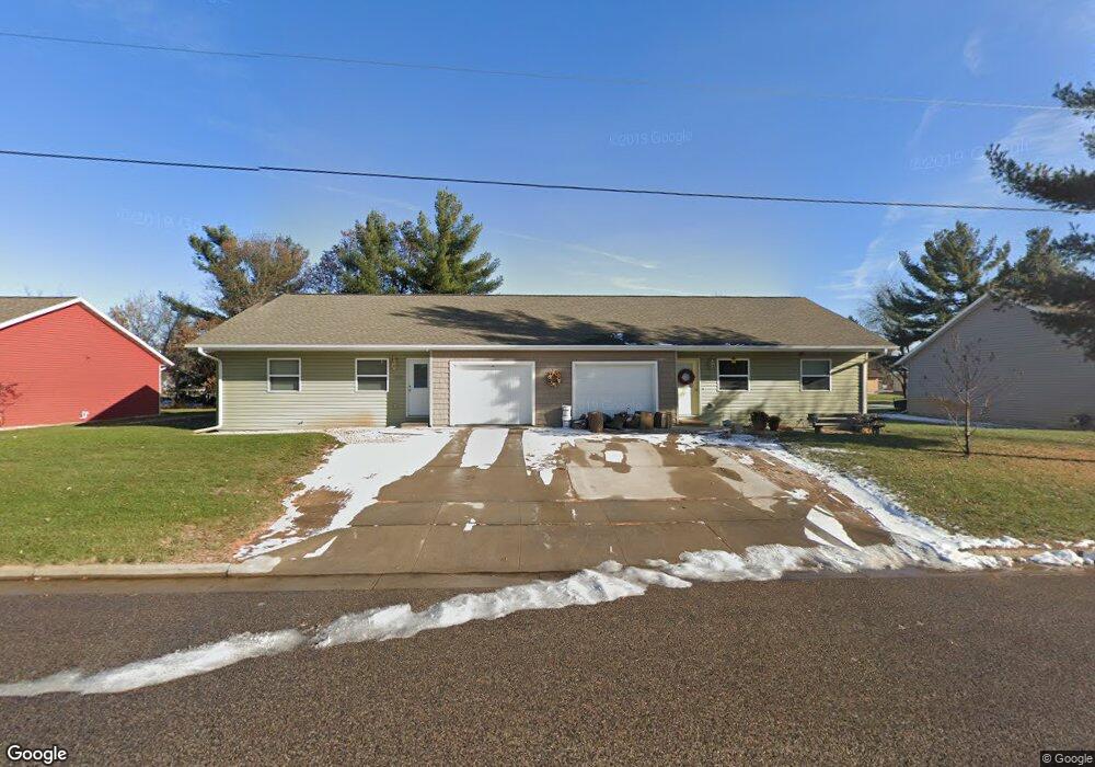
650 24th St N Wisconsin Rapids, WI 54494
Estimated Value: $174,000 - $342,000
--
Bed
--
Bath
--
Sq Ft
0.25
Acres
About This Home
This home is located at 650 24th St N, Wisconsin Rapids, WI 54494 and is currently estimated at $275,309. 650 24th St N is a home with nearby schools including Washington Elementary School, Wisconsin Rapids Area Middle School, and East Junior High School.
Ownership History
Date
Name
Owned For
Owner Type
Purchase Details
Closed on
Feb 28, 2019
Sold by
Ruesch Shane A
Bought by
Ruesch Co Llc
Current Estimated Value
Purchase Details
Closed on
May 17, 2011
Sold by
Herman Douglas G and Herman Donna L
Bought by
Ruesch Shane A
Home Financials for this Owner
Home Financials are based on the most recent Mortgage that was taken out on this home.
Original Mortgage
$118,000
Interest Rate
4.62%
Mortgage Type
Adjustable Rate Mortgage/ARM
Purchase Details
Closed on
May 13, 2011
Sold by
Herman Douglas G and Herman Donna L
Bought by
Ruesch Shane A
Home Financials for this Owner
Home Financials are based on the most recent Mortgage that was taken out on this home.
Original Mortgage
$118,000
Interest Rate
4.62%
Mortgage Type
Adjustable Rate Mortgage/ARM
Create a Home Valuation Report for This Property
The Home Valuation Report is an in-depth analysis detailing your home's value as well as a comparison with similar homes in the area
Home Values in the Area
Average Home Value in this Area
Purchase History
| Date | Buyer | Sale Price | Title Company |
|---|---|---|---|
| Ruesch Co Llc | -- | Midwest Title | |
| Ruesch Shane A | $15,670 | -- | |
| Ruesch Shane A | $15,700 | None Available |
Source: Public Records
Mortgage History
| Date | Status | Borrower | Loan Amount |
|---|---|---|---|
| Previous Owner | Ruesch Shane A | $118,000 |
Source: Public Records
Tax History Compared to Growth
Tax History
| Year | Tax Paid | Tax Assessment Tax Assessment Total Assessment is a certain percentage of the fair market value that is determined by local assessors to be the total taxable value of land and additions on the property. | Land | Improvement |
|---|---|---|---|---|
| 2024 | $5,061 | $253,100 | $13,100 | $240,000 |
| 2023 | $4,834 | $170,400 | $13,100 | $157,300 |
| 2022 | $4,829 | $170,400 | $13,100 | $157,300 |
| 2021 | $4,711 | $170,400 | $13,100 | $157,300 |
| 2020 | $4,526 | $170,400 | $13,100 | $157,300 |
| 2019 | $4,500 | $170,400 | $13,100 | $157,300 |
| 2018 | $4,412 | $170,400 | $13,100 | $157,300 |
| 2017 | $3,660 | $138,400 | $12,600 | $125,800 |
| 2016 | $3,631 | $138,400 | $12,600 | $125,800 |
| 2015 | $3,605 | $138,400 | $12,600 | $125,800 |
Source: Public Records
Map
Nearby Homes
- lot 3 23rd St N
- lot 2 23rd St N
- 1840/1850 Franklin St
- 1820 & 1830 Baker Dr
- 2815 Plover Rd
- 321 18th St N
- 460 17th St N
- 2011 26th St N
- 221 17th St N
- 921 16th St N
- 3020 Amundson St
- 1340 Baker St
- Lot 45 S Bluff Trail
- 1210 14th St N
- 310 16th St S
- 441 13th St N
- 920 11th St N
- 1021 Baker St
- 921 16th St S
- 940 Baker St