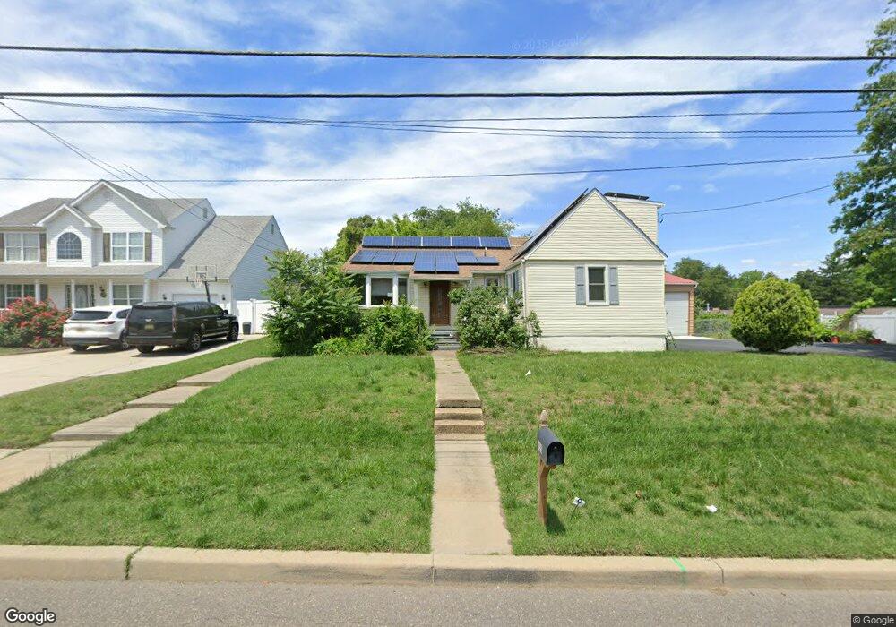
650 Crown Point Rd West Deptford, NJ 08086
West Deptford Township NeighborhoodEstimated Value: $272,215 - $382,000
--
Bed
--
Bath
1,841
Sq Ft
$185/Sq Ft
Est. Value
About This Home
This home is located at 650 Crown Point Rd, West Deptford, NJ 08086 and is currently estimated at $340,554, approximately $184 per square foot. 650 Crown Point Rd is a home located in Gloucester County with nearby schools including Red Bank Elementary School, Oakview Elementary School, and Green-Fields Elementary School.
Ownership History
Date
Name
Owned For
Owner Type
Purchase Details
Closed on
Jul 27, 2007
Sold by
Lonergan Joann and Redfield Joann
Bought by
Redfield David A
Current Estimated Value
Create a Home Valuation Report for This Property
The Home Valuation Report is an in-depth analysis detailing your home's value as well as a comparison with similar homes in the area
Home Values in the Area
Average Home Value in this Area
Purchase History
| Date | Buyer | Sale Price | Title Company |
|---|---|---|---|
| Redfield David A | -- | None Available |
Source: Public Records
Tax History Compared to Growth
Tax History
| Year | Tax Paid | Tax Assessment Tax Assessment Total Assessment is a certain percentage of the fair market value that is determined by local assessors to be the total taxable value of land and additions on the property. | Land | Improvement |
|---|---|---|---|---|
| 2025 | $6,237 | $195,300 | $44,400 | $150,900 |
| 2024 | $6,156 | $178,600 | $44,400 | $134,200 |
| 2023 | $6,156 | $178,600 | $44,400 | $134,200 |
| 2022 | $6,128 | $178,600 | $44,400 | $134,200 |
| 2021 | $5,892 | $178,600 | $44,400 | $134,200 |
| 2020 | $6,092 | $178,600 | $44,400 | $134,200 |
| 2019 | $5,922 | $178,600 | $44,400 | $134,200 |
| 2018 | $5,762 | $178,600 | $44,400 | $134,200 |
| 2017 | $5,628 | $178,600 | $44,400 | $134,200 |
| 2016 | $5,471 | $178,600 | $44,400 | $134,200 |
| 2015 | $5,212 | $178,600 | $44,400 | $134,200 |
| 2014 | $4,953 | $178,600 | $44,400 | $134,200 |
Source: Public Records
Map
Nearby Homes
- 107 Audubon Ave
- 121 Cape May Ave
- 266 Passaic Ave
- 400 Audubon Ave
- 10 Kennedy Ct
- 124 Brent Ct
- 439 Crown Point Rd
- 67 Pelican Place
- 64 Tilden Rd
- 433 Crown Point Rd
- 136 Sandpiper Ln
- 112 N Drexel St
- 1810 Fernwood Dr
- 6 Phoebe Terrace
- 97 Church St
- 1311 Barnesdale Rd
- 1678 Miller Ave
- 1676 Miller Ave
- 558 Prince St
- 21 S Columbia St
- 640 Crown Point Rd
- 6 Audubon Ave
- 219 Virginia Ave
- 215 Virginia Ave
- 2 Audubon Ave
- 10 Audubon Ave
- 211 Virginia Ave
- 550 Crown Point Rd
- 218 Virginia Ave
- 0 Woodbury Terrace
- 101 Woodbury Terrace
- 214 Virginia Ave
- 102 Audubon Ave
- 302 Virginia Ave
- 540 Crown Point Rd
- 103 Woodbury Terrace
- 104 Audubon Ave
- 105 Woodbury Terrace
- 530 Crown Point Rd
- 530 Crown Point Rd Unit 6