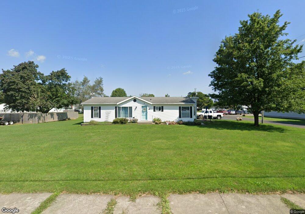
650 E Irving St Bucyrus, OH 44820
Estimated Value: $88,000 - $119,000
Studio
2
Baths
--
Sq Ft
4,661
Sq Ft
About This Home
This home is located at 650 E Irving St, Bucyrus, OH 44820 and is currently estimated at $104,667. 650 E Irving St is a home located in Crawford County with nearby schools including Bucyrus Elementary School, Bucyrus Secondary School, and Holy Trinity School.
Ownership History
Date
Name
Owned For
Owner Type
Purchase Details
Closed on
Jun 18, 2020
Sold by
Shuck Shari A and Shuck Matthew E
Bought by
Shuck Shari A
Current Estimated Value
Purchase Details
Closed on
Mar 7, 2009
Sold by
Hargis Troy C B
Bought by
Shuck Michael E
Purchase Details
Closed on
Oct 9, 2003
Bought by
Shuck Michael E
Purchase Details
Closed on
Apr 9, 2003
Bought by
Shuck Michael E and Troy Cb
Create a Home Valuation Report for This Property
The Home Valuation Report is an in-depth analysis detailing your home's value as well as a comparison with similar homes in the area
Home Values in the Area
Average Home Value in this Area
Purchase History
| Date | Buyer | Sale Price | Title Company |
|---|---|---|---|
| Shuck Shari A | $50,000 | None Available | |
| Shuck Michael E | $45,000 | -- | |
| Shuck Michael E | $45,000 | -- | |
| Shuck Michael E | -- | -- |
Source: Public Records
Mortgage History
| Date | Status | Borrower | Loan Amount |
|---|---|---|---|
| Closed | Shuck Shari A | $0 |
Source: Public Records
Tax History
| Year | Tax Paid | Tax Assessment Tax Assessment Total Assessment is a certain percentage of the fair market value that is determined by local assessors to be the total taxable value of land and additions on the property. | Land | Improvement |
|---|---|---|---|---|
| 2024 | $120 | $2,700 | $2,700 | $0 |
| 2023 | $122 | $2,100 | $2,100 | $0 |
| 2022 | $112 | $2,100 | $2,100 | $0 |
| 2021 | $112 | $2,100 | $2,100 | $0 |
| 2020 | $118 | $2,100 | $2,100 | $0 |
| 2019 | $121 | $2,100 | $2,100 | $0 |
| 2018 | $120 | $2,100 | $2,100 | $0 |
| 2017 | $124 | $2,100 | $2,100 | $0 |
| 2016 | $121 | $2,100 | $2,100 | $0 |
| 2015 | $119 | $2,100 | $2,100 | $0 |
| 2014 | $118 | $2,100 | $2,100 | $0 |
| 2013 | $118 | $2,100 | $2,100 | $0 |
Source: Public Records
Map
Nearby Homes
- 800 High St
- 1200 N Sandusky Ave
- 1575 N Sandusky Ave
- 210 N Walnut St
- 941 Reid St
- 1201 Reid St
- 112 Iron St
- 407 E Mansfield St
- 412 E Rensselaer St
- 231 E Rensselaer St
- 223 E Rensselaer St
- 1023 Tiffin St Unit Lot 5
- 1023 Tiffin St Unit 17
- 1023 Tiffin St Unit 30
- 1220 E Warren St
- 320 S Lane St
- 400 W Mansfield St
- 609 W Perry St
- 1792 Tiffin Rd
- 885 W Perry St
- 700 E Irving St
- 1121 Sherman St
- 608 E Irving St
- 645 E Irving St
- 1123 Sherman St
- 1027 Sherman St
- 1030 Sherman St
- 1023 Sherman St
- 1023 Sherman St
- 611 E Irving St
- 716 E Irving St
- 715 E Irving St
- 1180 High St
- 601 E Irving St
- 0 High St
- 745 E Irving St
- 1204 High St
- 1117 Teddy Ave
- 1211 Sherman St
- 520 E Irving St
Your Personal Tour Guide
Ask me questions while you tour the home.