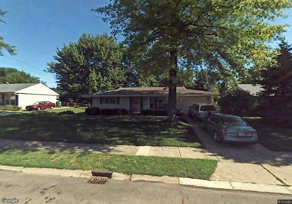
650 Hazelbrook Ave Springfield, OH 45506
Estimated Value: $145,807 - $175,000
3
Beds
1
Bath
1,169
Sq Ft
$131/Sq Ft
Est. Value
About This Home
This home is located at 650 Hazelbrook Ave, Springfield, OH 45506 and is currently estimated at $153,702, approximately $131 per square foot. 650 Hazelbrook Ave is a home located in Clark County with nearby schools including Perrin Woods Elementary School, Hayward Middle School, and Springfield High School.
Ownership History
Date
Name
Owned For
Owner Type
Purchase Details
Closed on
Apr 30, 1999
Sold by
Estep Orbie Sr and Estep Rosemary Orbie
Bought by
Harrison Terri J
Current Estimated Value
Home Financials for this Owner
Home Financials are based on the most recent Mortgage that was taken out on this home.
Original Mortgage
$62,449
Outstanding Balance
$15,163
Interest Rate
7.04%
Mortgage Type
FHA
Estimated Equity
$138,539
Create a Home Valuation Report for This Property
The Home Valuation Report is an in-depth analysis detailing your home's value as well as a comparison with similar homes in the area
Home Values in the Area
Average Home Value in this Area
Purchase History
| Date | Buyer | Sale Price | Title Company |
|---|---|---|---|
| Harrison Terri J | $62,500 | -- |
Source: Public Records
Mortgage History
| Date | Status | Borrower | Loan Amount |
|---|---|---|---|
| Open | Harrison Terri J | $62,449 |
Source: Public Records
Tax History
| Year | Tax Paid | Tax Assessment Tax Assessment Total Assessment is a certain percentage of the fair market value that is determined by local assessors to be the total taxable value of land and additions on the property. | Land | Improvement |
|---|---|---|---|---|
| 2025 | $1,549 | $36,550 | $5,330 | $31,220 |
| 2024 | $1,509 | $31,220 | $4,800 | $26,420 |
| 2023 | $1,509 | $31,220 | $4,800 | $26,420 |
| 2022 | $1,546 | $31,220 | $4,800 | $26,420 |
| 2021 | $1,305 | $24,330 | $3,430 | $20,900 |
| 2020 | $1,308 | $24,330 | $3,430 | $20,900 |
| 2019 | $1,311 | $24,330 | $3,430 | $20,900 |
| 2018 | $1,078 | $19,270 | $3,020 | $16,250 |
| 2017 | $1,077 | $19,362 | $3,024 | $16,338 |
| 2016 | $1,078 | $19,362 | $3,024 | $16,338 |
| 2015 | $1,118 | $19,362 | $3,024 | $16,338 |
| 2014 | $1,113 | $19,362 | $3,024 | $16,338 |
| 2013 | $1,101 | $19,362 | $3,024 | $16,338 |
Source: Public Records
Map
Nearby Homes
- 1730 Damascus Ave
- 550 W Parkwood Ave
- 2000 Springmont Ave
- 1920 Russell Ave
- 2140 Shawnee Ave
- 405 W Southern Ave
- 506 W Southern Ave
- 1619 S Center Blvd
- 1002 S Yellow Springs St
- 311 W Grand Ave
- 802 Innisfallen Ave
- 326 W Grand Ave
- 929 S Western Ave
- 1754 S Fountain Ave
- 1355 S Fountain Ave
- 410 W Liberty St
- 0 W Perrin Ave Unit 1043508
- 0 W Perrin Ave Unit 951292
- 830 Dibert Ave
- 209 W Liberty St
- 642 Hazelbrook Ave
- 700 Hazelbrook Ave
- 649 Damascus Ave
- 634 Hazelbrook Ave
- 641 Damascus Ave
- 1830 Portage Path
- 706 Hazelbrook Ave
- 635 Damascus Ave
- 641 Hazelbrook Ave
- 649 Hazelbrook Ave
- 1826 Portage Path
- 622 Hazelbrook Ave
- 701 Hazelbrook Ave
- 635 Hazelbrook Ave
- 623 Damascus Ave
- 709 Hazelbrook Ave
- 623 Hazelbrook Ave
- 614 Hazelbrook Ave
- 615 Damascus Ave
- 650 W John St
Your Personal Tour Guide
Ask me questions while you tour the home.