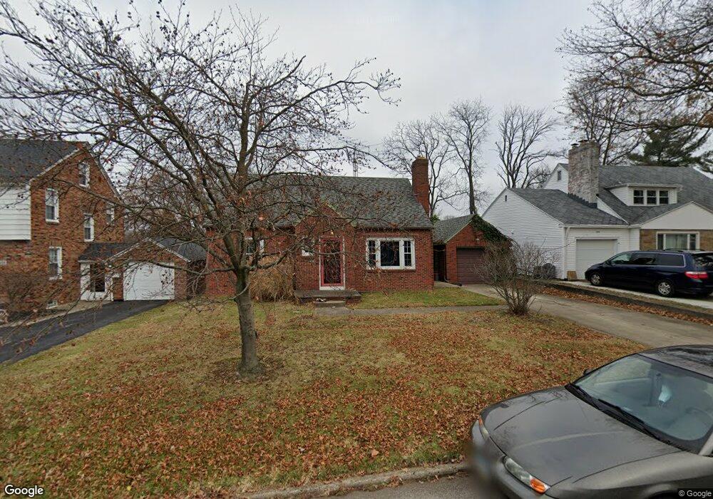
650 Manchester Rd Mansfield, OH 44903
Estimated Value: $136,000 - $148,000
3
Beds
1
Bath
1,060
Sq Ft
$133/Sq Ft
Est. Value
About This Home
This home is located at 650 Manchester Rd, Mansfield, OH 44903 and is currently estimated at $140,860, approximately $132 per square foot. 650 Manchester Rd is a home located in Richland County with nearby schools including Discovery School, St. Peter's High School/Junior High, and St. Peter's Elementary/Montessori School.
Ownership History
Date
Name
Owned For
Owner Type
Purchase Details
Closed on
Jan 18, 2000
Sold by
Burger Martin L
Bought by
Rasberry Richard D and Rasberry Amy E
Current Estimated Value
Home Financials for this Owner
Home Financials are based on the most recent Mortgage that was taken out on this home.
Original Mortgage
$60,700
Outstanding Balance
$19,358
Interest Rate
7.89%
Mortgage Type
New Conventional
Estimated Equity
$121,502
Purchase Details
Closed on
Dec 8, 1992
Sold by
Jenkins Bertha M
Bought by
Burger Martin Lm
Purchase Details
Closed on
Sep 1, 1985
Create a Home Valuation Report for This Property
The Home Valuation Report is an in-depth analysis detailing your home's value as well as a comparison with similar homes in the area
Home Values in the Area
Average Home Value in this Area
Purchase History
| Date | Buyer | Sale Price | Title Company |
|---|---|---|---|
| Rasberry Richard D | $75,900 | -- | |
| Burger Martin Lm | $48,500 | -- | |
| -- | $45,000 | -- |
Source: Public Records
Mortgage History
| Date | Status | Borrower | Loan Amount |
|---|---|---|---|
| Open | Rasberry Richard D | $60,700 |
Source: Public Records
Tax History Compared to Growth
Tax History
| Year | Tax Paid | Tax Assessment Tax Assessment Total Assessment is a certain percentage of the fair market value that is determined by local assessors to be the total taxable value of land and additions on the property. | Land | Improvement |
|---|---|---|---|---|
| 2024 | $1,439 | $30,740 | $4,450 | $26,290 |
| 2023 | $1,439 | $30,740 | $4,450 | $26,290 |
| 2022 | $1,271 | $22,740 | $3,820 | $18,920 |
| 2021 | $1,279 | $22,740 | $3,820 | $18,920 |
| 2020 | $1,308 | $22,740 | $3,820 | $18,920 |
| 2019 | $1,450 | $22,740 | $3,820 | $18,920 |
| 2018 | $1,430 | $22,740 | $3,820 | $18,920 |
| 2017 | $1,392 | $22,740 | $3,820 | $18,920 |
| 2016 | $1,535 | $24,320 | $4,890 | $19,430 |
| 2015 | $1,466 | $24,320 | $4,890 | $19,430 |
| 2014 | $1,447 | $24,320 | $4,890 | $19,430 |
| 2012 | $551 | $24,320 | $5,150 | $19,170 |
Source: Public Records
Map
Nearby Homes
- 616 Cline Ave
- 679 Coleman Rd
- 538 Broadview Ave
- 408 Fairlawn Ave
- 191 Fairlawn Ave
- 212 Marlow Rd
- 143 Fairlawn Ave
- 118 Parkwood Blvd
- 133 Stewart Ave S
- 135 Fairlawn Ave
- 129 Fairlawn Ave
- 126 Dawson Ave
- 655 Woodhill Rd
- 190 S Linden Rd
- 78 Glenwood Blvd
- 88 Sherman Ave
- 41 Parkwood Blvd
- 143 Kingwood Place
- 76 Bartley Ave
- 21 Glenwood Blvd
- 644 Manchester Rd
- 654 Manchester Rd
- 638 Manchester Rd
- 660 Manchester Rd
- 653 Barnard Ave
- 657 Barnard Ave
- 643 Barnard Ave
- 653 Manchester Rd
- 647 Manchester Rd
- 664 Manchester Rd Unit 668
- 632 Manchester Rd
- 641 Manchester Rd
- 659 Manchester Rd
- 661 Barnard Ave
- 637 Barnard Ave
- 672 Manchester Rd
- 626 Manchester Rd
- 665 Manchester Rd
- 631 Barnard Ave
- 0 Barnard Ave