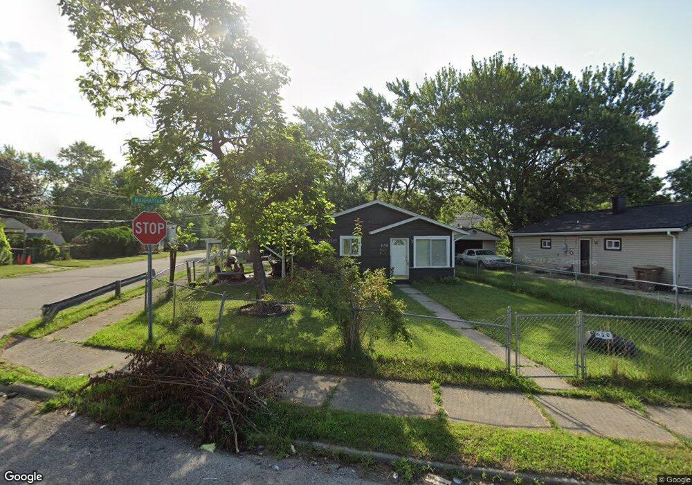
650 Stirling St Pontiac, MI 48340
Estimated Value: $103,735 - $123,000
3
Beds
1
Bath
870
Sq Ft
$132/Sq Ft
Est. Value
About This Home
This home is located at 650 Stirling St, Pontiac, MI 48340 and is currently estimated at $114,684, approximately $131 per square foot. 650 Stirling St is a home located in Oakland County with nearby schools including Herrington Elementary School, Pontiac Middle School, and Pontiac High School.
Ownership History
Date
Name
Owned For
Owner Type
Purchase Details
Closed on
Apr 7, 2011
Sold by
Nationstar Mortgage Llc
Bought by
Fannie Mae and Federal National Mortgage Association
Current Estimated Value
Purchase Details
Closed on
Apr 5, 2011
Sold by
Cole Meika J and Mortgage Electronic Registrati
Bought by
Nationstar Mortgage Llc
Purchase Details
Closed on
Aug 15, 2007
Sold by
Brown Michael Thomas and Brown Dalia
Bought by
Cole Meika J
Purchase Details
Closed on
Dec 18, 2006
Sold by
Brown Scott Thomas
Bought by
Brown Michael Thomas
Purchase Details
Closed on
Jul 22, 2000
Sold by
Brown Judith D and Baker Dennis George
Bought by
Brown Michael Thomas and Brown Scott Thomas
Purchase Details
Closed on
Jan 11, 2000
Sold by
Realty Exchange Group In
Bought by
Brown Judith D
Create a Home Valuation Report for This Property
The Home Valuation Report is an in-depth analysis detailing your home's value as well as a comparison with similar homes in the area
Home Values in the Area
Average Home Value in this Area
Purchase History
| Date | Buyer | Sale Price | Title Company |
|---|---|---|---|
| Fannie Mae | -- | None Available | |
| Nationstar Mortgage Llc | $64,564 | None Available | |
| Cole Meika J | $59,800 | Title One Inc | |
| Brown Michael Thomas | -- | None Available | |
| Brown Michael Thomas | -- | -- | |
| Brown Michael Thomas | -- | -- | |
| Brown Judith D | $11,143 | -- |
Source: Public Records
Tax History Compared to Growth
Tax History
| Year | Tax Paid | Tax Assessment Tax Assessment Total Assessment is a certain percentage of the fair market value that is determined by local assessors to be the total taxable value of land and additions on the property. | Land | Improvement |
|---|---|---|---|---|
| 2024 | $430 | $29,590 | $0 | $0 |
| 2023 | $410 | $27,160 | $0 | $0 |
| 2022 | $461 | $23,480 | $0 | $0 |
| 2021 | $449 | $20,510 | $0 | $0 |
| 2020 | $373 | $18,260 | $0 | $0 |
| 2019 | $425 | $15,570 | $0 | $0 |
| 2018 | $398 | $13,370 | $0 | $0 |
| 2017 | $382 | $12,700 | $0 | $0 |
| 2016 | $410 | $10,860 | $0 | $0 |
| 2015 | -- | $9,950 | $0 | $0 |
| 2014 | -- | $9,670 | $0 | $0 |
| 2011 | -- | $17,150 | $0 | $0 |
Source: Public Records
Map
Nearby Homes
- 644 Brady Ln
- 608 Brady Ln
- 602 Brady Ln
- 597 Brady Ln
- 591 Brady Ln
- 457 Cameron Ave
- 715 Kenilworth Ave
- Fairfiled Plan at Fairview Village
- Enclave II Plan at Fairview Village
- Enclave Plan at Fairview Village
- Carlyle Plan at Fairview Village
- 509 Cameron Ave
- 785 Kenilworth Ave
- 770 Cameron Ave
- 472 Kenilworth Ave
- 790 Parkwood Ave
- 790 Cameron Ave
- 821 Robinwood St
- 802 Cameron Ave
- 442 Kenilworth Ave
- 644 Stirling St
- 640 Stirling St
- 651 Melrose St
- 645 Melrose St
- 636 Stirling St
- 661 Stirling St
- 664 Stirling St
- 641 Melrose St
- 665 Stirling St
- 661 Melrose St
- 670 Stirling St
- 670 S Stirling
- 635 Melrose St
- 630 Stirling St
- 665 Melrose St
- 671 Stirling St
- 639 Stirling St
- 631 Melrose St
- 674 Stirling St
- 624 Stirling St