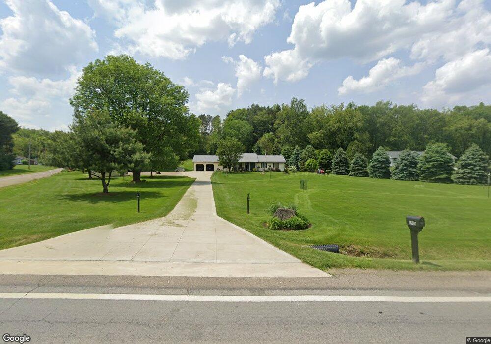
6500 State Route 95 Butler, OH 44822
Estimated Value: $270,000 - $333,000
3
Beds
2
Baths
1,820
Sq Ft
$163/Sq Ft
Est. Value
About This Home
This home is located at 6500 State Route 95, Butler, OH 44822 and is currently estimated at $296,598, approximately $162 per square foot. 6500 State Route 95 is a home located in Richland County.
Ownership History
Date
Name
Owned For
Owner Type
Purchase Details
Closed on
Sep 21, 2023
Sold by
Seib Andy J and Seib Linda L
Bought by
Seib Family Trust and Seib
Current Estimated Value
Purchase Details
Closed on
Apr 1, 2005
Sold by
Jeffers Bobby and Jeffers Lois Ann
Bought by
Seib Andy J and Treacle Linda L
Home Financials for this Owner
Home Financials are based on the most recent Mortgage that was taken out on this home.
Original Mortgage
$50,000
Interest Rate
5.64%
Mortgage Type
Fannie Mae Freddie Mac
Create a Home Valuation Report for This Property
The Home Valuation Report is an in-depth analysis detailing your home's value as well as a comparison with similar homes in the area
Home Values in the Area
Average Home Value in this Area
Purchase History
| Date | Buyer | Sale Price | Title Company |
|---|---|---|---|
| Seib Family Trust | -- | None Listed On Document | |
| Seib Family Trust | -- | None Listed On Document | |
| Seib Andy J | $185,900 | Chicago Title |
Source: Public Records
Mortgage History
| Date | Status | Borrower | Loan Amount |
|---|---|---|---|
| Previous Owner | Seib Andy J | $50,000 |
Source: Public Records
Tax History Compared to Growth
Tax History
| Year | Tax Paid | Tax Assessment Tax Assessment Total Assessment is a certain percentage of the fair market value that is determined by local assessors to be the total taxable value of land and additions on the property. | Land | Improvement |
|---|---|---|---|---|
| 2024 | $1,303 | $71,320 | $8,960 | $62,360 |
| 2023 | $2,604 | $71,320 | $8,960 | $62,360 |
| 2022 | $2,436 | $60,900 | $8,510 | $52,390 |
| 2021 | $2,640 | $60,900 | $8,510 | $52,390 |
| 2020 | $2,640 | $60,900 | $8,510 | $52,390 |
| 2019 | $2,374 | $51,880 | $7,210 | $44,670 |
| 2018 | $2,351 | $51,880 | $7,210 | $44,670 |
| 2017 | $2,312 | $51,880 | $7,210 | $44,670 |
| 2016 | $2,411 | $54,650 | $6,860 | $47,790 |
| 2015 | $2,411 | $54,650 | $6,860 | $47,790 |
| 2014 | $2,404 | $54,650 | $6,860 | $47,790 |
| 2012 | $1,171 | $54,650 | $6,860 | $47,790 |
Source: Public Records
Map
Nearby Homes
- 3898 Ohio 97
- 128 College St
- 224 Blue Bird Dr
- 1260 Ohio 97 Unit 115
- 1259 State Route 97 E
- 5449 Hagerman Rd
- 1169 State Route 97 E
- 0 Mishey Rd
- 2070 Riggle Rd
- 21625 N Liberty Rd
- 361 Honey Creek Rd E
- 6533 Durbin Rd
- 5042 Possum Run Rd
- 4978 Bott Rd
- 6509 Ankneytown Rd
- 6902 Ankneytown Rd
- 76 Smith Rd
- 5800 Ankneytown Rd
- 70 Betty Dr
- 0 Kenton Rd
- 6480 State Route 95
- 6550 State Route 95
- 6460 State Route 95
- 1904 Wagner Rd
- 1889 Wagner Rd
- 6551 State Route 95
- 6568 State Route 95
- 6586 State Route 95
- 6586 Ohio 95
- 1874 Wagner Rd
- 6575 State Route 95
- 95 Sr
- 1853 Wagner Rd
- 1853 Wagner Rd
- 6521 State Route 95
- 1854 Wagner Rd
- 6405 State Route 95
- 6396 State Route 95
- 6396 Ohio 95
- 1831 Wagner Rd