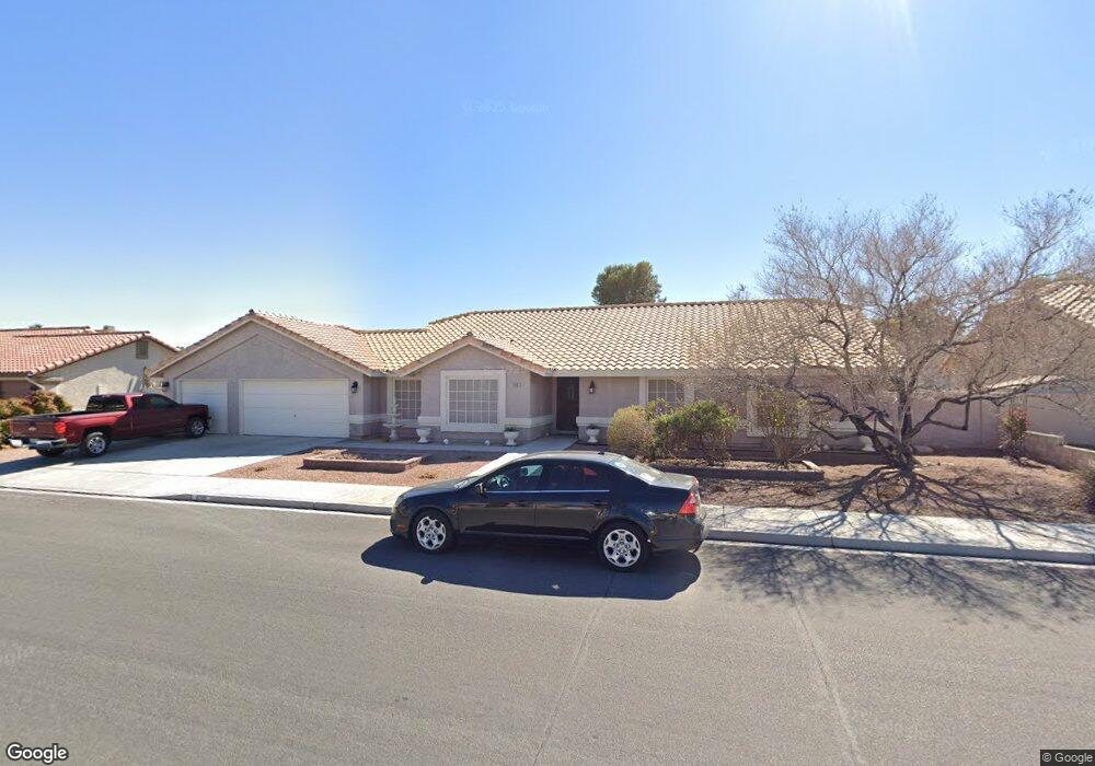
6501 W Brooks Ave Las Vegas, NV 89108
Michael Way NeighborhoodEstimated Value: $556,000 - $638,000
4
Beds
3
Baths
2,411
Sq Ft
$247/Sq Ft
Est. Value
About This Home
This home is located at 6501 W Brooks Ave, Las Vegas, NV 89108 and is currently estimated at $595,150, approximately $246 per square foot. 6501 W Brooks Ave is a home located in Clark County with nearby schools including Berkeley L. Bunker Elementary School, Irwin & Susan Molasky Junior High School, and Cimarron Memorial High School.
Ownership History
Date
Name
Owned For
Owner Type
Purchase Details
Closed on
May 21, 2001
Sold by
Denning Thomas A and Denning Launa S
Bought by
Schwartz Glenn A and Schwartz Diane F
Current Estimated Value
Home Financials for this Owner
Home Financials are based on the most recent Mortgage that was taken out on this home.
Original Mortgage
$150,000
Outstanding Balance
$56,134
Interest Rate
7.06%
Estimated Equity
$539,016
Purchase Details
Closed on
Oct 10, 1998
Sold by
Denning Thomas A and Denning Launa S
Bought by
Denning Thomas A and Denning Launa S
Create a Home Valuation Report for This Property
The Home Valuation Report is an in-depth analysis detailing your home's value as well as a comparison with similar homes in the area
Home Values in the Area
Average Home Value in this Area
Purchase History
| Date | Buyer | Sale Price | Title Company |
|---|---|---|---|
| Schwartz Glenn A | $208,000 | United Title | |
| Denning Thomas A | -- | -- |
Source: Public Records
Mortgage History
| Date | Status | Borrower | Loan Amount |
|---|---|---|---|
| Open | Schwartz Glenn A | $150,000 |
Source: Public Records
Tax History Compared to Growth
Tax History
| Year | Tax Paid | Tax Assessment Tax Assessment Total Assessment is a certain percentage of the fair market value that is determined by local assessors to be the total taxable value of land and additions on the property. | Land | Improvement |
|---|---|---|---|---|
| 2025 | $2,089 | $106,525 | $28,875 | $77,650 |
| 2024 | $2,029 | $106,525 | $28,875 | $77,650 |
| 2023 | $1,655 | $103,887 | $29,260 | $74,627 |
| 2022 | $1,970 | $92,780 | $23,870 | $68,910 |
| 2021 | $1,913 | $88,260 | $22,330 | $65,930 |
| 2020 | $1,854 | $87,340 | $21,560 | $65,780 |
| 2019 | $1,800 | $83,772 | $18,480 | $65,292 |
| 2018 | $1,748 | $79,249 | $15,960 | $63,289 |
| 2017 | $2,613 | $79,698 | $15,120 | $64,578 |
| 2016 | $1,655 | $78,184 | $13,020 | $65,164 |
| 2015 | $1,652 | $69,848 | $8,400 | $61,448 |
| 2014 | $1,603 | $47,452 | $6,720 | $40,732 |
Source: Public Records
Map
Nearby Homes
- 6544 Old Oxford Ave
- 3100 Garehime St
- 6612 Gentle Winds Ct
- 3116 Gentle Breeze St
- 2912 Drury St
- 6632 Light Breeze Dr
- 6632 Coastal Breeze Ct
- 6612 Old Newbury Ave
- 6536 Castor Tree Way
- 2789 Trotwood Ln
- 6428 Yarmouth Dr
- 2809 Du Barry Manor Ln
- 2764 Trotwood Ln
- 3265 Mustang St
- 2915 Maverick St
- 6204 Barkstone Ave
- 2801 N Rainbow Blvd Unit 252
- 2801 N Rainbow Blvd Unit 103
- 2801 N Rainbow Blvd Unit 273
- 2624 Shakespeare Rd
- 6500 Old Oxford Ave
- 6504 Old Oxford Ave
- 6457 W Brooks Ave
- 6509 W Brooks Ave
- 6508 Old Oxford Ave
- 2924 Sterling Silver St
- 6512 Old Oxford Ave Unit II
- 6516 Old Oxford Ave
- 6486 W Brooks Ave
- 2920 Sterling Silver St
- 6449 W Brooks Ave
- 6510 W Brooks Ave
- 6520 Old Oxford Ave
- 6462 W Brooks Ave
- 2916 Sterling Silver St
- 2916 Sterling Silver St
- 2916 Sterling Silver St Unit na
- 6505 Old Oxford Ave
- 6505 Old Oxford Ave
- 6524 Old Oxford Ave