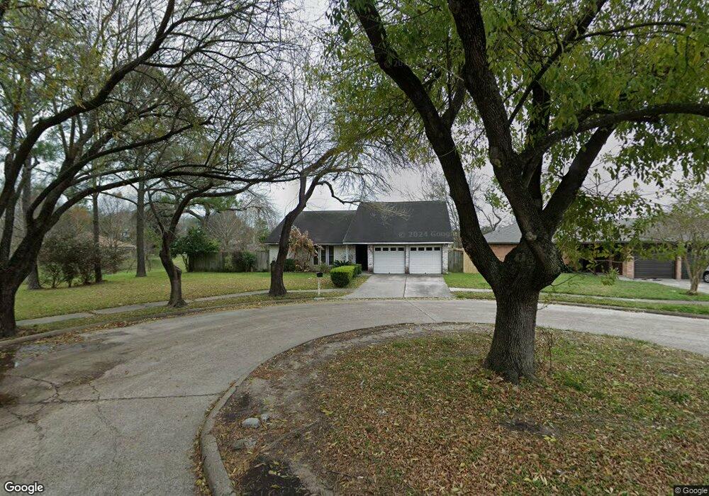
6503 Billikin Dr Houston, TX 77086
North Houston NeighborhoodEstimated Value: $237,145 - $248,000
3
Beds
2
Baths
1,860
Sq Ft
$130/Sq Ft
Est. Value
About This Home
This home is located at 6503 Billikin Dr, Houston, TX 77086 and is currently estimated at $241,786, approximately $129 per square foot. 6503 Billikin Dr is a home located in Harris County with nearby schools including Kujawa EC/Pre-K/K School, Wilson Intermediate School, and Shotwell Middle School.
Ownership History
Date
Name
Owned For
Owner Type
Purchase Details
Closed on
Jun 15, 2001
Sold by
Cooper Patricia A
Bought by
Alanis Leopoldo
Current Estimated Value
Home Financials for this Owner
Home Financials are based on the most recent Mortgage that was taken out on this home.
Original Mortgage
$89,725
Outstanding Balance
$34,028
Interest Rate
7.08%
Estimated Equity
$207,758
Create a Home Valuation Report for This Property
The Home Valuation Report is an in-depth analysis detailing your home's value as well as a comparison with similar homes in the area
Home Values in the Area
Average Home Value in this Area
Purchase History
| Date | Buyer | Sale Price | Title Company |
|---|---|---|---|
| Alanis Leopoldo | -- | -- |
Source: Public Records
Mortgage History
| Date | Status | Borrower | Loan Amount |
|---|---|---|---|
| Open | Alanis Leopoldo | $89,725 |
Source: Public Records
Tax History Compared to Growth
Tax History
| Year | Tax Paid | Tax Assessment Tax Assessment Total Assessment is a certain percentage of the fair market value that is determined by local assessors to be the total taxable value of land and additions on the property. | Land | Improvement |
|---|---|---|---|---|
| 2025 | $3,170 | $222,049 | $41,566 | $180,483 |
| 2024 | $3,170 | $225,324 | $41,566 | $183,758 |
| 2023 | $3,170 | $229,523 | $41,566 | $187,957 |
| 2022 | $3,875 | $193,143 | $35,225 | $157,918 |
| 2021 | $3,515 | $161,244 | $35,225 | $126,019 |
| 2020 | $3,552 | $152,730 | $35,225 | $117,505 |
| 2019 | $3,357 | $145,314 | $17,922 | $127,392 |
| 2018 | $1,202 | $137,635 | $17,922 | $119,713 |
| 2017 | $2,675 | $128,960 | $16,093 | $112,867 |
| 2016 | $2,432 | $117,074 | $16,093 | $100,981 |
| 2015 | $1,720 | $108,915 | $16,093 | $92,822 |
| 2014 | $1,720 | $82,345 | $16,093 | $66,252 |
Source: Public Records
Map
Nearby Homes
- 6610 Northleaf Dr
- 6630 Brownie Campbell Rd
- 11009 Panicum Ct
- 6654 Brownie Campbell Rd
- 10522 Northview Dr
- 6615 Winding Trace Dr
- 11021 Crenchrus Ct
- 11006 Crinkleawn Dr
- 6722 Winding Trace Dr
- 6502 Trail Valley Way
- 13610 Kaltenbrun Rd
- 11007 Tobasa Ct
- 13518 Kaltenbrun Rd
- 7002 Sandswept Ln
- 10306 Jillana Kaye Dr
- 3240 Brownie Campbell Rd
- 7023 Sandswept Ln
- 6911 Silver Star Dr
- 7218 Winding Trace Dr
- 6822 Dusty Dawn Dr
- 6507 Billikin Dr
- 6511 Billikin Dr
- 6502 Billikin Dr
- 6506 Billikin Dr
- 6510 Billikin Dr
- 6515 Billikin Dr
- 3442 Brownie Campbell Rd
- 6514 Billikin Dr
- 6503 Northleaf Dr
- 6507 Northleaf Dr
- 6519 Billikin Dr
- 6518 Billikin Dr
- 6511 Northleaf Dr
- 3441 Brownie Campbell Rd
- 3434 Brownie Campbell Rd
- 6515 Northleaf Dr
- 10402 Antoine Dr
- 6522 Billikin Dr
- 6519 Northleaf Dr
- 3433 Brownie Campbell Rd