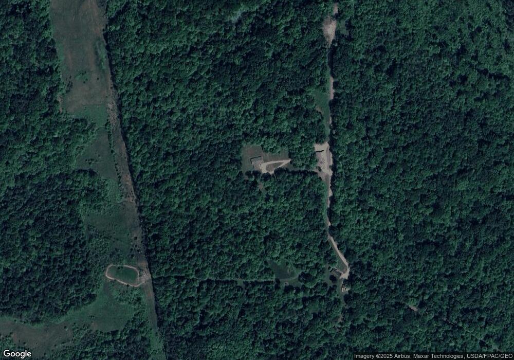
6505 Poverty Ridge Rd Blue Rock, OH 43720
Estimated Value: $323,000 - $496,735
3
Beds
2
Baths
1,920
Sq Ft
$205/Sq Ft
Est. Value
About This Home
This home is located at 6505 Poverty Ridge Rd, Blue Rock, OH 43720 and is currently estimated at $394,184, approximately $205 per square foot. 6505 Poverty Ridge Rd is a home located in Muskingum County with nearby schools including Philo High School.
Ownership History
Date
Name
Owned For
Owner Type
Purchase Details
Closed on
May 17, 2016
Bought by
G Smith Waylon
Current Estimated Value
Home Financials for this Owner
Home Financials are based on the most recent Mortgage that was taken out on this home.
Interest Rate
3.57%
Purchase Details
Closed on
Dec 22, 2014
Sold by
Ramos Raymond
Bought by
Smith Gene
Home Financials for this Owner
Home Financials are based on the most recent Mortgage that was taken out on this home.
Interest Rate
3.8%
Purchase Details
Closed on
Jun 21, 2007
Sold by
Hampton Lydle L and Hampton Stephen L
Bought by
Ramos Raymond W and Ramos Mary A
Create a Home Valuation Report for This Property
The Home Valuation Report is an in-depth analysis detailing your home's value as well as a comparison with similar homes in the area
Home Values in the Area
Average Home Value in this Area
Purchase History
| Date | Buyer | Sale Price | Title Company |
|---|---|---|---|
| G Smith Waylon | -- | -- | |
| Smith Gene | $7,885 | -- | |
| Ramos Raymond W | $25,000 | Attorney |
Source: Public Records
Mortgage History
| Date | Status | Borrower | Loan Amount |
|---|---|---|---|
| Closed | Smith Gene | -- | |
| Previous Owner | Smith Gene | -- |
Source: Public Records
Tax History Compared to Growth
Tax History
| Year | Tax Paid | Tax Assessment Tax Assessment Total Assessment is a certain percentage of the fair market value that is determined by local assessors to be the total taxable value of land and additions on the property. | Land | Improvement |
|---|---|---|---|---|
| 2024 | $3,598 | $111,860 | $15,225 | $96,635 |
| 2023 | $4,120 | $73,360 | $11,305 | $62,055 |
| 2022 | $3,376 | $73,360 | $11,305 | $62,055 |
| 2021 | $2,055 | $73,360 | $11,305 | $62,055 |
| 2020 | $1,908 | $66,675 | $10,290 | $56,385 |
| 2019 | $149 | $12,950 | $9,590 | $3,360 |
| 2018 | $958 | $12,950 | $9,590 | $3,360 |
| 2017 | $191 | $9,905 | $8,330 | $1,575 |
| 2016 | $183 | $9,910 | $8,330 | $1,580 |
| 2015 | $194 | $9,910 | $8,330 | $1,580 |
| 2013 | $814 | $17,750 | $8,470 | $9,280 |
Source: Public Records
Map
Nearby Homes
- 426 Main St
- 252 Front St
- 143 Front St
- 135 Front St
- 142 Main St
- 718 3rd St
- 0 1st St Unit 225021970
- VL 1st St
- 754 3rd St
- 0 Old River Rd Unit 225036638
- 0 Old River Rd Unit 5159965
- 7979 Old River Rd
- 250 Sycamore St
- 8285 Old River Rd
- 280 Virginia Ridge Rd
- 5780 Henderson St
- 2640 Red Fox
- 4495 Old River Rd
- 3900 Dietz Ln
- 9390 Shady Ln
- 6300 Poverty Ridge Rd
- 6290 Poverty Ridge Rd
- 6570 S River Rd
- 6265 Poverty Ridge Rd
- 6200 Poverty Ridge Rd
- 6560 S River Rd
- 6600 S River Rd
- 6165 Poverty Ridge Rd
- 9255 Gaysport Hill Rd
- 6504 S River Rd
- 6440 S River Rd
- 0 Gaysport Rd Unit 4416095
- 6620 S River Rd
- 6430 S River Rd
- 6405 S River Rd
- 6405 S River Rd
- 6405 S River Rd
- 6475 S River Rd
- 6505 S River Rd
- 6505 S River Rd
